|
BiblePlaces Newsletter
Vol 10, #1 - May 4, 2011
This newsletter began in March 2002, some time before we learned about
blogging software that makes it easy to post frequent updates online.
The BiblePlaces Blog allows us to update our readers about news events
quickly and easily. If you are not a regular reader of the blog, there
are several ways you can stay connected. One option is to
visit the
site directly. You can facilitate that by adding it to your
shortcuts or bookmarks. A second option is to subscribe to the
blog
by email. A third
option is to add
the RSS feed to your reader
(e.g., Google Reader).The newsletter will
continue alongside the blog, though we feel less pressure to send
out newsletters given the ability to provide updates daily on the blog. We plan to use
the newsletter to continue (1) giving away free photos; (2) notifying
you of great deals; and (3) informing you of our latest photo
collections. On the last point, we anticipate a major announcement
by the end of (the northern hemisphere's) summer.
On a personal note, we reflect on the Lord's goodness
to us in the seven months since the last newsletter. Since
then, we finished our most significant writing project ever (1,400
pages), passed a series of difficult exams, and
welcomed a
new son into this world. Maybe these things help explain how
the time has passed so quickly!
Todd Bolen
Editor, BiblePlaces.com and
LifeintheHolyLand.com
Special Offer: Views That
Have Vanished
Our special offer in the last
newsletter was so popular that we have decided to make a similar offer
in this issue. For a limited time, we are offering
Views That Have Vanished: The Photographs of David Bivin for 55%
off.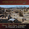 For $14, you can own a fantastic collection of more
than 700 high-resolution color photographs from the 1960s. This is
one of our favorite items in the Historic Views of the Holy Land
series, and this is a very short-lived sale, good for the next 48 hours
only. Shipping is free inside the U.S. To get the
discount, you must use
this link no later than midnight on
May 6. (After clicking the link, proceed to "checkout.")
For $14, you can own a fantastic collection of more
than 700 high-resolution color photographs from the 1960s. This is
one of our favorite items in the Historic Views of the Holy Land
series, and this is a very short-lived sale, good for the next 48 hours
only. Shipping is free inside the U.S. To get the
discount, you must use
this link no later than midnight on
May 6. (After clicking the link, proceed to "checkout.")
If you want to pass this deal on
to others or post it online, make sure to use
this link
to get the discount.
Israeli Guides: Danny the Digger
I am often asked my recommendation for an Israeli guide. The
inquirer is looking for something "more" than what they will get with
the luck-of-the-draw from a travel agency. The internet makes it
easier to get to know some guides before you commit to them, and I
thought I might do a brief series this year on guides who are "a cut
above."
Danny Herman is best known as "Danny the Digger." While he is a
licensed tour guide, he is also a trained archaeologist, having received
his MA in Archaeology from the Hebrew University. Danny knows the
regular tourist sites, but he also loves to get off the trail in his
four-wheel drive and visit places that buses cannot access. Danny
is the featured tour guide in a new series of videos at the
Jerusalem Post. The videos include
an introduction, the discovery of "King
David's palace,"
Jerusalem's water systems, the
Assyrian siege of Jerusalem, and the discovery of the
earliest biblical texts.
Danny's website has many helpful resources, including a list of
Christian archaeology sites, his
top 10 recommended experiences, and his recommendations for
what not
to do. He has certainly done a very good job in allowing you to
get to know the guide before you hire him.
News from the BiblePlaces Blog...
Urban Legends of Bible Teachers - Some things just aren't
true...
Top Tourist Sites in Israel in 2010 - The top three were Masada,
the Jerusalem zoo, and Caesarea...
Franz: No Crucifixion Nails with Caiaphas - In the most recent
of several posts concerning Simcha Jacobovici's claim that he found the nails of
the crucifixion, Gordon Franz points to some difficulties...
Teaching Archaeology to College and K-12 Students - ASOR has
posted four presentations online which address the use of technology in teaching
archaeology...
James Ossuary Inscription: Experts Support Authenticity - Why is
it that most articles and blogs ignore the fact that many scholars
doubt that the inscription was forged?...
MEGA-Jordan: Archaeological Sites on the Map - This online
database locates 11,000 archaeological sites using an interface overlain
on Google
Maps...
Lead Codices Update - The most recent post about forged books
passed off as early Christian writings...
The Myth of the Burning Garbage Dump of Gehenna - There is no
ancient evidence for a burning garbage dump in the Hinnom Valley...
And more...
Featured BiblePlaces Photos:
Off the Beaten Trail in Galilee
While I have spent many days
in the front seat of a tour bus guiding students, I must say that I
enjoy no less the times when I leave the bus and the crowds behind
and explore the land of Israel on foot. The featured images
this month come from travels "off the beaten trail" in the northern
part of Israel. While these sites are less frequently visited
today, they are rich in historic significance and natural beauty.
Each photo below is linked to a higher-resolution version, but we
recommend that you download the
Off the Beaten
Trail PowerPoint presentation
(3.3 MB), which includes an additional 6 photos (12 total). You are
welcome to use these images for personal study and teaching.
Commercial use requires separate permission. For more
high-quality, high-resolution photographs and illustrations of biblical
sites, purchase the
Pictorial Library of
Bible Lands or the
Historic Views of
the Holy Land collections.
You are
welcome to use these images for personal study and teaching.
Commercial use requires separate permission. For more
high-quality, high-resolution photographs and illustrations of biblical
sites, purchase the
Pictorial Library of
Bible Lands or the
Historic Views of
the Holy Land collections. |