(Post by A.D. Riddle)

The Ancient World Mapping Center is making available for free download their wall map of Asia Minor. The blog post from yesterday reads:

After several years of preparation, AWMC’s newest wall map is now available online. This map is a successor to that of J.G.C. Anderson (1903) and its partial revision by W.M. Calder and G.E. Bean (1958).  It was displayed in draft at the ‘Roads and Routes in Anatolia’ conference organized by the British Institute at Ankara (March 2014).  It was then revised with a view to being issued with the volume planned to follow that meeting in due course.  Meantime the Center is now making the map available online.

The map is noteworthy because the Ancient World Mapping Center has reconstructed the ancient coastline, most notable at places such as Miletus, Ephesus, north of Smyrna, and between Xanthos and Patara. The map shows Roman roads, bridges, quarries, and aqueducts. It also shows rivers, wetlands, and elevation with subtle hillshading. According to the legend, the map includes mountain passes and shrines, though I noticed only one of each.

There are a few symbols that do not appear in the legend, and I am not entirely sure what they mean: an asterisk before the name Sparza, and these three patterns

[UPDATE: A commenter noted that the asterisk is identified in the legend and is used to indicate a reconstructed ancient place name. The first pattern, blue dots outlined in blue, appears to represent an “intermittent lake.” The second pattern, burnt orange dotes, appears to represent a “dry lake.” The last pattern remains a mystery to me.]

Yesterday, I could download the map directly, but as of today you have to email the Ancient World Mapping Center for a download link. The TIF file I downloaded is a whopping 1.72GB! If you were to print the map at 300dpi, the sheet would measure 80″ x 50″. (To download a JPG version of the map at about 100MB, use this temporary link.) The map is licensed under CC-by-4.0.

This map is the latest creation by the Ancient World Mapping Center in a line of cartographic products which includes the Barrington Atlas of the Greek and Roman World (print and digital), Benthos Digital Atlas of Ancient Waters, the AWMC à-la-carte Map, and the Routledge Wall Maps for the Ancient World.

Share:
(Post by A.D. Riddle)

As mentioned before, I took my first trip to Egypt this year. The main part of the trip was led by James Hoffmeier (Trinity International University) and was organized by Shepherd Travel. For those interested in traveling to Egypt, I am happy to recommend Shepherd Travel, and in particular, our guide Maged. At the end of the Hoffmeier trip, a friend and I remained a few extra days to visit additional sites. Maged was an enormous help during our extended time.

Egypt possesses many amazing places and artifacts to see, but travel in Egypt can present a few challenges. If we had not had Maged as our guide, it would have been extremely difficult (maybe impossible) to visit and photograph all the sites that we did.

Our Egyptian guide Maged

Here are four ways having a good guide helped us:

Negotiation. First, everything in Egypt must be negotiated—from transportation, to prices and tips, to permission to enter some of the sites and permission to photograph. All of this takes time and knowledge of how things work (the ability to speak Arabic is also huge advantage). There were a few sites that were “closed” or where photography was forbidden, but Maged was able to negotiate our way into nearly every one of them. In addition, if we had been by ourselves, we surely would have paid more and tipped more (or less) than we needed to, because we are not familiar with the customs. Maged made sure we avoided these situations. (In Egypt, everything you can imagine requires a tip, and you have to be willing to give each transaction plenty of time to “transpire.” If you are in a hurry, you will probably miss out.)

Transportation. Second, we had to rely on local transportation. In other Middle East countries I have visited, it is not difficult to rent a car and do all of my own navigating, but I would not recommend this in Egypt. Instead, we utilized local drivers, trains, and subways for transportation. Some of this we could have figured out on our own, but it would have taken us twice as long and in some cases we probably would have paid (much) more than we should have. Maged arranged all our transportation needs to maximize our schedule and negotiated fair prices. In places where Maged was not with us, he made sure we had a driver, that the driver knew where we wanted to go, and that we knew how much we needed to pay and tip.

Security. Third, Egypt is very protective of tourists, excessively even at times. During the Hoffmeier trip, we noted at one site that the number of police and guards exceeded the 40-something members of our tour group. Travel to some sites and use of the desert highway require police escort, and it was helpful to have Maged explain our intentions to authorities, to procure their assistance when needed, and to keep us informed of everything that was going on. Maged also knew which sites are located in military zones and therefore off-limits, thus saving me wasted time and effort trying in vain to reach them. Finally, Maged could verify whether it was safe for us to travel to some of the out-of-the-way sites.

Expertise. Fourth, Maged studied Egyptian archaeology and ancient Egyptian language in university. He showed us his comprehensive exams in Egyptian hieroglyphs, hieratic and Coptic, and they looked quite impressive. He has participated in excavations and was familiar with all of the sites on my itinerary—even the ones that I thought were ultra-obscure. In addition, Maged is quite knowledgable about the history, sites, doctrines, and traditions of the Coptic Orthodox Church. Many American Christians probably are not too familiar with traditions related to Joseph and Mary’s flight to Egypt (Matt 2), the martyrdom of Mark in Alexandria, the ostensible fulfillments of Isaiah 19, the Desert Fathers, or the differences between the Latin and Eastern Church. And not least, Maged speaks very good English.

If you are thinking of taking a trip to Egypt, I recommend Shepherd Travel and ask for Maged to be your guide. You can find more at Shepherd Travel’s website or on Facebook.

Share:
(Post by A.D. Riddle)

Ralph Hawkins has announced a new excavation to be undertaken at the site of Khirbet el-Mastarah in the Jordan River Valley. The inaugural season will be June 3-30, 2017, and they are looking for volunteers. The dig is part of the newly launched Jordan Valley Excavation Project, co-directed by Ralph Hawkins and David Ben-Shlomo. The project’s website provides further information along with this description.

The Jordan Valley Excavation Project (JVEP) was launched in 2016 to investigate the ancient history and archaeology of the region of the southern Jordan Valley, with a particular focus on the Iron Age. This period is traditionally connected with a period of tribal settlement in the region, followed by the rise of ethnic states. A thorough survey of the region, conducted by Adam Zertal, revealed a dramatic population shift in this region during the transition from the Late Bronze Age to the beginning of the Iron Age (around 1200 B.C.E.). Whereas there were only seven sites in the region in the Late Bronze Age (1550-1200 B.C.E.), fifty-four new sites were founded at the beginning of the Iron Age. Zertal proposed that the eastern sites are slightly earlier than the western ones, a phenomenon he attributed to the movements of peoples, whom he identified with the Tribe of Manasseh, from the Transjordan westwards. JVEP’s goals are to test the date and character of some of the sites in the region, as well as Zertal’s interpretations, through archaeological excavation and research. JVEP will conduct excavations at two sample sites, beginning with Khirbet el-Mastarah, in the eastern part of the region, where at least three years of excavation will be conducted. After that, an additional site will be chosen in the western part of the region, which will likewise be excavated for several seasons. The evidence from these (possibly) single-period sites may shed a great deal of light on the settlement of the tribal peoples living in the region during the Iron Age.

Khirbet el-Mastarah is the low mound illuminated by sunlight behind the tree.
Photo from jvep.org.

Map showing location of Khirbet el-Mastarah relative to Jericho and Shechem.

As mentioned in the project description, this region was surveyed by Adam Zertal. Four out of five planned volumes of the survey were published in Hebrew before his death just over one year ago, and three of these have been translated into English:

Zertal, Adam.
  2004  The Manasseh Hill Country Survey, Volume 1: The Shechem Syncline. Culture and History of the Ancient Near East 21.1. Leiden: Brill.
  2007 The Manasseh Hill Country Survey, Volume 2: The Eastern Valleys and the Fringes of the Desert. Culture and History of the Ancient Near East 21.2. Leiden: Brill.

Zertal, Adam, and Nivi Mirkam.
  2016  The Manasseh Hill Country Survey, Volume 3: From Nahal ʿIron to Nahal Shechem. Culture and History of the Ancient Near East 21.3. Leiden: Brill.

Some preliminary reports on two Iron Age sites were published by Zertal in the below articles.
Zertal, Adam, and Dror Ben-Yosef.
2009     “Bedhat esh-Shaʿab: An Iron Age I Enclosure in the Jordan Valley.” Pp. 517-529 in Exploring the Longue Durée: Essays in Honor of Lawrence E. Stager. Ed. J. D. Schloen. Winona Lake: Eisenbrauns.

Zertal, Adam; Dror Ben-Yosef; Oren Cohen; and Ron Beʾeri.
2009 “Kh. ʿAujah el-Foqa (North) — An Iron Age Fortified City in the Jordan Valley.” Palestine Exploration Quarterly 141/2: 104–123.

UPDATE: The Jordan Valley Excavation Project also has a Facebook page.

Share:
(Post by A.D. Riddle)

At the end of last week, after a lengthy delay, we were happy finally to get our grubby mitts on Lawson Younger’s newest book, A Political History of the Arameans: From Their Origins to the End of Their Polities (Atlanta: SBL, 2016).

Lawson Younger is a professor at Trinity Evangelical Divinity School, and I have had the pleasure of taking several of his classes during my sojourn in Illinois. I am not sure when he began work on this volume. I do recall attending a seminar that he first offered in the fall of 2006 entitled “Arameans and the Bible.” Since then, Younger has published a handful of book chapters and articles dealing with the Arameans and he has given several lectures on the subject. Now, 10 years later, that initial course has morphed into a two-inch-thick book.

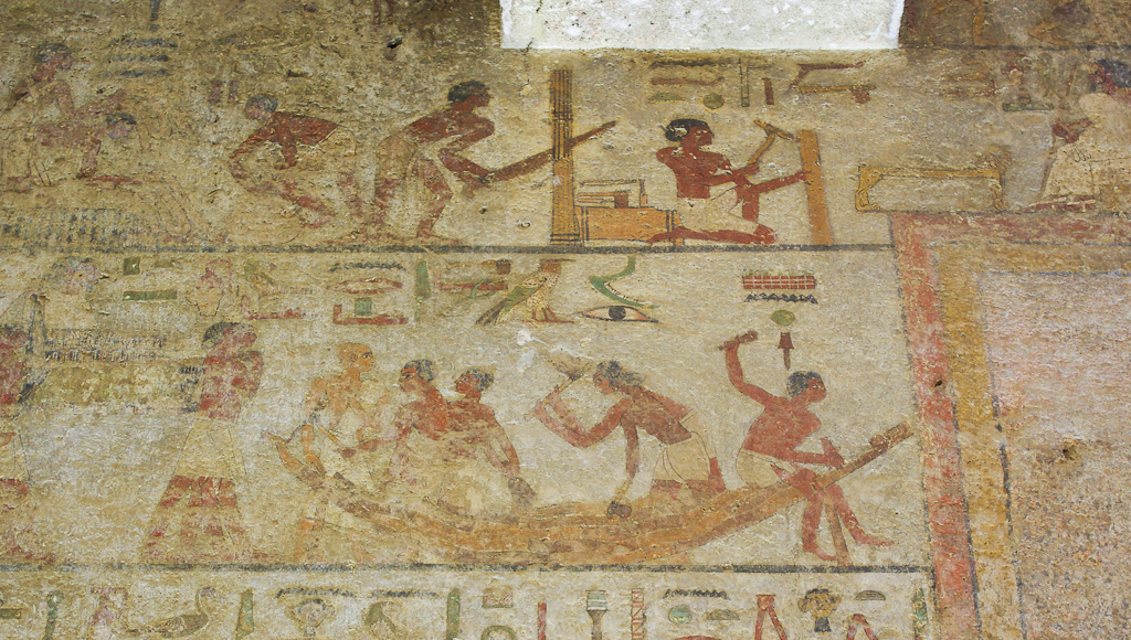
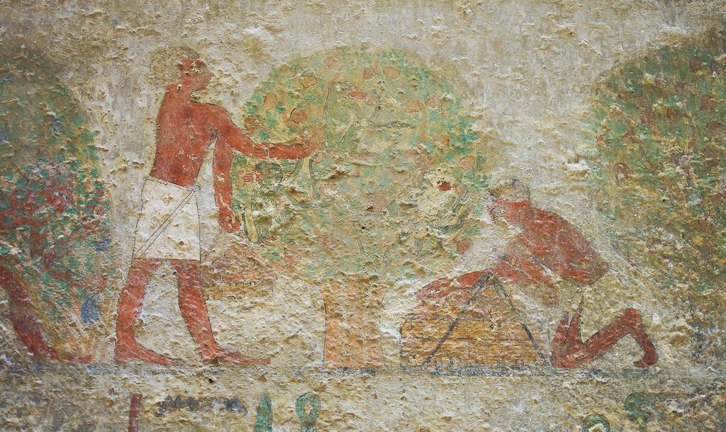
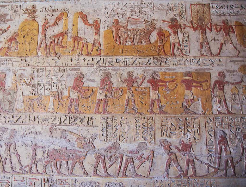
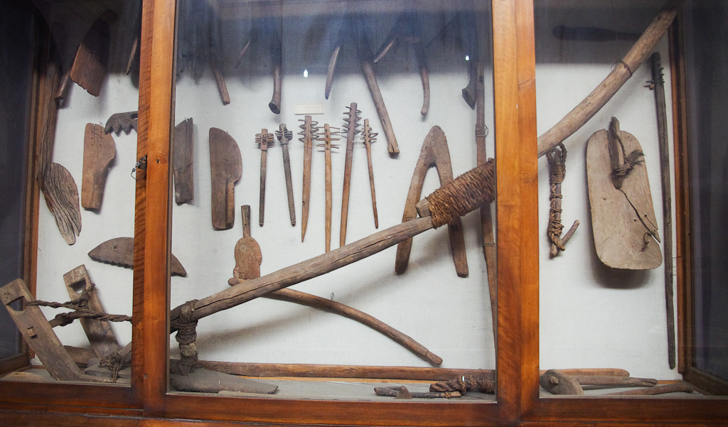
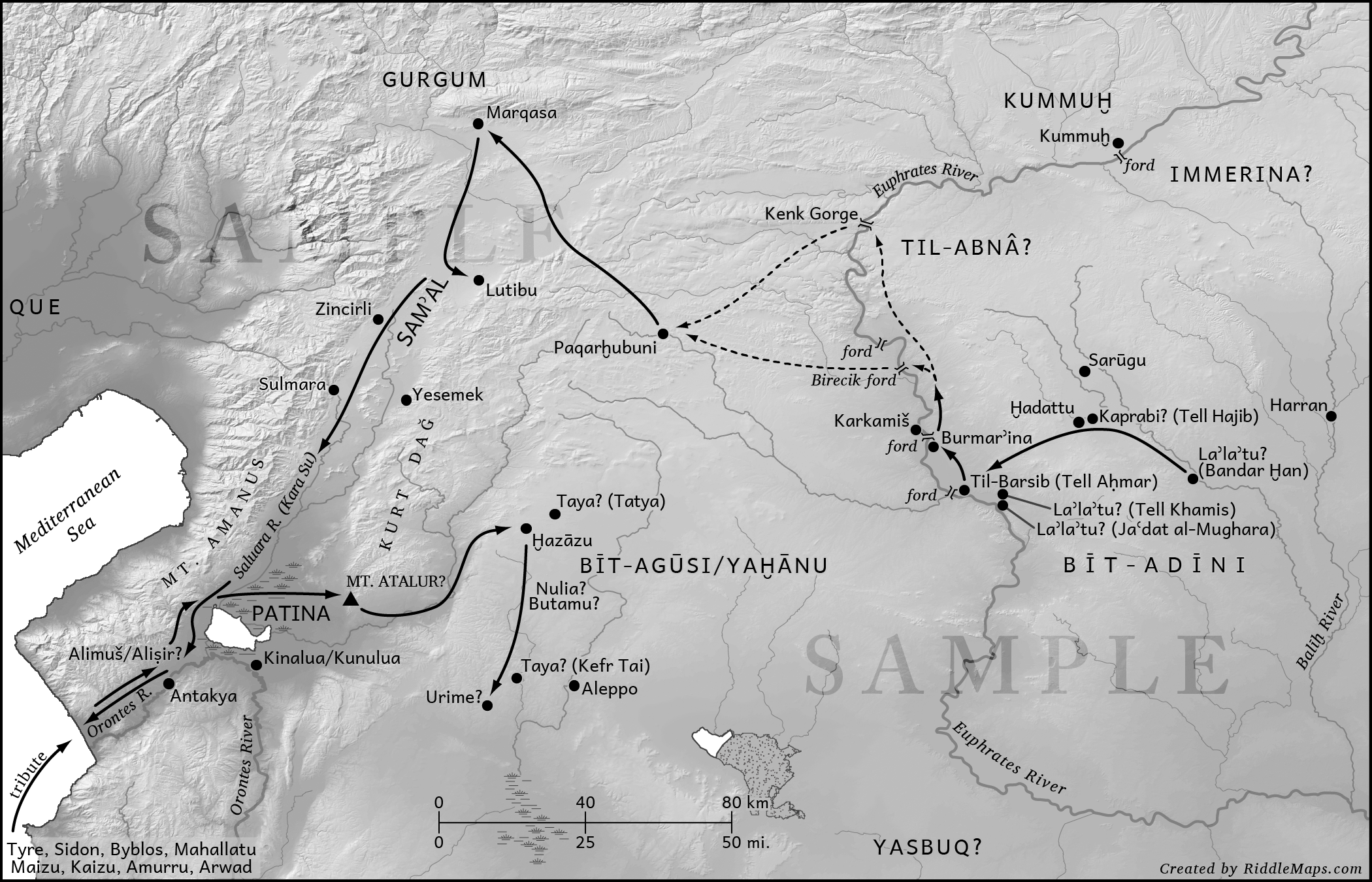
This is a technical work packed with data and analysis—it is not fluff reading. Bible students will find much of interest in its pages, for Younger treats all biblical references to Aram/Arameans, beginning with the Patriarchs through the divided monarchy. But he does much more than that, covering Aramean kingdoms and entities that receive no biblical mention but that are attested in the textual and/or archaeological record of the Near East. It is quite an impressive accomplishment. Due to the nature of the sources, a good portion of the book is told from the perspective of the Assyrians as they campaigned to the West. There are over 100 maps, illustrations, and tables sprinkled throughout the chapters (we are quite fond of the maps). You should find that this volume will satisfy all of your Aramean-history needs, and at 857 pages, it should satisfy them for some time.

From the back cover:

This volume presents a political history of the Arameans from their earliest origins at the end of the Bronze Age to the demise of their independent polities. Employing the most recent understanding of tribal political structures, aspects of mobile pastoralism, and models of migration, K. Lawson Younger Jr. takes a regional approach to explain the rise of the Aramean political institutions. He thoroughly explores the complex relationships and interactions of the Arameans with the Luwians, the Assyrians, and the Israelites. By drawing on all available sources—sociological, textual, and archaeological—Younger is able to develop a comprehensive picture of this complex and important people whose influence and presence spanned the Fertile Crescent during the Iron Age.

A Political History of the Arameans can be purchased in hardback ($118) or in paperback ($98). (Apparently, SBL has chosen to opt for European publishers’ pricing on this title which is too bad.) Below is the table of contents.

1.      Preliminary Issues
     a.     Geographic Issues
     b.     Chronological Issues
     c.     Linguistic Issues: Luwian, Phoenician, Akkadian, Aramaic
2.      The Origins of the Arameans
     a.     The Word “Aram” in the Earliest Sources
     b.     The Question of Qir/Kir
     c.     Socially Constructed Groups
     d.     Nomadism
     e.     Links with the Aḫlamû and Sutû
     f.     Aram in the Biblical Texts
3.      The Rise of the Aramean Polities in Iron I
     a.     The Hittite Sphere
     b.     The Assyrian Sphere
     c.     The Levantine Sphere
4.      The Aramean Polities of the Jezirah
     a.     The Early Renewal of Conflict between Arameans and Assyrians (934-884 BC)
     b.     Temanites
     c.     Gōzān/Bīt-Baḫiāni
     d.     Azallu, Bīt-Yaḫiri
     e.     The Laqē Confederation
     f.     Bīt-Zamāni
     g.     Aramean Tribal Entities of the Jezirah
5.      Bīt-Adīni
     a.     Territory
     b.     History
     c.     Šamšī-ilu
6.      Samʾal/Yādiya/Bīt-Gabbāri
     a.     Introduction
     b.     Territory
     c.     History
7.      Hamath and Luǵath
     a.     Territory
     b.     History
8.      Bēt-Gūš/Arpad
     a.     Territory
     b.     History
9.      Aram-Damascus
     a.     Introduction
     b.     Territory
     c.     History
10. Arameans in Southern Mesopotamia
     a.     Aramean Tribal Entities of the Jezirah
     b.     Aramean Tribes of Southern Mesopotamia
11.      Conclusion

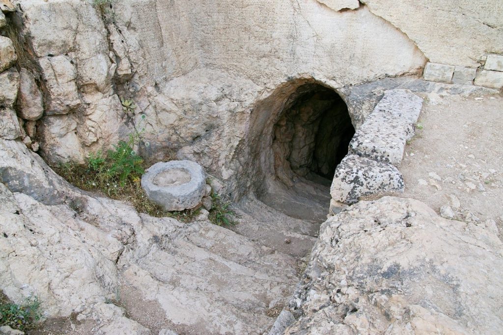
Side note: For a treatment of the Aramean oppression of Israel from the Israelite perspective, I recommend this work.

Share:
(Post by A.D. Riddle)


A commenter to our post about Egypt yesterday requested assistance in locating the monkeys in the fig tree. The monkeys are green with brown bottoms and faces, making it hard to pick them out among the green foliage and brown fruit and branches. The monkeys form a triangle, one in the lower left, one in top center, and one in the lower right. Here is the photo with their faces circled and numbers placed above each monkey’s head.

(Click to enlarge.)

Here they are individually.

Monkey in lower left. He appears to be hanging on the man’s arm.
Monkey in top center.
Monkey in lower right. This one is the hardest to make out due to damage.


Share:
(Post by A.D. Riddle)


Earlier this year, I took my first trip (hopefully of many) to Egypt. Normally I am interested in Bible history and geography, though recently, my attention has been drawn to ordinary, daily-life objects and cultural behaviors. For Bible times and places, it can be a little challenging to come up with photographs that illustrate these sorts of things. But that is why I found Egypt is so amazing.

One of BiblePlaces.com‘s photographers on location in Egypt.


Egypt provides three sources for helping us visualize ancient ways of life.

1. Tomb Models.
You can probably find examples of tomb models in most museums with Egyptian collections. These are ancient models that depict people in various occupations, most of them I think dating to the Middle Kingdom. Examples include herding cattle, storing grain, baking, butchering, sailing boats.

The models were placed in the tombs of nobles and depict the kinds of industries and activities that that particular noble oversaw during his lifetime. This photograph from the Egyptian Museum in Cairo shows carpenters at work. You can see them with their various tools: mallet, adzes, chisels, saw. Some of them are working on a sarcophagus.

Here is a model granary also from the Egyptian Museum. You can see people carrying sacks of grain to a scribe who is recording the amounts. You can even see the hieratic writing on his tablet. The red and white rectangles below are chambers or bins for storing the grain. (Now re-read Genesis 41:47-49.)

2. Tomb Paintings.
In royal tombs, you can see artwork of the king or members of the royal family interacting with deities, involved in funerary rituals, dealing with their enemies, and receiving tribute. In the tombs of nobles, however, the same sources for the models above, you can find elaborate paintings or reliefs of more mundane activities like cultivating fields, hunting, fishing, helping a cow give birth, and so on.

Here is a tomb painting from Beni Hasan that shows carpenters at work on a boat. Again, you can see the tools: axes, mallets, and adzes. Above them some carpenters are building furniture. One man is using a saw and another an adze. Between them are several other woodworking tools.

This photo, also from Beni Hasan, shows two men harvesting figs from a tree. There are three monkeys in the tree—apparently also big fans of the fruit. (Need help seeing the monkeys? Click here.)

This scene from El-Kab shows the cycle of a grain harvest. In the bottom register, two plows are being pulled, one by oxen and the other by men. In between two men are tilling with hoes. Partially concealed by the oxen a man is sowing seed. In the middle register, men with sickles are reaping the grain. It must be hot work because the man in the center is stopping to drink from a jug. In the top register, they are bringing the grain in baskets to be threshed by oxen, then winnowed by hand. In the top left, a scribe is overseeing the storage of the grain (now shown).

3. The Real Thing.
And if that were not enough, in Egypt you can see the actual objects themselves, thanks to the arid climate and the fact that burials were located in the desert beyond the cultivated land. Many items which are not preserved in other countries—such as textiles, food, wood—can be found in Egypt.

In keeping with the theme of carpentry, here is a wooden mallet.

This case in the Egyptian Museum in Cairo shows many of the tools shown above: a wooden plow (with fiber ropes!), hand scoops for winnowing grain, and hoes.

I might also make mention that, although not unique to Egypt, in the rural agricultural villages and fields, you can see traditional methods of farming, herding, butchering, etc. that in many cases do not appear all that different from their ancient counterparts.

UPDATE: Follow-up post “Travel in Egypt.”

Share: