|
BiblePlaces Newsletter
Vol 9, #4 -
September 14, 2010
Summer came and went without the
sending of this newsletter, and I appreciate those who wrote and noted
your continued interest in it. The primary reason that the
newsletter did not get out in mid-July was the anticipated switch-over
of the BiblePlaces online store. The delays have now been overcome
and we have a special offer below if you want to "take a look around"
the new place.
Another task that
required some of my "free" time this summer was a
series of short articles for The Bible
and Interpretation. In the first one, I suggest that
Herod Agrippa I died not in the theater of Caesarea, but in the
hippodrome (Acts 12). In the second, I call attention to the
failure of archaeology to account for the historically attested
presence of Israel in the Merneptah Stele. I'm wrapping up a third
article now on the location of David's palace. If you have
interest in any of these, I hope that you'll find them stimulating and
helpful.
Finally, see below
for a "scoop" on how to get more than a hundred high-resolution digital
maps for free when you purchase one of the best Bible atlases available.
Thanks so much for
reading here, the blog, and the websites.
Todd Bolen
Editor, BiblePlaces.com and
LifeintheHolyLand.com
Picturesque Palestine Special
Offer
After nine good years processing the orders for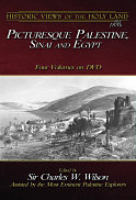 BiblePlaces.com, setSystems is being closed and our webstore is being
transferred to its partner eSellerate. To kick the tires on our
new (and much improved!) site, we're offering a big sale for a brief
time.
BiblePlaces.com, setSystems is being closed and our webstore is being
transferred to its partner eSellerate. To kick the tires on our
new (and much improved!) site, we're offering a big sale for a brief
time.
The four volumes of
Picturesque Palestine, Sinai and Egypt are available for $20
each, but for the next 48 hours, you can get the entire set for
$20. That includes free shipping inside the U.S. To get the
discount, you must use
this link not later than midnight on
September 16.
You will see the
discount in your cart when you go to checkout.
If you want to pass this deal on
to others or post it online, make sure to use
this link
to get the discount.
Free Digital Maps from the Moody
Atlas
I got the scoop for this story from the trash can. Literally. Some of you
will be impressed by the serious commitment that I and my sources have
for bringing you news that even the famous tabloids have not yet learned
about. The scoop is this: all purchasers of the
New Moody Atlas of the Bible by Barry Beitzel can get the maps and photos in
electronic format, for free. This tip right here is worth the cost
of your subscription to this fine newsletter!
When I heard about this, just a few days ago, from my trash-snooping
friend, I immediately ordered the book. I have wanted it ever since
it came out, but knowing that I could get all of the maps and photos in
digital format put me over the edge and I couldn't spend my $31.49 fast
enough.
Of course, Barry Beitzel is one of the finest historical geographers of
the biblical world. This is not an atlas written by a one-time
visitor to the Holy Land (yes, those exist, and no, I'm not going to
name them). Beitzel wrote the first edition of this atlas 25
years ago. The new edition has the benefit of all of his
continued years in the classroom and extensive travels in the Middle East.
It is not surprising that it won the ECPA 2010 Christian Book Award, Medallion of Excellence,
in the Bible Study and Reference category.
As for the digital maps and photos, there are a few things that may be
worth knowing. First, the files are available to both past and
current purchasers. If you already bought the atlas, you can
email
[email protected] or call 1-800-678-8812 to get a
code to download the files. If you buy the atlas as I just did,
the code is included in the book (at least it is in the copies sitting on the
shelves at
Amazon; bookstores with a slow turnover may have earlier printings
still around).
Second, the maps are presented in very high resolution. You
will be impressed! The photos are available in lower
resolution. (But who reading this newsletter needs more photos of
the Bible lands anyway,
right?) Third, you access the materials through
WORDsearch. Though
the program is free with this code, I would have preferred to have
avoided the hassle of installing another program. If you have a Mac, you'll have to run WORDsearch
using WINE or run it in a Windows environment
(via a virtual machine). From this point, you can save
the images in png or pdf format. (Or you can do as I did and just
poke around in your Program Files or Program Data folder, find all of
the images, and copy them to a more convenient location if you do not
plan to access them via WORDsearch. The pdf files are at a higher
resolution than the png images.)
I commented on the blog a few months ago that I really
appreciated the
publisher's wisdom in making the
ESV Bible Atlas maps available on CD to its users and I noted my hope
that others would get on board. I'm delighted to see another
publisher following suit. This is a great service to those of us
who research and teach using a computer, and it both spares us the time
needed for scanning and gives us clean images without the unsightly
crease from the center binding.
You can search the internet for information about this offer, but I don't
think you'll find anything. If you're thinking this is all too
good to be true, I've uploaded the
official
document giving the details. Of course, I cut off the part
encrusted with noodles first.
News from the BiblePlaces Blog...
Cyrus Cylinder Loaned to Iran - The British Museum has sent the
inscription to Tehran for a four-month exhibit...
Balsam Plants Living Again at En Gedi - Scientists in Israel
have tried to revive the biblical plant in hopes of once again producing
the precious perfume...
Temple Discovered in
Ataroth,
Jordan -
The announcement of the discovery of this Moabite temple prompts me to
tell my story of when I "discovered" the site six years ago. Can't
remember the significance of Ataroth in the Bible? This
follow-up post is for you...
Palestine Park, Chautauqua, New York - I certainly had no
knowledge that such a place existed until a friend who grew up in the
area alerted me to it. This 350-foot-long outdoor "map" is a
remarkable teaching tool...
2010 Excavation Blogs - A round-up of the places to get the most
recent updates on the summer digs in Israel...
Cuneiform Tablet Discovered in Jerusalem - This 14th-century
cuneiform inscription found near the Temple Mount is very important to
understanding the city's history (and follow-up
here)...
And more...
Featured BiblePlaces Photos:
The City of Samaria
The most important city in
Judah during Old Testament times was Jerusalem, but its northern
counterpart was equally impressive during its heyday. The city
of Samaria enjoyed lavish expenditures during the reigns of Ahab and
later Herod, and the results of their building campaigns are still
visible if seldom visited today. We have made the opportunity
to get to this out-of-the-way location several times in recent years
and we're happy to share some of our favorite photos. Among
other things, these images may be helpful in studying and teaching
biblical books such as Kings, Chronicles, Hosea, Amos, and Isaiah.
Each photo below is linked to a higher-resolution version, but we
recommend that you download the
Samaria PowerPoint presentation
(3.8 MB), which includes an additional 9 photos (16 total). You are
welcome to use these images for personal study and teaching.
Commercial use requires separate permission. For more
high-quality, high-resolution photographs and illustrations of biblical
sites, purchase the
Pictorial Library of
Bible Lands or the
Historic Views of
the Holy Land collections.
You are
welcome to use these images for personal study and teaching.
Commercial use requires separate permission. For more
high-quality, high-resolution photographs and illustrations of biblical
sites, purchase the
Pictorial Library of
Bible Lands or the
Historic Views of
the Holy Land collections. |