A favorite region of
Israel and an exciting new resource for learning biblical
geography—these are the topics of this month's newsletter.
If you could choose an
area of Israel to build your home, irrespective of employment or income
or politics, where would you want to live? I've thought about this
personally and with regard to the ancient Israelites. The featured
photos this month come from the "hot real estate market" at the time of
the Israelite settlement.
The new
resource is one that I've been excited about ever since I was involved
in planning discussions for it nearly a decade ago. For the last few
years, we've been using "beta" editions, but now the
Satellite Bible
Atlas is published and available to all. We have a great special
this month that includes a fantastic wall map. See below for details.
News from the BiblePlaces Blog...
Picture of the Week: Churning Butter - A photo of an
ancient custom provides insight into a biblical proverb...
Archaeology Discovery Weekend
at La Sierra University -
A number of major archaeologists will be lecturing on the subject of
Jerusalem...
Website for Gabriel Barkay
- This resource provides Barkay's speaking schedule and links to his
publications...
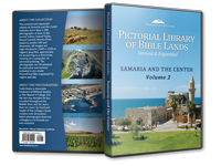
Picture of the Week: Knossos
Palace Throne Room (and Thoughts on the PLBL in the Classroom)
- Seth M. Rodriquez provides some good insights in how to make the
most from the Pictorial Library...
First Season of Excavations
at Abel Beth Maacah
- A new dig is always exciting, especially when it's a virgin site
near the ancient border of the Israelites and Arameans...
And more...
New Satellite Bible Atlas (& Map)
We're excited to announce here the
publication of a new atlas that we've come to love! The
Satellite Bible Atlas
is the result of years of research and preparation by Bill Schlegel,
long-time professor at the
Israel Bible Extension
of The Master's College. Early editions have been used by our
students in recent years, but the atlas is now available to all in
an affordable, hardcover edition.
There are other good atlases, but
here's what makes the
Satellite Bible Atlas
unique and superior to its predecessors:
1. Every map covers a
full page
and is in full color.
That allows for lots of detail and context.
2.
Every other page
is a map. That's a good thing if you think that atlases should be
full of maps!
3. The atlas provides maps of
everything from Abraham's journey from Ur to Paul's arrival
in Rome. Whatever you're reading or teaching, you will find a map
that marks the location and explains the event. You'll never have to guess where something
took place.
4.
The commentary
for the maps is provided on the facing pages, so you don't have to
flip back and forth to understand what you're seeing. Because the
author has a high regard for the historicity of Scripture, you don't
have to worry about whether you can recommend this to others in your church.
5. All of the imagery comes from
satellite photographs.
It is difficult to be more accurate than this!
6. No other atlas has
video commentary
filmed on location in Israel to help you understand the regional
dynamics.
7. Purchase includes free access to
all of the maps in digital (jpg) format. This makes
it easy to use the maps in the classroom and on location.
The
Satellite Bible Atlas
is now reduced to $28, including
free shipping
in the U.S. For an extra $4, you can add
the wall/door map
that shows the entire
land from Dan to Beersheba (and south to Elath). This is a fabulous
deal that we recommend you
take advantage of today.
Those interested in ordering larger quantities for use in the church
or classroom can
contact us
for a greater discount. Customers outside the U.S. may save on
shipping costs by ordering
from Israel.
Check out our website
for more details including screenshots, free downloads, and teaching
videos.
Featured BiblePlaces Photos:
Ephraim and Manasseh
Do you have a favorite area in Israel? The ancient Israelite tribes
did and it was not around the Sea of Galilee. We know what was the choicest
territory based on which land was given to the dominant tribes,
ahead of the "lottery system" used for the rest of the tribes.
 Because the two
faithful spies, Joshua and Caleb, were from the tribes of Ephraim
and Judah, these two tribes were given first pick. They chose the
central hill country north and south of Jerusalem. The remaining seven tribes were apportioned
the land that was left over according to the "casting of lots" in
Joshua 18. (Two and a half tribes had already received portions on
the east side of the Jordan.)
Because the two
faithful spies, Joshua and Caleb, were from the tribes of Ephraim
and Judah, these two tribes were given first pick. They chose the
central hill country north and south of Jerusalem. The remaining seven tribes were apportioned
the land that was left over according to the "casting of lots" in
Joshua 18. (Two and a half tribes had already received portions on
the east side of the Jordan.)
This month's featured photos are from the central hill country that
was allotted to the two sons of Joseph, Ephraim and Manasseh. This is
not only a beautiful area, but it is rich with biblical history as
you'll see from the explanations below.
All of the photos below are available, with
additional photos, in a
free PowerPoint presentation.
A limited version is
also available
in pdf format.
Readers are
welcome to use these images for personal study and teaching.
Commercial use requires separate permission. For more
high-quality, high-resolution photographs and illustrations of biblical
sites, purchase the
Pictorial Library of
Bible Lands or the
Historic Views of
the Holy Land collections.