Look Inside

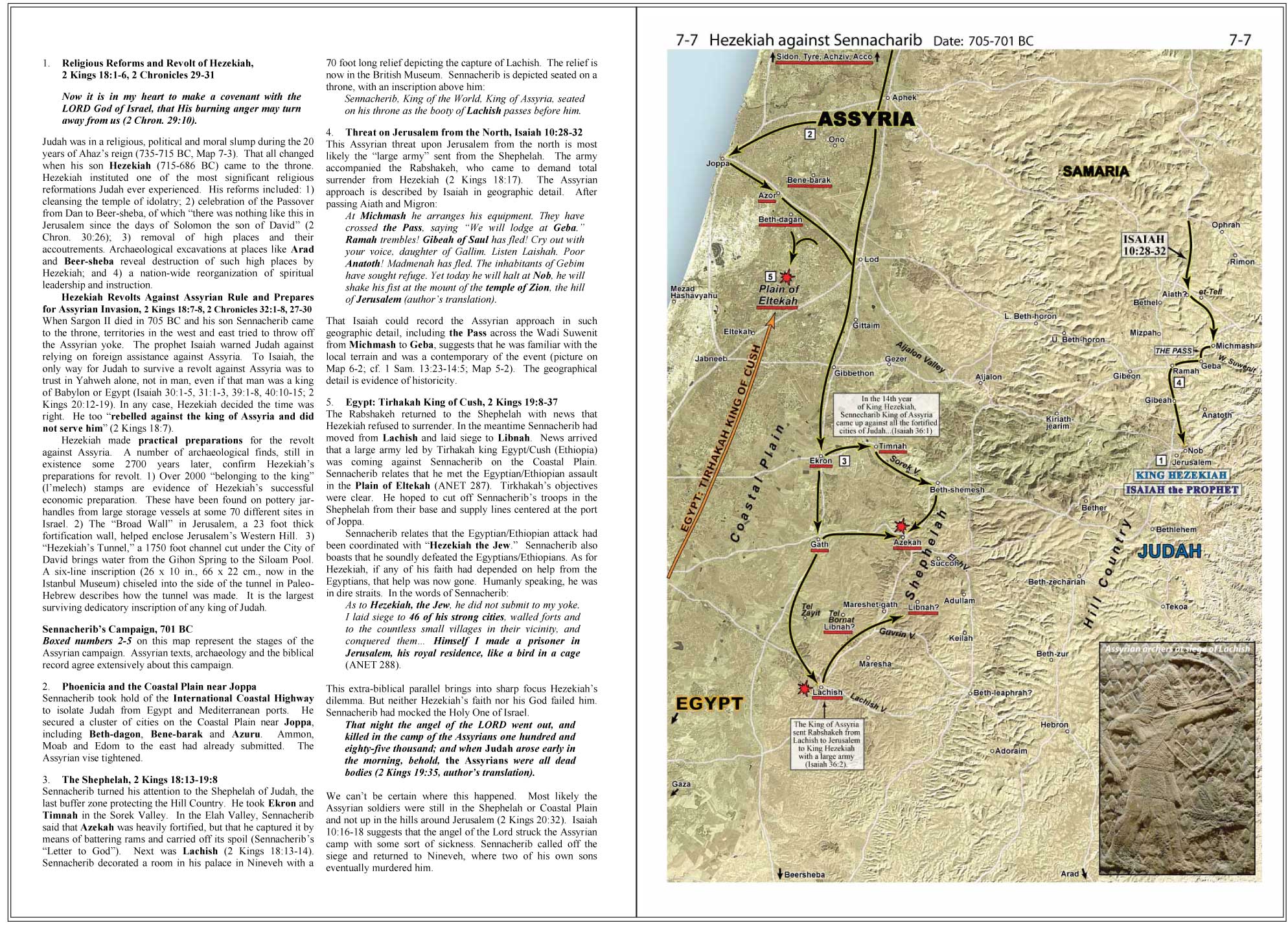
7-7: Hezekiah Against Sennacherib

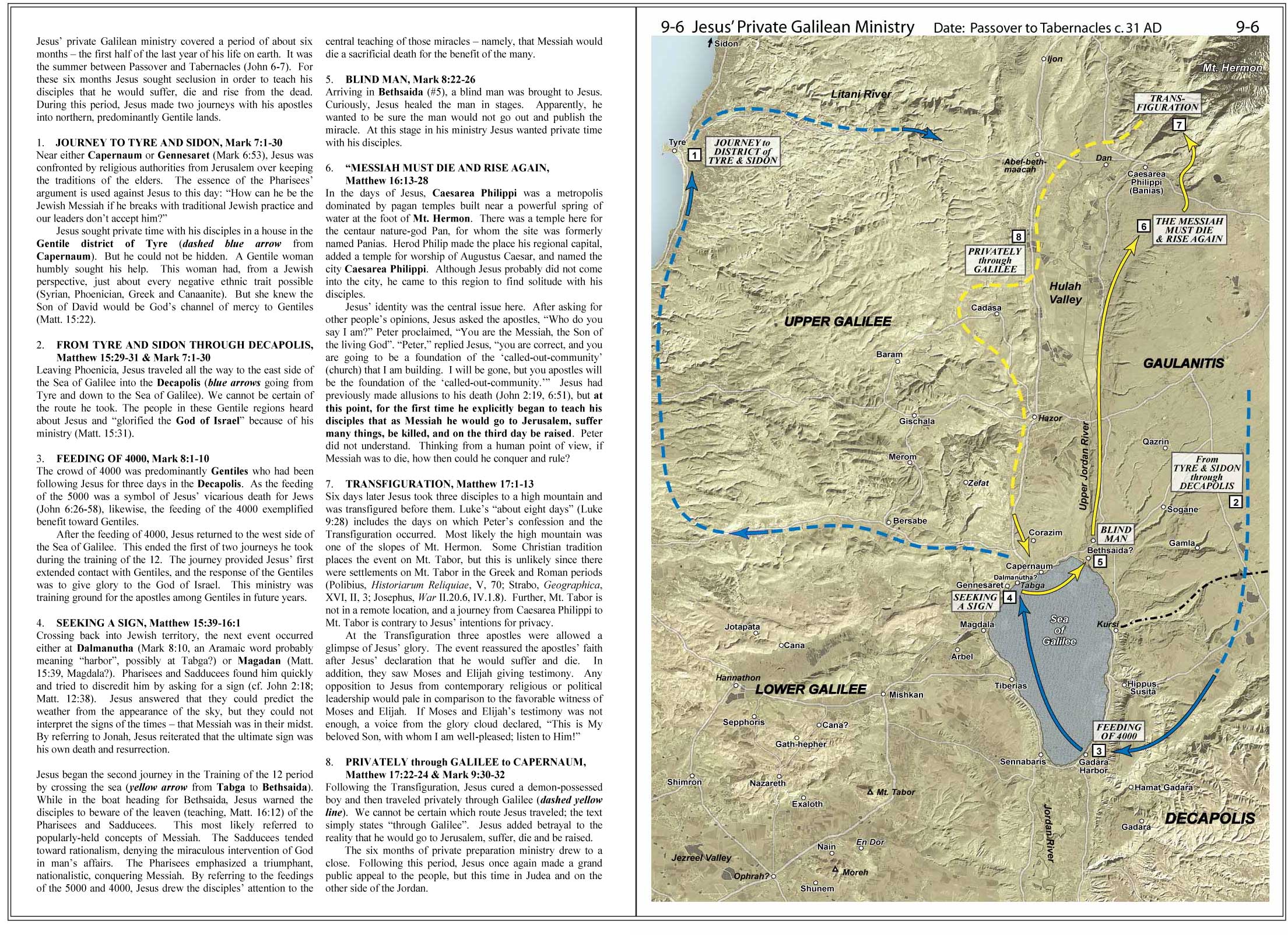
9-6: Private Galilean Ministry
Free Downloads
The Land and the Bible: A Historical Geographical Companion to the Satellite Bible Atlas – An in-depth commentary on the 11 historical sections in the new atlas. 190 pages, pdf format.
Regional Maps Introduction – A brief commentary on the first section in the Satellite Bible Atlas.
Study Questions for the Satellite Bible Atlas – Ideal for personal or classroom use.
Sample Maps
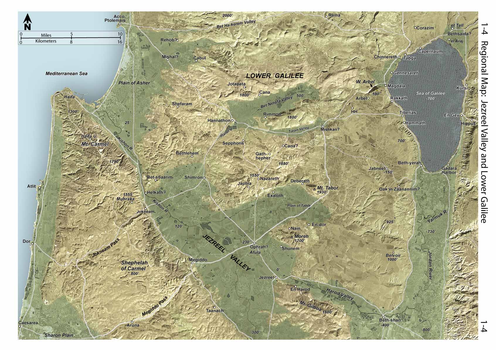
1-4: Regional Map: Jezreel Valley and Lower Galilee

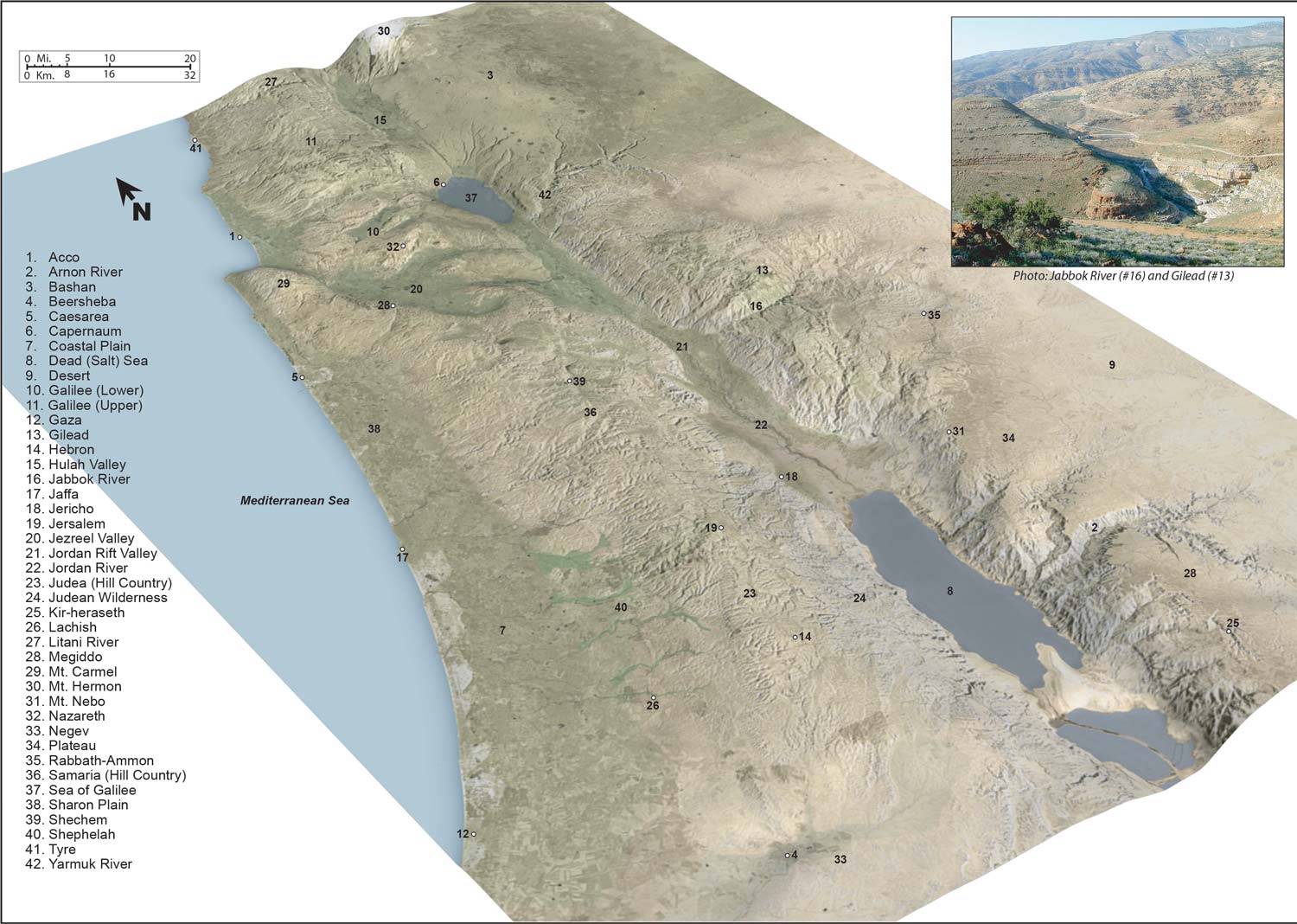
1-16: 3D View to Northeast
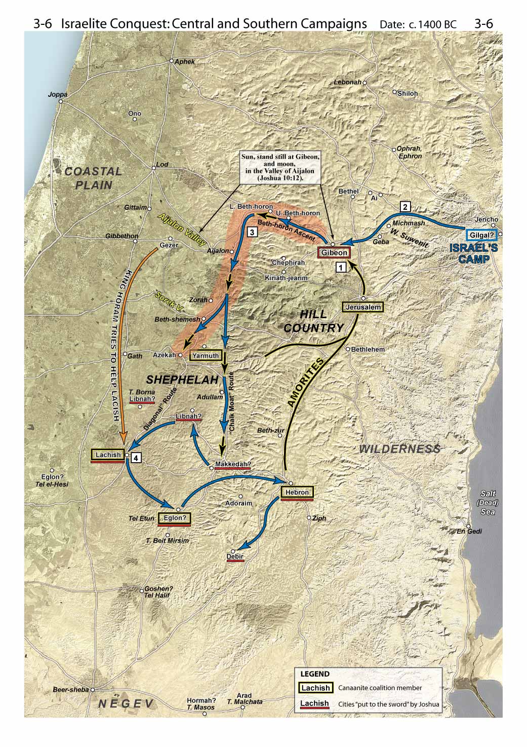
3-6: Israelite Conquest: Central and Southern Campaigns
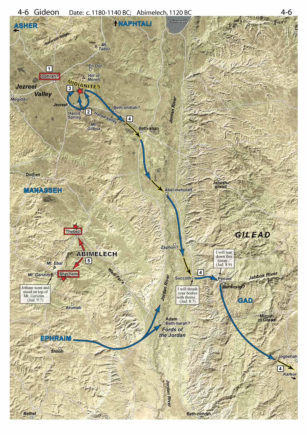
4-6: Gideon
Sample Photos
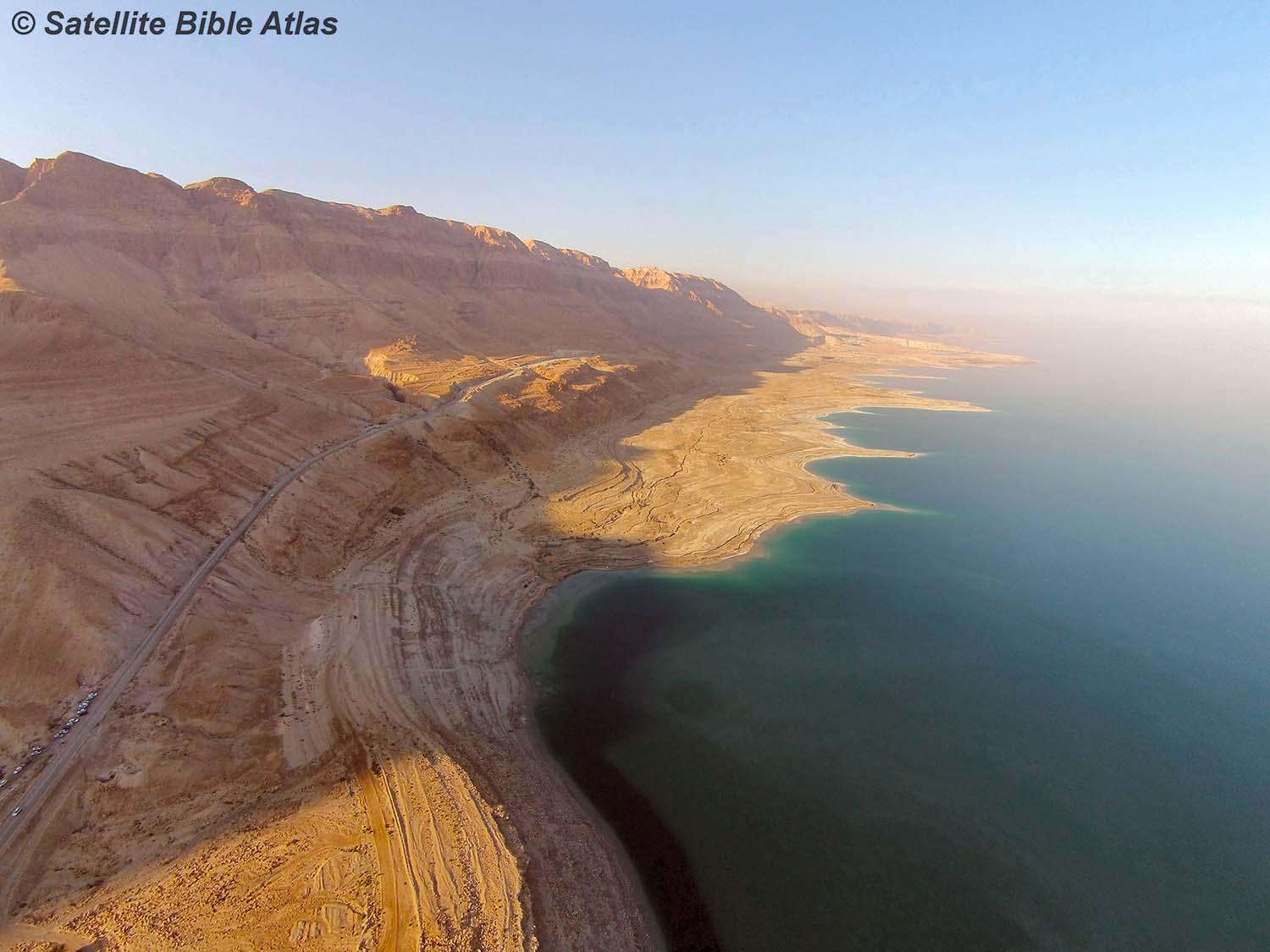
The Dead Sea
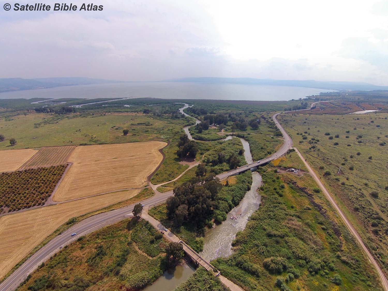
The Jordan River
Reviews
Todd Bolen, creator of the Pictorial Library of Bible Lands, Professor of Biblical Studies, The Master’s University
“This is a must-have. Our students use this atlas in our Israel travel/study program. The precision of satellite photography overlaid with clearly demarcated boundary lines and biblical historical graphics—the whole topped off by text commentary—has resulted in this beautiful and useful historical atlas of Bible lands.”
Eugene H. Merrill, Distinguished Professor of Old Testament Studies, Dallas Theological Seminary
“A delightful and dependable compendium of historical facts and insights. The work is thoroughly researched, punctuated throughout by helpful synchronisms with extra-biblical records, meaningfully interactive with competing opinions, and thoughtfully committed to the factual inerrancy of the Scriptural record. The map markings are remarkably helpful, and the fact that those markings are not superimposed upon a drawn map but upon cartographically-enhanced satellite photographs of the terrain adds a healthy level of reality to the work. Very much worth a focused read-through, and then perpetually valuable as a study resource no matter where the student is in the Scriptures.”
Doug Bookman, Professor of New Testament, Shepherds Theological Seminary
“I own sixteen separate Bible Atlases, and I can say unequivocally Bill Schlegel’s Satellite Bible Atlas is the one I recommend. It is a gateway to some absolutely dynamic Bible study; it is theologically sound and Biblically conservative. I pray that God will use this book in your life as he has in mine.”
Richard Rigsby, Professor Emeritus of Old Testament and Former Director of Talbot Bible Lands Program, Talbot School of Theology
Satellite Bible Atlas
by William Schlegel
Free shipping in the U.S.
Description: A new Bible atlas with 85 full-page color maps with biblical events marked on enhanced satellite imagery, accompanied by geographical and historical commentary.
Product Specifications:
2nd edition
Hardcover: 148 pages
ISBN-13: 978-0-9884275-2-5
Dimensions: 8.5 x 12 inches (21.6 x 30.5 cm)
Shipping weight: 2.3 lbs. (1 kg)
Shipping Options:
For additional discounts on purchases of 12 or more atlases, contact us.
European customers, and others outside the U.S., may save on shipping costs by ordering from Israel. Australian customers will save here.
The atlas is also available in Chinese (Traditional Script).
Table of Contents:
About the Author:
Bill Schlegel taught biblical geography in Israel for 30 years. He now lives with his wife and family in Tennessee.
Visit us on Facebook
Teaching Videos
01 Introduction. Land of the Bible: Location and Land Bridge (5 min)
02 Land of the Bible: Basic Regions and Regional Variety (10 min)
03 Major Routes in the Land of the Bible (6 min)
04 Approaches to Jerusalem and the Benjamin Region, Maps 1-8 and 1-9 (12 min)
05 Southern Approaches to Jerusalem, Map 1-8 (10 min)
06 Jezreel Valley and Lower Galilee, Map 1-4 (14 min)
07 Shephelah of Judah, Maps 1-10, 1-11 (12 min)
08 Samaria, Map 1-7 (15 min)
09 Jerusalem Highway (Modern) in Judean Hill Country (6 min)
10 Sea of Galilee, Golan, Hulah Valley, Mt. Hermon, Map 1-5 (18 min)
11 The Road from Jericho to Jerusalem (11 min)
12 The Negev, Part 1, Maps 1-12, 1-13 (10 min)
13 The Negev, Part 2, Maps 1-12, 3-1, 3-2 (12 min)
Borders of the Promised Land (11 min)