In the Old City of Jerusalem, opportunities are rare to excavate large areas. The best such opportunity followed the recapture of Jerusalem in 1967 when archaeologist Nahman Avigad opened areas that led to the discoveries of the Broad Wall, Israelite Tower, Nea Church, and the Byzantine Cardo. Most tourists to the Old City today see the remains of that Cardo, perhaps while grabbing a bite to eat or doing some shopping.
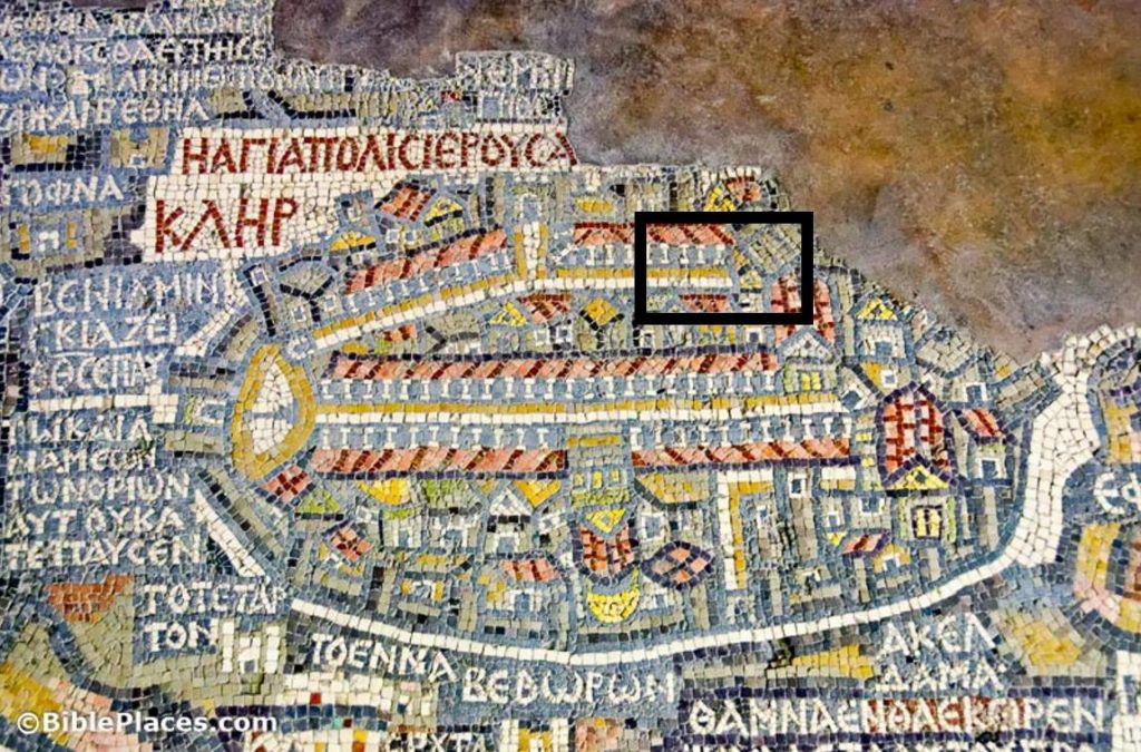 |
| Jerusalem, as depicted on the Medeba Map (circa AD 580); the excavation area is marked with a black box |
Plans to construct a heritage center at the back side of the Western Wall prayer plaza provided Shlomit Weksler-Bdolah and Alexander Onn with the opportunity to see what lay beneath before the building went up. Their large-scale excavations from 2005 to 2010 revealed a Old Testament-era four room house (described here last week) and the Eastern Cardo. They uncovered a few other things as well, including a portion of the Low-Level Aqueduct, but these are the two main discoveries described in their report in Ancient Jerusalem Revealed.
If you can picture the Western Cardo (aka “the Cardo”) in the Jewish Quarter, you can picture the Eastern Cardo. Both consist of a large paved street with sidewalks on either side and with porticoes probably on both sides as well. The street continued in use for nearly 2,000 years, so a lot of the superstructure was missing, including nearly all of the columns. The Eastern Cardo is slightly wider than the Western Cardo, which is not what you would expect from the Medeba Map. The excavators suggest that the Western Cardo was more prominent on the map because this street connected the churches that the pilgrims visited.
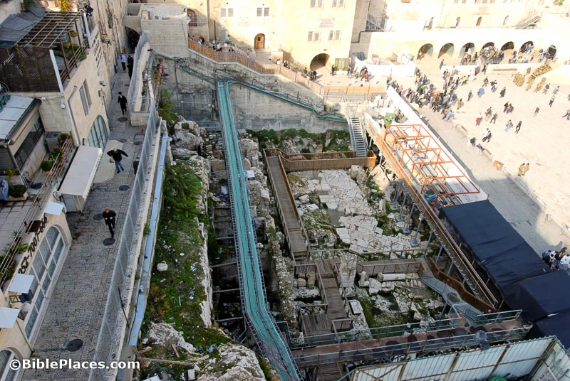 |
| Eastern Cardo excavations, with paving stones visible |
The Eastern Cardo ran from the present-day Damascus Gate south to the area of the present-day Dung Gate, but unlike the Western Cardo, it was constructed in its full length in the Roman period. The archaeologists know that because they found the latest material they found in sealed contexts beneath the paving stones is early 2nd century AD. But while most have expected that the street was built during the Aelia Capitolina renovation circa AD 130, the excavators think it predates that by a few years. It cannot date before Hadrian’s reign (117-138), because of a coin found beneath the pavement, but it may date to Hadrian’s earliest years. The street continued in use through the Byzantine period.
The conclusion of the article describes the history of the street over the following 1,500 years. The short version is this: as years went by, the street’s elevation increased (ultimately 13 feet higher in the 20th century) and its width decreased (down from 77 feet to 9 feet). Presumably at least a portion of this street will be displayed to visitors in the lowest level of the heritage center now under construction.