This isn’t exactly breaking news, but I did not find any other blogs that had written about it, and it seems worthy of mention.

Back in September 2007, Turkish Daily News (now known as The Hürriyet Daily News and Economic Review) reported that operations to clear the land mines near the site of Carchemish had commenced. At the time, it was estimated the clean-up would take about one-and-a-half years. Todd mentioned it here.

As a follow-up to this story, it was reported last December in Today’s Zaman that the mines had been cleared and the land was now in the process of being turned over to the city. After bidding for the mine-clearing project, work actually commenced in March 2010. Three hundred days later, it was complete. Mine-sniffing dogs were used in the initial stages, and to avoid damaging antiquities, the mines were removed to another location for detonation (usually, mines are detonated on the spot). Now that the mines have been cleared, archaeologists will begin “serious and long-term” excavations, which it is hoped will attract tourism.

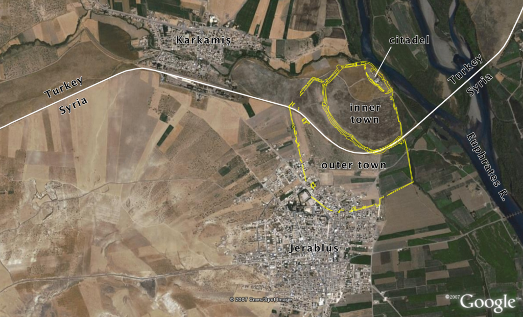
The site of ancient Carchemish is cut by the modern Turkey-Syria border. The citadel and inner town are located within Turkey, but most of the outer town is located in Syria. On the Turkish side is the modern village of Karkamiş and on the Syrian side is the village of Jerablus. As part of Turkey’s attempts to open up trade with its neighbors, plans are underway to open three new border crossings with Syria by 2012, one of which will be located at Karkamiş.


For an account of the earlier excavations conducted by Sir Leonard Woolley, see here.

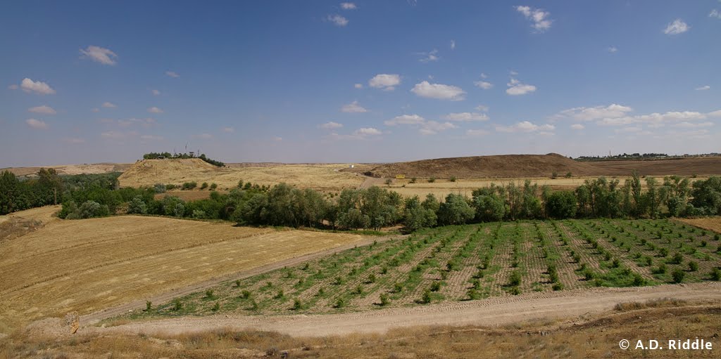
Carchemish from the northwest, view of citadel and inner town wall.

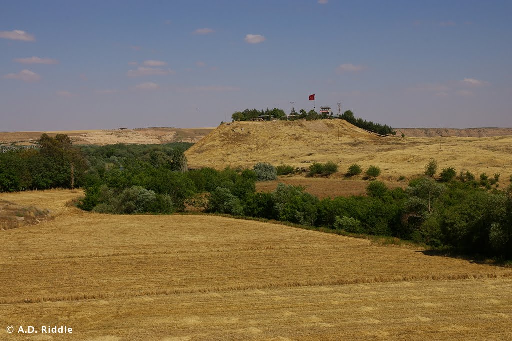
Carchemish citadel from the northwest.
Share:

A large public building that was turned into a church was recently excavated at Khirbet Midras in the Shephelah.  The area was populated in the Second Temple period and is well known for a beautiful rolling stone tomb (since destroyed by vandals). 

The archaeologists are suggesting that the church commemorated the burial place of the prophet Zechariah.  Given that the sources for this appear to date nearly 1,000 years after Zechariah’s death (c. 500 BC), it may be best to regard this as a dubious Byzantine tradition.  Some of the overstated wording of the IAA press release suggests that this claim is going to be the basis for reconstruction and promotion of the site.  From the press release:

A public building of impressive beauty dating to the Byzantine period, in which there are several construction phases, was exposed in the excavation. In the last two construction phases the building was used as a splendid church. However, based on the results of the excavation and as evidenced by the artifacts, it seems that this church is built inside a large public compound from the Second Temple period and the Bar Kokhba uprising which was used in the first construction phases of the compound.
The church, in its last phases, was built as a basilica, at the front of which is a large flagstone courtyard from which worshippers passed into an entry corridor. Through a shaped opening one enters into the nave where there were eight breathtaking marble columns that bore magnificent capitals which were specially imported from Turkey. At the end of the nave is a raised bema and on either side of the nave are two wide aisles. All of the floors in the building were adorned with spectacular mosaic floors decorated with faunal and floral patterns and geometric designs that are extraordinarily well preserved. Located behind the bema are two rooms, one paved with a marble floor and the other that led to an underground tomb devoid of any finds. Branching out beneath the entire building is a subterranean hiding complex in which there are rooms, water installations, traps and store rooms. This complex belongs to the large building from the Second Temple period which the Byzantine church was built into. Among the artifacts discovered in the hiding complex are coins from the time of the Great Revolt (66-70 CE) and the Bar Kokhba uprising (132-135 CE), stone vessels, lamps and various pottery vessels that are characteristic of the Jewish population from the settlement at that time.
As previously mentioned, researchers who visited the site are of the opinion that this place is the residence and tomb of the prophet Zechariah. Ancient Christian sources identified the burial place of the prophet Zechariah in the village of Zechariah, and noted that his place of burial was discovered in 415 CE. The researchers believe that in light of an analysis of the Christian sources, including the Madaba Map, the church at Horbat Midras is a memorial church meant to mark the tomb of the prophet Zechariah. This subject will be examined and studied in the near future.

The full story and the two photos posted below are available at the IAA website (also at the MFA website).


Byzantine church at Khirbet Midras.
Photos courtesy of the Israel Antiquities Authority
Share:

The Bible and Interpretation has the latest “Archaeology in Israel Update” by Stephen Gabriel Rosenberg.  He reports on six stories from November and December 2010.


Non-Destructive Investigation by X-Ray: X-ray fluorescence spectrometry allows for non-destructive analysis of clay and other materials.


Aelia Capitolina, A Roman Bathing Pool in Jerusalem: Excavations revealed where soldiers of the Tenth Roman Legion free time.


Monastery of St. George in Wadi Qelt: A new access road has been completed.


Funding for Restoration of Historic Sites: Sixteen sites will receive additional government funding, including the Herodium.


Sudden Fierce Storm, Destruction and Recovery: The site with the most damage is Caesarea.


Early Homo Sapiens from Cave in Israel, 400,000 Years Ago? Ancient teeth were discovered near
biblical Aphek.

The full review is here.

Share:

The channel from the Western Wall area to the Pool of Siloam is not yet open to the public, but you can get a look inside with photos posted by the Israel Antiquities Authority.  Three high-resolution images are currently available at this page (or try this direct link to the zip file).

You can also watch a 3-minute video posted by the Israel Antiquities Authority, with archaeologist Eli Shukrun showing off the results of seven years of his work.

Share:

Archaeologist Eli Shukrun gave the Jerusalem Post a tour of the recently completed excavations of the drainage channel that runs from the area of the Western Wall to the Pool of Siloam.  The article includes details that have not been previously reported.  From the Jerusalem Post:

The channel was an early drainage system for the city of Jerusalem, which emptied into the Shiloah Pools on the southern end, in today’s Silwan neighborhood. Archeologists believe that the other side of the channel is near Nablus gate [Damascus Gate]. The channel was extensively excavated more than 100 years ago by British explorer Charles Warren in 1867 and archeologists Bliss and Dickey in the 1890s. The southern section of the channel has been open to the public for many years, but this was the first time that it was discovered that it is a continuous channel, about 600 meters long altogether.
[…]
Shukron led the Post on a tour of the channel following the announcement on Tuesday afternoon. The channel is about 1/3 of a meter wide and ranges in height from one to two meters, and is between 15 to 20 meters underground. The channel’s clearing also allowed archeologists to see the lower stones of the Kotel that are currently underground, though Shukron dismissed the Kotel stones as the least exciting part of the project.
“You know the Kotel already; that’s already been overdone,” he said, hurrying past the bottom of the Kotel to point out an underground mikve (ritual bath) and an ancient manhole.
[…]
Shukron also pointed out the remnants of previous explorations, including old wires and writing on the wall in French. He stressed that the channel did not go anywhere near the Temple Mount or the mosques, in contradiction to some claims. The channel follows the Tyropoeon Valley, which is the lowest area in ancient Jerusalem. “That’s why I can’t go up to the Temple Mount, because the Temple Mount is high. There’s no way that a drainage pipe could reach there,” Shukron explained.

The full story includes a photo of the ancient manhole.  The excavations are also reported by Arutz-7 and Ynetnews.

HT: Joe Lauer

Share:

As noted here over the weekend, archaeologists have completed excavation of a drainage channel that ran below street level in the 1st century.  It is now possible to walk along the street and then through the channel from the Pool of Siloam at the south of the City of David up to the Jerusalem Archaeological Park just inside the Old City walls.  In the future visitors will be able to exit the tunnel in the Davidson Center, the archaeological museum at the southwest corner of the Temple Mount. 

This will effectively create a protected route of passage for visitors through a sometimes dangerous Arab neighborhood.  Tourists would enter the archaeological area on the north end of the City of David, walk down to “Area G” before entering the Warren’s Shaft.  From this point, visitors have two options.  Those who are more adventurous and prepared to get wet can walk through Hezekiah’s Tunnel.  Others may choose the dry Siloam Tunnel.  Once at the Pool of Siloam, the tourist can walk along the newly excavated street (first photo below) and then through the newly excavated drainage channel (second photo below).

Excavated street in City of David, Schick, IMG_4413

First-century street in the City of David.  Photo courtesy of Alexander Schick.

Excavated drainage channel in City of David, Schick, IMG_4425

Drainage channel below first-century street in the City of David.  Photo courtesy of Alexander Schick.
From Haaretz:

The Israel Antiquities Authority has completed an archaeological dig of a tunnel that will enable visitors to cross under the walls of Jerusalem’s Old City, not far from the Temple Mount.
The tunnel, which was uncovered during excavations conducted over the past few months, was formerly used for drainage and dates back to the Second Temple. It links the City of David in Silwan with the Archaeological Park & Davidson Center, which is located near the Western Wall.
The Antiquities Authority stressed that the newly uncovered tunnel does not come near the Temple Mount and that it has no plans to dig in that direction.
The digging had been going on for seven years and was delayed for about a year by order of the High Court of Justice, after Silwan residents filed a petition claiming the dig was damaging their homes.

The full story is here.  Earlier reports about these excavations are linked to in a previous post.

Share: