The site of Carchemish is located on the Euphrates River, straddling the Turkey-Syria border. The first excavations in 1878-1881 were conducted by the British consul in Aleppo, Patrick Henderson.

The main excavations at the site, however, took place in 1911-1914 and 1920. The first season was directed by D. G. Hogarth and R. Campbell Thompson. Subsequent seasons were directed by Sir C. Leonard Woolley with the assistance of T. E. Lawrence (aka Lawrence of Arabia) and, in the final year, with the assistance of P. L. O. Guy. The work was interrupted both by World War I (1914-1918) and by the Turkish War of Independence (1919-1923). After the Turkish War of Independence, the modern borders were established, and it became impossible to excavate Carchemish any further.

Carchemish, orthostat in the British Museum with relief of the Storm-god.

Now, 91 years later, work is underway to resume excavations at the ancient site. We remarked on this before, but an online news article now gives additional details. According to a piece in Hurriyet Daily News, the renewed excavations will be conducted by Italian and Japanese archaeologists and are set to begin sometime this year. In preparation for excavations, a contractor had to clear 1,200 landmines from the site. During the mine-clearing, some coins and other objects were retrieved from the site and turned over to the Ministry of Culture and Tourism.

Share:
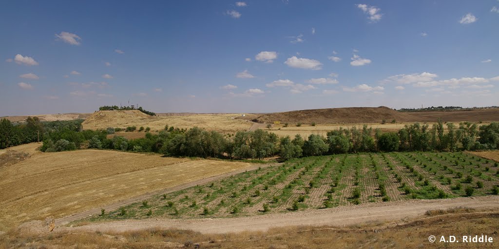
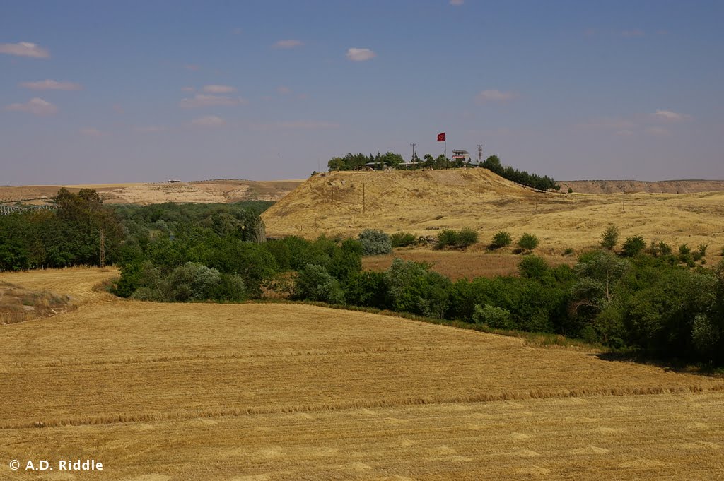
Taita was the ruler of a Syrian kingdom in the Iron Age II. His name appears in Hieroglyphic Luwian inscriptions found at Shaizar and Muhradah, Syria (adjoining towns on the Orontes River, about 13 miles northwest of Hamah) and in a Hieroglyphic Luwian inscription from the Storm-god temple found on the citadel of Aleppo, Syria. (A pdf guidebook by Julia Gonnella entitled The Citadel of Aleppo: Description, History, Site Plan and Visitor Tour, 2nd ed. [2008] can be downloaded for free here. Pages 8-9 and 37-38 show the location of the Storm-god temple and give a brief description.)

In the inscriptions Taita is said to be the “Walastinean hero/king” or “Palastinean hero/king.” This title also appears in Hieroglyphic Luwian inscriptions found at Tell Tayinat, in the Amuq Plain in Turkey. It has been suggested that Tell Tayinat was the capital of Taita’s kingdom and that it extended east to Aleppo and south to Hamath. See most recently J. David Hawkins, “Cilicia, the Amuq, and Aleppo: New Light in a Dark Age,” Near Eastern Archaeology 72/4 (2009): 164-173.

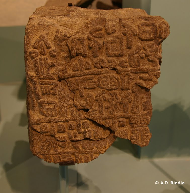
Fragment of a Hieroglyphic Luwian inscription from Tell Tayinat which mentions the “Walastinean king.” On display at the Oriental Institute Museum, Chicago.

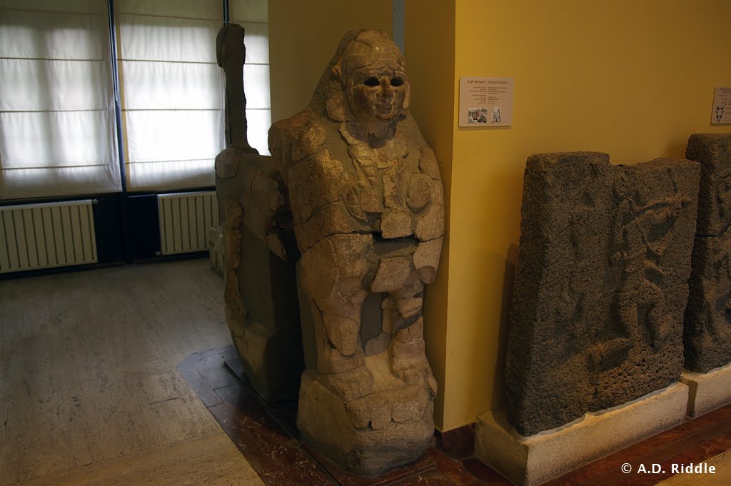
The Luwian language is closely related to Hittite, Lycian, and other Anatolian languages. Luwian was written in both a cuneiform script and a hieroglyphic script, no relation to Egyptian hieroglyphs. Hieroglyphic Luwian was used by kings of the Hittite Empire for monumental inscriptions and seals.

After the fall of the Hittite Empire, Hieroglyphic Luwian continued to be used in the Neo-Hittite and Aramean kingdoms that emerged. In publications, the inscriptions are often named after the place they were found. For the Late Bronze Luwian inscriptions from the Hittite Empire period, see this list. For the Hieroglyphic Luwian inscriptions from the Iron Age, see the three-part volume by John David Hawkins, Corpus of Hieroglyphic Luwian Inscriptions (Berlin: Walter de Gruyter, 2000), aka CHLI. It is reasonably priced at Amazon, though if anyone would like to make a contribution towards my purchase of the set, I am accepting offers. Inscriptions found since the publication of CHLI are listed here. Two years ago, I made a map showing the distribution of Iron Age Hieroglyphic Luwian inscriptions which can be viewed here. It is now outdated.

Returning to Taita, Charles Steitler recently published an article in which he proposed Taita is To‘î, a king who paid tribute to David after David defeated Hadadezer, king of Zobah (2 Sam 8:9-11; 1 Chr. 18:9-11). To‘î is a Hurrian name, and Steitler argues Taita is also a Hurrian name. There is a -ta element in Taita’s name which does not appear in the name To‘î. Steitler is not able to give a definitive explanation for the significance of this element, and thus, we cannot say why it would have dropped out. (Steitler’s article is entitled “The Biblical King Toi of Hamath and the Late Hittite State of ‘P/Walas(a)tin,’ ” Biblische Notizen 146 [2010]: 81-99. It was noted by several blogs beginning I think with Aren Maeir.) There is also the difficulty of dating Taita’s inscriptions. In CHLI, Hawkins said the dating of Taita’s inscriptions was doubtful, but suggested the period 900-700 B.C. In the 2009 article I mentioned previously above the photo, Hawkins now suggests a possible date between the 11th and 10th centuries B.C. So it is hard to know right now if Taita was King To‘î of the Bible.

Benjamin Sass has now written two pieces, one here and more recently, “Four Notes on Taita King of Palistin with an Excursus on King Solomon’s Empire,” Tel Aviv 37 (2010): 169–174. He suggests dating Taita to around 900 B.C. for the main reason that, for Sass, this paints a more satisfying historical picture.

Last month, Brian Janeway contributed a summary of these findings as well. It can be read here.

If these recent discussions are any indication, we can expect that Hieroglyphic Luwian inscriptions will more-and-more play a significant role in our reconstructions of the early Iron Ages. Kenneth Kitchen has already written a couple of essays in which he shows how these inscriptions are an important source of new information for understanding King David’s kingdom.

Kitchen, Kenneth A.
2002 “The Controlling Role of External Evidence in Assessing the Historical Status of the Israelite United Monarchy.” Pp. 111-130 in Windows into Old Testament History: Evidence, Argument and the Crisis of “Biblical Israel.” Ed. V. P. Long, D. W. Baker, and G. J. Wenham. Grand Rapids: Eerdmans.

2005 “The Hieroglyphic Inscriptions of the Neo-Hittite States (c. 1200-700): A Fresh Source of Background to the Hebrew Bible.” Pp. 117-134 in The Old Testament in Its World: Papers Read at the Winter Meeting, January 2003 The Society for Old Testament Study and at the Joint Meeting, July 2003 The Society for Old Testament Study and Het Oudtestamentisch Werkgezelschap in Nederland en België. Ed. R. P. Gordon and J. C. de Moor. Leiden: Brill.

2010 “External Textual Sources — Neo-Hittite States.” Pp. 365-368 in The Book of Kings: Sources, Composition, Historiography and Reception. Supplements to Vetus Testamentum 129. Ed. B. Halpern and A. Lemaire. Leiden: Brill.

And this is for that last reader who is not yet bored to tears. For more reading, probably the best place to start is Near Eastern Archaeology 72/4 (2009). The entire issue is dedicated to Taita, Tell Tayinat, and the Aleppo Storm-god temple. For more information on Luwians and the Luwian language, one might pursue:

Melchert, H. Craig, ed.
2003 The Luwians. Leiden: Brill.

Payne, Annick.
2010 Hieroglyphic Luwian: An Introduction with Original Texts. 2nd revised ed.Wiesbaden:
Harrassowitz.

UPDATE: I received today the latest issue of Biblical Archaeology Review. The cover story is an article by Victor Hurowitz in which he identifies similarities between the Aleppo Storm-god temple, two temples excavated at Tell Tayinat, and Solomon’s temple. See Victor Hurowitz, “Solomon’s Temple in Context,” Biblical Archaeology Review 37/2 (2011): 46-57 and 77-78.
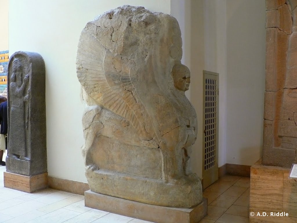
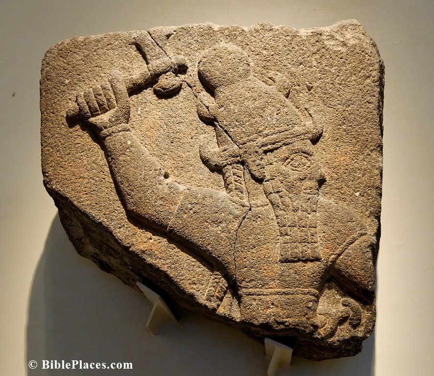
Share:

In Lebanon, just northeast of the city of Zahle, there is a small village named Karak Nouh. Karak Nouh is located in the Beqaa at the eastern foot of the Mt. Lebanon range. In a building adjoining the village mosque, there is a long sarcophagus draped in a green cloth. It is claimed this is the tomb of Noah.


Karak Nouh, Lebanon.

Mark Twain wrote about his visit to Karak Nouh in The Innocents Abroad.

Noah’s tomb is built of stone, and is covered with a long stone building. Bucksheesh let us in. The building had to be long, because the grave of the honored old navigator is two hundred and ten feet long itself! It is only about four feet high, though. He must have cast a shadow like a lightning-rod. The proof that this is the genuine spot where Noah was buried can only be doubted by uncommonly incredulous people. The evidence is pretty straight. Shem the son of Noah, was present at the burial, and showed the place to his descendants, who transmitted the knowledge to their descendants, and the lineal descendants of these introduced themselves to us to-day. It was pleasant to make the acquaintance of members of so respectable a family. It was a thing to be proud of. It was the next thing to being acquainted with Noah himself.

There is another tomb of Noah in the city of Cizre, Turkey (pronounced Jizre). Cizre is on the Tigris River, north of the location where Iraq, Turkey, and Syria all meet. To the east is Cudi Dağ, identified as Mt. Ararat in some traditions.

Tomb of Noah, Cizre, Turkey.


Evidently, there is also a shrine to Noah name Hazrat Nuh in Kerak, Jordan. I have not visited this one, nor do I know if there is a tomb associated with the shrine. I believe the shrine is the small, turquoise building at the far left in this photograph. It is located in a cemetery on the northwestern edge of the modern town.

Kerak, Jordan.

Share:

According to an online news article, Turkey’s Minister of Culture and Tourism, Ertuğrul Günay, is pressuring Germany to return a gate sphinx found at Hattusa, even threatening to revoke the German Archaeological Institute’s permit to excavate Hattusa. The Germans have been directing excavations at Hattusa, the ancient capital of the Hittite Empire, since 1906.

The sphinx in question is presently on display in the Pergamonmuseum in Berlin. It belongs to a pair of sphinxes from the Sphinx Gate of the Yerkapi rampart at Hattusa. The complementary sphinx is on display in the Museum of the Ancient Orient in Istanbul, Turkey.

Berlin Pergamonmuseum.
This is a copy of the sphinx shown below. The sphinx which is being disputed is not in the photo; it is displayed on the opposite wall behind where the photographer stood. (The photographer is now kicking himself.)

Istanbul Museum of Ancient Orient.
Sphinx from Yerkapi rampart Sphinx Gate at Hattusa. This sphinx complements the one in Berlin.

Turkey has given Germany until the end of July to return the sphinx. Germany has apparently rejected previous requests. The sphinx was taken to Berlin in 1915 to be restored.

Hattusa is an enormous and complex site just on the outskirts of the modern village of Boğazkale (more commonly known by its former name Boğazköy). Hattusa had dozens of temples and a citadel.

The fortifications included various gates with parabolic arches, a massive rampart on the southern end, and casemate walls. The German excavations are currently directed by Andreas Schachner. From 1994-2005, Jürgen Seeher directed the excavations. Seeher is the author of the best guidebook on Hattusa, Hattusa Guide: A Day in the Hittite Capital, 3rd rev. ed. (Istanbul: Ege Yayınları, 2006). It is chock full of photos, plans, and descriptions, and has a fold-out map.

Much of the guide is available online here. If you have the opportunity to visit the site, allow yourself at least one complete day and make sure you have a car and Seeher’s guidebook.


Yerkapi rampart at the south end of Hattusa.
Below center is a postern gate and tunnel and directly above is the Sphinx Gate.

Buyukkale, the Royal Citadel at Hattusa.

HT: Jack Sasson

UPDATE (5/20): Germany has agreed to give the Sphinx to Turkey.  Details are here.

Share:

This isn’t exactly breaking news, but I did not find any other blogs that had written about it, and it seems worthy of mention.

Back in September 2007, Turkish Daily News (now known as The Hürriyet Daily News and Economic Review) reported that operations to clear the land mines near the site of Carchemish had commenced. At the time, it was estimated the clean-up would take about one-and-a-half years. Todd mentioned it here.

As a follow-up to this story, it was reported last December in Today’s Zaman that the mines had been cleared and the land was now in the process of being turned over to the city. After bidding for the mine-clearing project, work actually commenced in March 2010. Three hundred days later, it was complete. Mine-sniffing dogs were used in the initial stages, and to avoid damaging antiquities, the mines were removed to another location for detonation (usually, mines are detonated on the spot). Now that the mines have been cleared, archaeologists will begin “serious and long-term” excavations, which it is hoped will attract tourism.

The site of ancient Carchemish is cut by the modern Turkey-Syria border. The citadel and inner town are located within Turkey, but most of the outer town is located in Syria. On the Turkish side is the modern village of Karkamiş and on the Syrian side is the village of Jerablus. As part of Turkey’s attempts to open up trade with its neighbors, plans are underway to open three new border crossings with Syria by 2012, one of which will be located at Karkamiş.


For an account of the earlier excavations conducted by Sir Leonard Woolley, see here.

Carchemish from the northwest, view of citadel and inner town wall.

Carchemish citadel from the northwest.
Share:

About four months ago, Todd announced the publication of a new guidebook for Turkey entitled Biblical Turkey: A Guide to Jewish and Christian Sites of Asia Minor, by Mark Wilson (Ege Yayınları, 2010). What prompts this review is the news that the book can now be ordered from Amazon.com and sells for $39.95.

Biblical Turkey
is not a guidebook like Lonely Planet or Rough Guide—it does not tell you where to find accommodations or the best places for affordable dining. What Biblical Turkey does do, however, is give you just about all the archaeological and historical information you will need for numerous sites in Turkey. The book includes every well-known and lesser-known site which is mentioned in the Bible, but it includes much more than that. As such, this is rich resource, whether you travel to Turkey or not (though, I recommend that you take a trip at some point).

What sets this book apart from A Guide to Biblical Sites in Greece and Turkey, by Fant and Reddish (Oxford Univ. Press, 2003), is its comprehensiveness. Fant and Reddish did not include a number of sites that are mentioned in the Bible, such as Cnidus, Carchemish, and Harran. Wilson includes all of these as well as many other important archeological sites which are not mentioned in the Bible, such as Van Kalesi (ancient Tushpa, the capital of Urartu), Gordium (the capital of Phrygia), Kanesh/Kültepe (the Old Assyrian trading colony), and Nemrut Dağ (the mausoleum of Antiochus I of Commagene).

Nemrut Dağ west terrace, toppled heads from colossal statues.

Biblical Turkey is organized by five regions, beginning in eastern Turkey and working westwards. Each chapter begins with historical and geographic descriptions of ancient regions and provinces (e.g., Cappadocia, Galatia) and then covers the ancient cities within that region. For each region and city, biblical references are listed, a historical summary is given, and the relevant inscriptions and archaeological remains are described. Though written in a non-technical style, the text betrays a depth of technical knowledge in these areas which is quite impressive. Nearly every two-page spread is graced with a carefully selected photograph of the site, an architectural element, or an inscription, which is helpful for understanding the text. Finally, for many sites, Wilson provides a title or two for “further reading.” Most of the titles he suggests are guides available at the site itself, often written by the archaeologists, and published in Turkey. These can be difficult to obtain, but it is helpful nevertheless to have this information. (For those who are desperate enough to pay the stiff shipping charges, many of the titles can probably be purchased at Zero Books.)

I find several other features of Biblical Turkey helpful. The Turkish names are provided alongside the more common English names which facilitates navigating by maps and road signs. The book is also generously furnished with site plans and sidebars. The sidebars come in three types: “side trip” boxes provide brief descriptions of lesser-known sites you may want to add to your trip if you have spare time, “in-site” boxes give more background detail (e.g., a New Testament timeline, the seven ecumenical councils, or ancient travel on the Mediterranean), and “ancient voice” boxes discuss ancient textual sources in greater detail.

Maybe I’m gushing now, but I wish all guidebooks were written like this one. A lot of thought and research went into the content and its organization. Turkey is a vast country with many fascinating things to see and study. With this book in hand, no longer will so much of it go unnoticed.

FURTHER NOTE: Mark Wilson is the director of Seven Churches Network and Asia Minor Research Center. You can read more about Mark here. Leen Ritmeyer reviewed and recommended the book here.

Share: