fbpx

Excavations continue on the Mugrabi Gate leading to the Temple Mount, though the protests seem to have ended.  Haaretz has the story, and I have photos from a few days ago.

Tensions have subsided even though construction at the Mugrabi Gate has never stopped despite violent Temple Mount clashes in February and concerns of diplomatic confrontations with Arab and Muslim countries. The construction has not been considered a reason to limit entry to worshipers, and senior police sources say the relative calm stems from the evaluation of the work by a Turkish and UN delegation, who confirmed that the Temple Mount is not being harmed by these efforts.
The Jerusalem police no longer consider the construction activity, which is being carried out by the Israel Antiquities Authority to bolster crumbling infrastructure, as a danger to calm in the Temple Mount area. Each Thursday the police hold a special meeting, evaluating the situation and deciding whether to impose restrictions to the entry of Muslims wishing to attend Friday prayers at the Temple Mount mosques.

Photos from May 17, 2007


HT: Explorator

Share:

I’m not sure if I’ve linked to this before, but if you haven’t yet seen this man move massive stones singlehandedly, it’s worth a look.  It certainly gives insight into how the ancients might have constructed monumental buildings like the Giza pyramids, the Temple Mount of Jerusalem, and Stonehenge.

I know that in recent weeks I haven’t been very regular in posting here, and that’s going to continue for the next three weeks as I am teaching a group, from Dan to Beersheba, and beyond.

Share:

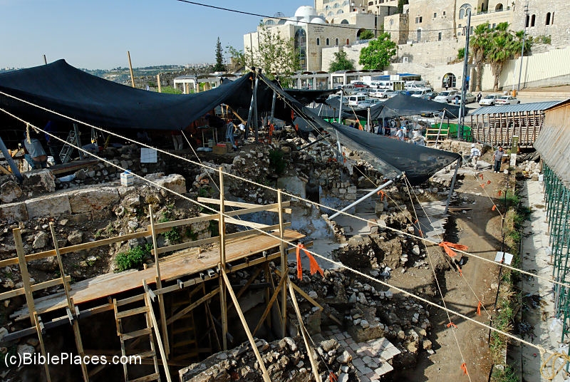
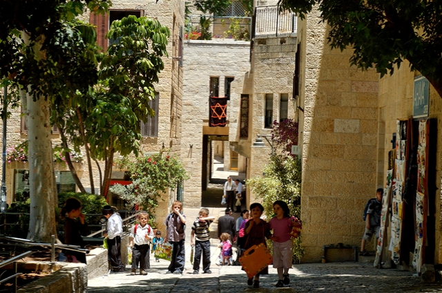
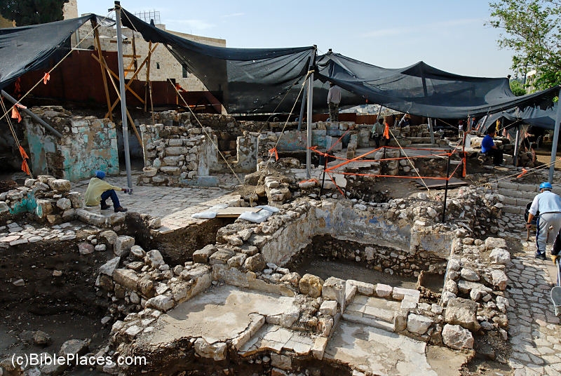
For the 40th anniversary of Jerusalem as a united city under Israeli control, the Jerusalem Post has a reflective article on the changes in the Jewish Quarter of the Old City during these four decades. 

What once was a place for cheap rent has become the most expensive real estate in the city, with an apartment selling recently for $5 million.  The article includes interviews with some who have witnessed the dramatic changes.  An excerpt:

In addition to new buildings and archeological finds, the rebuilt quarter needed residents. “It was difficult to bring people to live here after ’67,” explains Arzy. “At the beginning of the period, the director decided that if someone from the US wanted to buy a house here, we wouldn’t sell it. There was a fear that Jews wouldn’t come here, that foreigners would buy up all the property and there wouldn’t be Jewish residents here.”
Real estate in the Jewish Quarter includes some of the most desirable properties in the world; rentals and property for sale are known to be available only for hours at the most, not days, weeks or months. The JQDC officially owns the entire quarter and those who buy property technically lease it for only 49 years. In keeping with the original 1967 decision, only Israeli citizens may purchase real estate, and all purchases, rentals or transfers must be approved by the JQDC.
“The population has changed from the beginning,” says Arzy. “Once, there were very few haredim; there were more religious Zionists and secular residents. Little by little more haredi families moved in and then in a certain period, in the 1990s, a lot of haredi immigrants came from America.”
Today, there are 600 families, or about 2,500 Jewish residents, out of 34,700 total residents in the Old City.
“But at the beginning of the 20th century, there were 20,000 Jewish residents, out of 37,000 total. That means, back then it was mostly Jewish in the Old City, and not just in the Jewish Quarter,” he adds.
Arzy is reluctant to talk about property values today. “I can say it’s a pity that I didn’t buy here, because today the prices are astronomical. To my knowledge it’s the most expensive real estate in Jerusalem. An apartment I know, a house opposite the Western Wall, was sold recently for $5 million.”

Share:

Dave Barrett has let me know that Bible Mapper 2.0 has been released.  Bible Mapper 2.0 does a lot:

Bible Mapper is a fully interactive, highly accurate Bible mapping system that helps you quickly and easily create customized maps of the Holy Lands or study a particular period and aspect of Bible history. With Bible Mapper you can:
+ select the types of standard map objects you want to appear on your map (cities, mountain peaks, rivers, roads, political boundaries, etc.)
+ select terrain imagery (relief and elevation, satellite land cover, etc.) or even load your own
+ select which biblical eras to display (only those cities and boundaries that existed during that period will be displayed)
+ change the color or style of almost any object on your map, including the terrain
+ create your own custom objects (or make a duplicate of a standard object) right on your map, including points, lines, areas, and ellipses, and apply a uniform style to it from a style library
+ texturize your lines or boundary areas, allowing the underlying relief to be combined with it
+ import basic geographic data (points, lines, areas, etc.) created by other software and customize it on your map
+ print, save, or export your map, or copy it to the Windows® clipboard
+ quickly calculate the exact distance of a road, river, or custom line object
+ find a place from biblical times just by clicking on it in the Find box
+ read an encyclopedia article about a biblical place
Bible Mapper is the ideal tool for developing customized maps of Bible lands and researching Bible places.

You can get all of the details at www.biblemapper.com.  I really like the screenshot below that illustrates some of the new capabilities.  The program offers a lot of features and it’s easily worth the $35.  But you can download it and try it out before buying.


Click map for high-resolution screenshot
Share:

After reading the full press release of the Hebrew University, I am more convinced that this is Herod’s tomb that was discovered recently.  The location, high on the slope of the hill next to (or along?) the monumental staircase, could hardly be the site of anyone’s tomb outside of the royal family.  By the way, that monumental staircase has long been known about, as its remains are visible on the slope.  But no one realized that it led to the tomb instead of (or as well as?) the upper palace. 

It certainly is a curious fact that Herod built two tomb monuments for himself, and it is equally remarkable that it took archaeologists more than 35 years of active work to locate the structure.

As indicated in the press release, the sarcophagus is a clear indicator of the date and wealth of its inhabitant.  Only fragments of the stone coffin were found, but it is clearly of the highest quality and from the right time period.  I think that one could argue that it belonged to any one of the royal family (e.g., a wife or a son), but it’s probably more likely it belonged to King Herod himself.

I recommend reading the press release yourself (it’s not long), but here are three points that caught my attention:

  • The tomb was approached “via a monumental flight of stairs (6.5 meters wide) leading to the hillside that were especially constructed for the funeral procession.”
  • The podium was “built of large white ashlars (dressed stone) in a manner and size not previously revealed at Herodium.”
  • “Worthy of note is the fact that the sarcophagus was broken into hundreds of pieces, no doubt deliberately. This activity, including the destruction of the monument, apparently took place in the years 66-72 C.E.”  I wonder how many of these pieces were found (not many, judging from the reconstruction), and I wonder if there’s any real evidence to suggest the date of destruction, or if that’s just an educated guess.

An old but detailed and illustrated article on the Herodium from Biblical Archaeology Review is now available online (probably for a limited time) if you want to learn more about the site.


Archaeologist Ehud Netzer
Photo: © Alexander Schick / www.bibelausstellung.de
Share:

Arutz-7 appears to be the first with a detailed report from the press conference.  The Jerusalem Post and Haaretz are still reporting only the basics.

The approach to the burial site was via a monumental flight of stairs 6.5 meters wide, leading to the hillside; the stairs were especially constructed for the funeral procession. Herod died in Jericho, but left instructions to be buried in the area known as the Herodium.
The mausoleum itself was almost totally dismantled in ancient times, but part of its well-built podium remains. Spread among the ruins are pieces of a large, unique coffin, nearly 2.5 meters (over 8 feet) made of a Jerusalemite reddish limestone, decorated by rosettes. The sarcophagus (coffin) had a triangular cover, which was decorated on its sides. Only very few similar sarcophagi are known in the country, and can be found only in elaborate tombs such as the famous one at the King’s Tomb on Salah a-Din Street in eastern Jerusalem.

The tomb was found on the slope of the hill, and not in the complex that Herod had prepared for his burial.  Some possibilities: 1) Herod ordered the location change in order to thwart tomb robbers (if so, he failed).  2) Herod’s subjects buried him here, defying the wishes of the king (as did Herod’s sister in ordering the leading men of the kingdom released before Herod’s order to kill them could be carried out).  3) Herod’s body was moved at a later time.  4) This isn’t Herod’s tomb.

On the last point, I would simply note that the basis for this “definite” identification is “a combination of the location, type of work at the tomb, the decorations, and pieces of the coffin.”  In other words, there is no inscription.  In order to make a convincing case, the workmanship of the tomb and coffin are going to have to be of the highest quality.  It is interesting that “location” is factored into the identification, as it seems that the location, not in the prepared burial place, would argue against the identification.  But of course, it is at the Herodium, and presumably, not just any wealthy citizen could be buried there.

I look forward to seeing photographs of the discoveries, and hope that soon the tomb area will be open to visitors.


Herodium with swimming pool and lower city in foreground
Update: Yahoo has the AP story with a nice slideshow showing the area of the excavation.
Share: