This is the first in what I plan to be an extended series of blog posts illustrating the value of historic photos using examples from The American Colony and Eric Matson Collection. I’ve written much elsewhere about how the biblical lands have been altered in the last 100 years, but there’s no better way to illustrate this than with photographs.
A good example of how the land has changed in the last hundred years is Ein Harod, also known as Gideon’s spring. Here the timid warrior gathered thousands of Israelites to fight the Midianites, but the Lord gave him a plan to sift the men by separating the lappers from the kneelers (Judges 7).
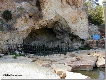
Today the spring has been nicely “improved” so that it’s very difficult to understand how such a selecting procedure would have occurred.
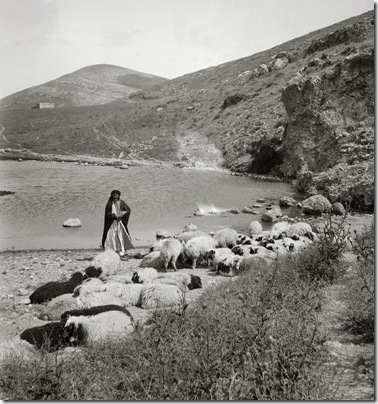
One hundred years ago, there was no fence to keep tourists out and no paving stones to walk across. Not only that, the flow of the spring has apparently been greatly diminished because of modern wells in the area. It is likely that the way the spring looked like in A.D. 1900 is the way that it looked in 1100 B.C. when Gideon brought his men here.
George Adam Smith described it this way: “It bursts some fifteen feet broad and two deep from the very foot of Gilboa, and mainly out of it, but fed also by the other two springs, flows a stream considerable enough to work six or seven mills” (Historical Geography of the Holy Land [1909]: 397-98).
This is one of 600 high-resolution photographs in the new Northern Palestine CD, volume 1 of The American Colony and Eric Matson Collection. Photo: Library of Congress, LC-matpc-01077.

