The waters of the Dead Sea rise and fall. You may not know that if you only read the newspapers and not the history books. Climate change has affected the earth as long as we can tell. There’s a great demonstration of the historically changing levels (and therefore shape) of the Dead Sea recently created by A.D. Riddle and David Parker. (After you click that link and read the introduction, click on the “Play” button on the right side and you’ll see the water level rise and fall.)
Evidence of the changing water levels is not so easily seen at the Dead Sea today. There is one spot on the northwestern corner (south of Qumran) where a marker made by the Palestine Exploration Fund in the early 1900s shows the level above today’s current highway.
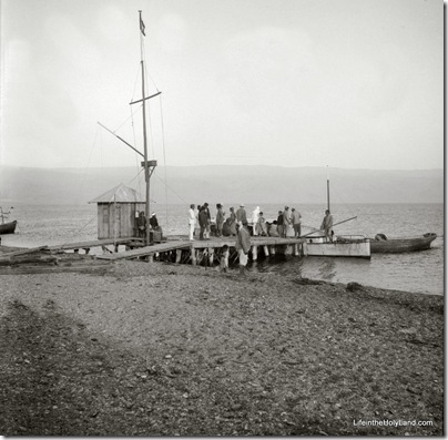
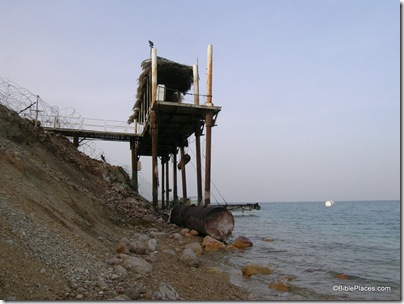
Another evidence is visible from boat docks. The photo below was taken by the American Colony sometime in the first half of the 20th century, showing passengers embarking on boats on the Dead Sea. Today there is little boat traffic and almost no windsurfers or waterskiiers. That’s not the only thing that has changed, as evidenced by the second photo below.
The photo below is not the same dock, but it illustrates the declining water level. This photo was included in a recent issue of Biblical Archaeology Review in an article making the same point.
The top photograph is from the newly published Southern Palestine volume of The American Colony and Eric Matson Collection (originally Library of Congress, LC-matpc-07571). It is one of a series of 65 photos of the western shore of the Dead Sea included in the collection.

