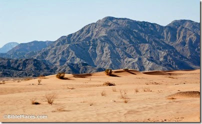
The area between the Dead Sea and the Red Sea is slated for major development on the eastern side as Jordan has announced a master plan for constructing dams, lakes, and tourist venues.
From The Jordan Times:
The JVA will create a new specialised unit that will supervise the implementation of the development projects in Wadi Araba, a 165-kilometre long and 9-25-kilometre-wide area between Southern Ghor and the Gulf of Aqaba, an official at the ministry told The Jordan Times.
In the statement, Nasser underscored that the development ventures will be implemented once funding is secured, highlighting that the projects seek to attract people to live in Wadi Araba and businessmen to invest in the area.
[…]
Meanwhile, the planned Red Sea-Dead Sea Water Conveyance Project, which will pass through Wadi Araba, is expected to have a major impact on the area’s development by attracting investment, the minister noted.
“Lakes will be created to establish tourist projects, chalets and entertainment centres, in addition to artificial sea-water lakes for fish farming.”
[…]
Wadi Araba is situated along Rift Valley-Red Sea route, which is the world’s second most-used flyway, with 37 types of migratory soaring birds that maintain flight by using rising air currents, travelling on the flyway annually, according to the Royal Society for the Conservation of Nature.
The article gives more information about the planned dams, the agricultural development, and the migratory pathways. Jordan’s ability to attract tourism has proven poor in the past (compare Aqaba with the neighboring Eilat), but the popularity of Petra could help to boost interest in the Arabah in the winter months.
HT: Jack Sasson
Photo from the Jordan volume
