fbpx
(Post by A.D. Riddle)

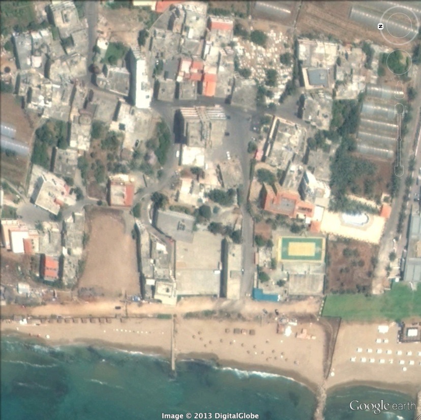
The answer to yesterday’s challenge is Nabi Yoûnis (or Nebi, Neby, Yunus, Younes, Yunas—there are a variety of English spellings. I will use the spelling “approved” by the U.S. Board on Geographic Names). It was answered correctly and quickly in the comments, so maybe next time, we should leave out the Google Earth view. The name Nabi Yoûnis is Arabic for Prophet Jonah, and the site commemorates the location where the great fish spit Jonah out onto dry land. It is located in Google Earth at 33.660894°, 35.418515°.

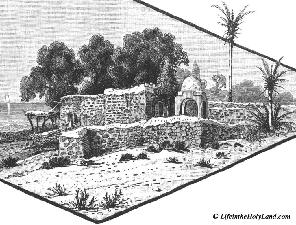
At 8:10 am on Tuesday, June 26, 1838, Edward Robinson passed by Khan Nabi Yoûnis on his way from Sidon to Beirut. He mentions that nearby was “Wely Neby Yunas, with a white dome, marking the place where, according to the Muhammedan legend, the prophet Jonas was thrown up by the fish” (Biblical Researches 3: 430-431). A nearly identically-worded description is found in Picturesque Palestine 3: 40. 

Drawing of Nabi Yoûnis from Picturesque Palestine, vol. 3.

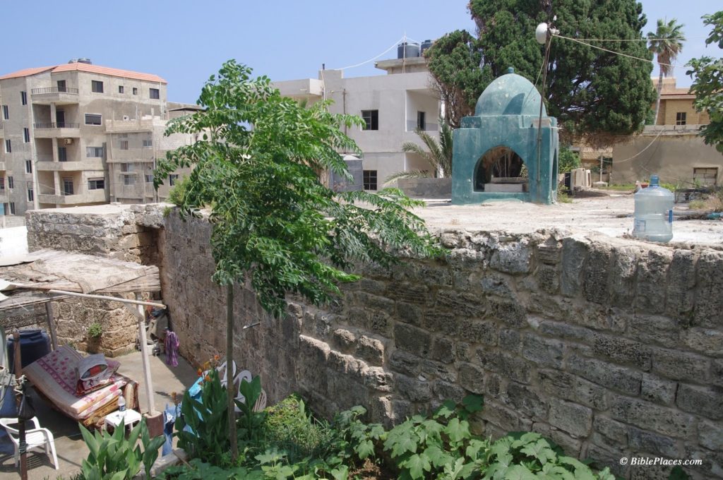
Today, the Muslim shrine described by Robinson is surrounded by the Shiite village named Nabi Yoûnis and bears little resemblance to the drawing above. Also, the dome is now green.

Modern Nabi Yoûnis. 

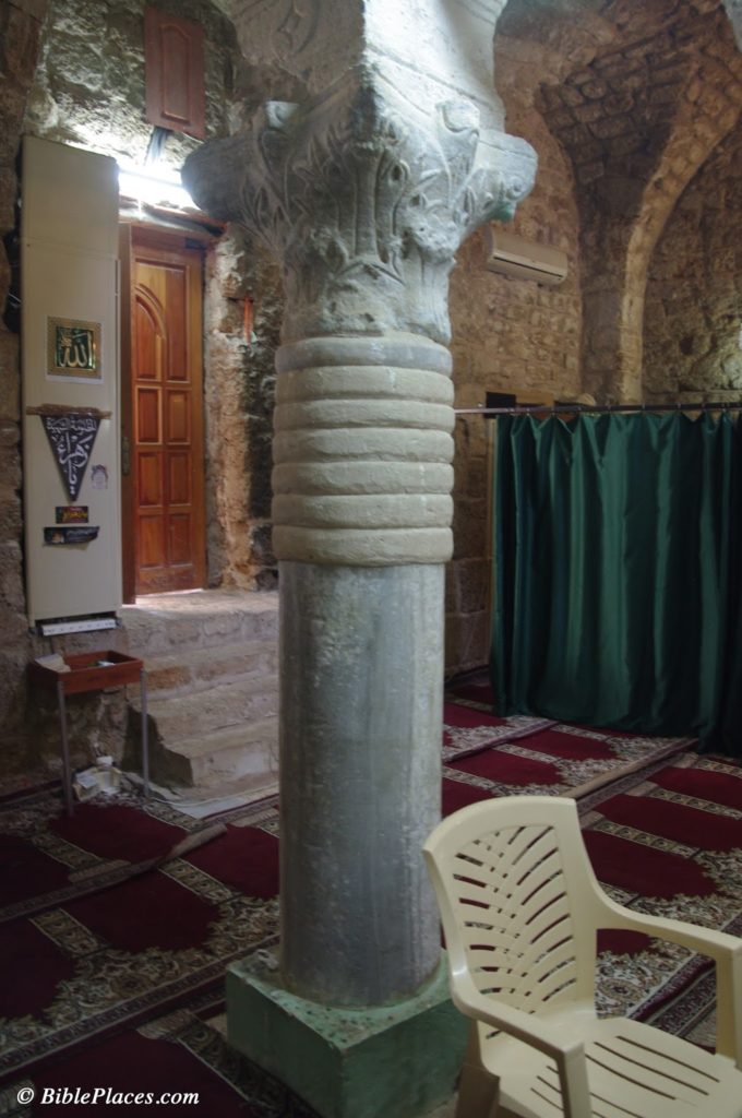
The Muslim shrine occupies the site of an earlier Byzantine church which was apparently destroyed by earthquake. Some remains from this church can be seen in reuse inside the shrine. During the Mamluk period, the structure was rebuilt and converted into a Muslim shrine.

Nabi Yoûnis, Corinthian capital from Byzantine church reused in modern Muslim shrine.

I have no way for evaluating whether or not this tradition is historically accurate, that Nabi Yoûnis is the place where Jonah was spit out. It is interesting to note that according to 2 Kings 14:25, a prophet named Jonah son of Amittai lived during Jeroboam II’s reign. This verse explains that Jonah announced large territorial gains for the kingdom of Israel in the time of Jeroboam II. For a brief moment in history, the boundary of the kingdom extended north to Lebo-Hamath, identified with modern Labwe in Lebanon. The Aramean kingdoms of Damascus and Hamath were also subjected to Israel. Nothing is said concerning the Phoenician coastal cities, so I do not know if Nabi Yoûnis would have been under some kind of Israelite control or not at this time as well.

Further note: a small side room in the Nabi Yoûnis shrine supposedly houses the tomb of Jonah. As with Noah, there are apparently multiple sites that are believed to be Jonah’s burial place. Another such tomb of Jonah is located in el-Meshhad, Israel, the site identified with Jonah’s hometown, Gath-hepher (see Picturesque Palestine 2: 61, illustration on 56).

References
Harb, Antoine Khoury.
2008     The Roots of Christianity in Lebanon. Beirut: Lebanese Heritage Foundation.

Share:
(Post by A.D. Riddle)

“The LORD commanded the fish, and it spewed Jonah out upon dry land” (Jonah 2:11, JPS).

Can anyone name the place where, in church tradition, Jonah was vomited back onto land? Here is a Google Earth view to get the ball rolling.

Post your answers in the comments below, and tomorrow we will post a follow-up with photo. I think it is safe to allow research for this one. Please give some indication of your source(s).

Share:

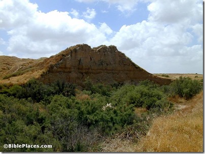
The site identified as the most eroded site in Israel is Tell Jemmeh, located on the bank of the Nahal Besor about 7 miles (12 km) due south of the city of Gaza. The site was identified as biblical Gerar by W. J. Phythian-Adams and Sir Flinders Petrie. Benjamin Mazar’s suggestion that Tell Jemmeh is Yurza is now commonly accepted. Yurza is mentioned in Egyptian and Assyrian texts but not in the Bible. The source of the quotation is the “Jemmeh, Tell” article by the late Gus W. Van Beek in The Anchor Bible Dictionary, volume 3, page 677.

We had a number of good responses in the comments yesterday, all of which show that there are many severely eroded tells in Israel. The correct answer was given by Dr. Carl Rasmussen, but if you’re feeling bad that you lost out, you can take comfort in the fact that you lost to someone who has written one of the best Bible atlases!

Tell Jemmeh side washed out by Nahal Besor, tb050701352
Tell Jemmeh, showing erosion caused by the Nahal Besor.
Photo from the Pictorial Library of Bible Lands,
volume 5
Share:

Can you identify this site?

“[The site] originally occupied a mesa encompassing an area of 4.92 hectares (12.15 acres). It is the most-eroded major site in Israel, the N end having been destroyed by flash floods in Nahal [X], and the S end by severe erosion. The area on the top of the mound is now reduced to 0.26 hectares (0.64 acres) from an estimated original area of 3.04 hectares (7.51 acres). The site is the highest point in the landscape, reaching a height of 22 m (71 feet) above present ground level. Its upper 15.50 m (50 feet) is occupation debris of successive towns.”

If you know the answer, you’re welcome to post it in the comments below. If you discover the answer by research, please do not post it in the comments below. I’ll post the answer, source of the quotation, and a photo tomorrow.

Share:

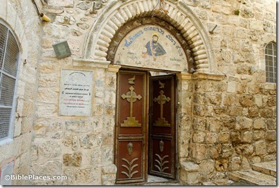
Miriam Feinberg Vamosh has written an article on the little-known Church of St. Mark near the Armenian Quarter of the Old City of Jerusalem. According to tradition in the Syriac Orthodox church, this was the place of the Last Supper.

A Byzantine winepress has been excavated at Hamei Yo’av near Kiryat Gat. High-resolution photos are available here (zip).

If you’re traveling to the Middle East, it’s worth preparing not only for the sites, but also for the food.

Debra Kamin has four rules for eating hummus.

The LMLK Blogspot has a “modern ancient art mystery” for savvy biblical archaeology sleuths.

The AP has more about the new excavations in the city of Ur.

Scientists are studying a battering ram found in a Greek or Roman ship sunk off the coast of Libya.

The ruins of ancient Palmyra are being threatened by the fighting in Syria.

Some new maps of the ancient world are now going online at the Encyclopedia of Ancient History.

Aren Maeir will be lecturing on “The Search for Goliath” on April 18 at William Jessup University.

Yesterday’s quotation was by William Dever, long-time crusader against biblical archaeology. It’s
from page 14 of Archaeology and Biblical Studies: Retrospects and Prospects. Evanston, IL:
Seabury-Western Theological Seminary, 1974.

HT: Jack Sasson

Syrian Orthodox Church, St Mark's Convent, traditional house of Mark and Upper Room, tb010312374
Entrance to Church of St. Mark
Photo from the Pictorial Library of Bible Lands, Jerusalem volume (available at Amazon for $220 or at BiblePlaces.com for $39)
Share:

The discovery of a Sabbath boundary marker in the Galilee several months ago makes one wonder just how many more have been preserved. Surely this was not the only one, either for this village or for other villages. Inscriptions in the rock like the Sabbath one were made at least twelve times around the city of Gezer.

BibleWalks made the initial discovery and now they are encouraging others to join in the hunt. To assist in this endeavor, they have created several maps that show the Sabbath marker in relation to two ancient sites. Roads are then drawn out in each direction and the intrepid adventurer can explore these routes to discover the next inscription. As BibleWalks notes, when hiking the hills of Galilee, the joy is not only in reaching the destination but in the journey itself. You can get all of the details here.

Share: