(Post by A.D. Riddle)

The answer to yesterday’s challenge is Nabi Yoûnis (or Nebi, Neby, Yunus, Younes, Yunas—there are a variety of English spellings. I will use the spelling “approved” by the U.S. Board on Geographic Names). It was answered correctly and quickly in the comments, so maybe next time, we should leave out the Google Earth view. The name Nabi Yoûnis is Arabic for Prophet Jonah, and the site commemorates the location where the great fish spit Jonah out onto dry land. It is located in Google Earth at 33.660894°, 35.418515°.

At 8:10 am on Tuesday, June 26, 1838, Edward Robinson passed by Khan Nabi Yoûnis on his way from Sidon to Beirut. He mentions that nearby was “Wely Neby Yunas, with a white dome, marking the place where, according to the Muhammedan legend, the prophet Jonas was thrown up by the fish” (Biblical Researches 3: 430-431). A nearly identically-worded description is found in Picturesque Palestine 3: 40. 

Drawing of Nabi Yoûnis from Picturesque Palestine, vol. 3.

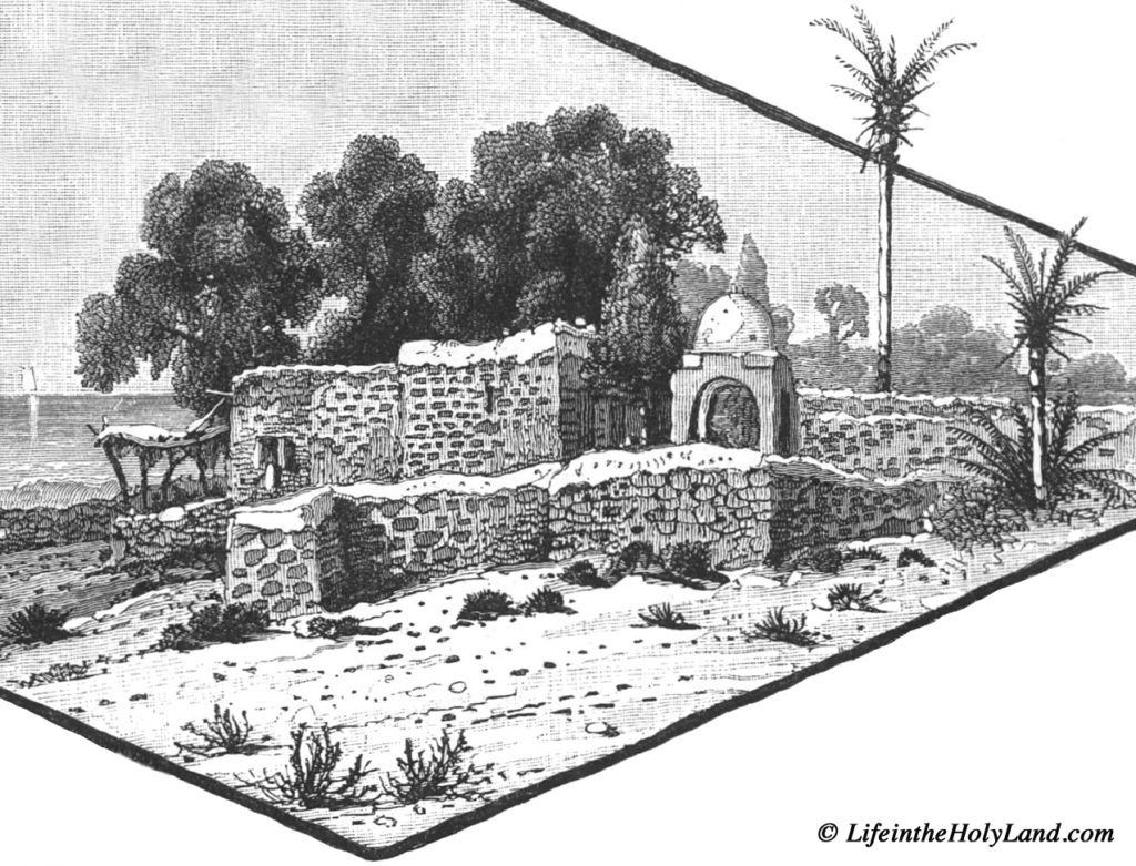
Today, the Muslim shrine described by Robinson is surrounded by the Shiite village named Nabi Yoûnis and bears little resemblance to the drawing above. Also, the dome is now green.

Modern Nabi Yoûnis. 

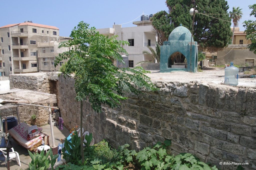
The Muslim shrine occupies the site of an earlier Byzantine church which was apparently destroyed by earthquake. Some remains from this church can be seen in reuse inside the shrine. During the Mamluk period, the structure was rebuilt and converted into a Muslim shrine.

Nabi Yoûnis, Corinthian capital from Byzantine church reused in modern Muslim shrine.

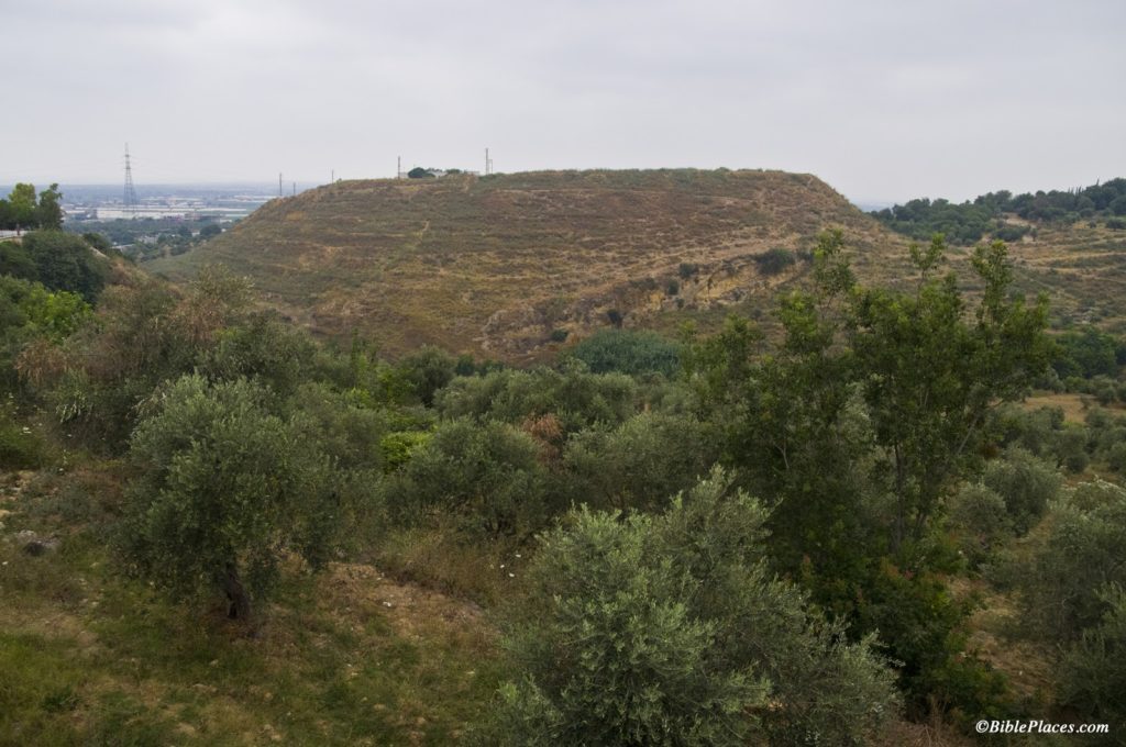
I have no way for evaluating whether or not this tradition is historically accurate, that Nabi Yoûnis is the place where Jonah was spit out. It is interesting to note that according to 2 Kings 14:25, a prophet named Jonah son of Amittai lived during Jeroboam II’s reign. This verse explains that Jonah announced large territorial gains for the kingdom of Israel in the time of Jeroboam II. For a brief moment in history, the boundary of the kingdom extended north to Lebo-Hamath, identified with modern Labwe in Lebanon. The Aramean kingdoms of Damascus and Hamath were also subjected to Israel. Nothing is said concerning the Phoenician coastal cities, so I do not know if Nabi Yoûnis would have been under some kind of Israelite control or not at this time as well.

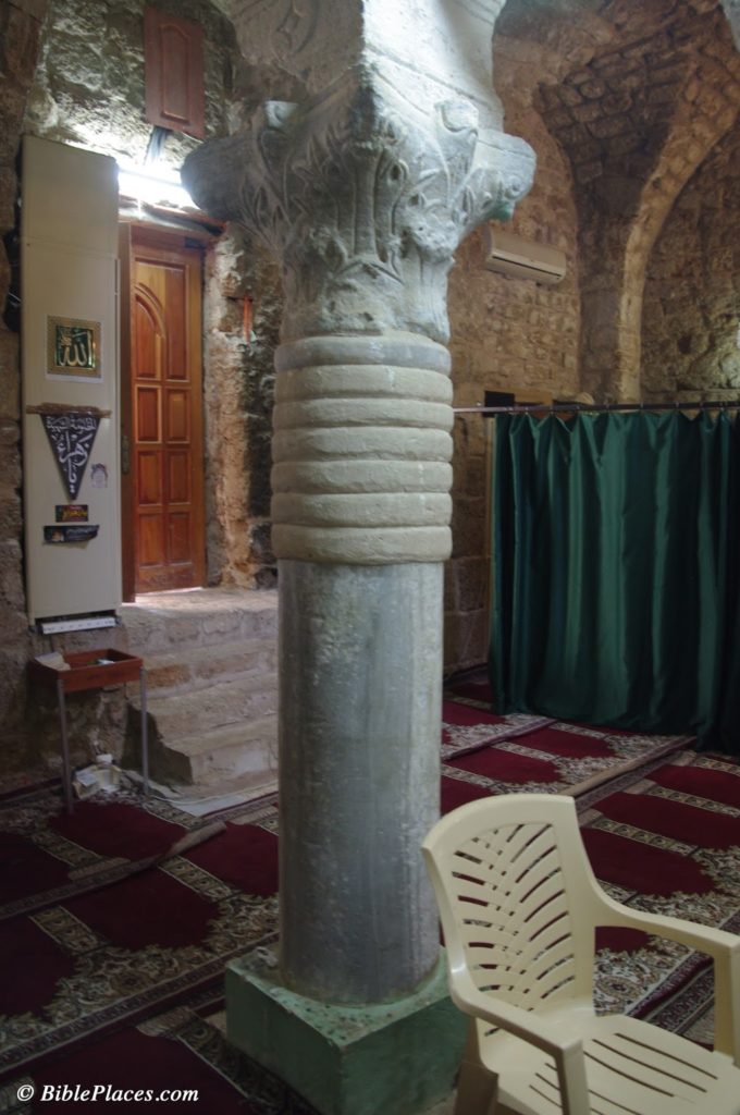
Further note: a small side room in the Nabi Yoûnis shrine supposedly houses the tomb of Jonah. As with Noah, there are apparently multiple sites that are believed to be Jonah’s burial place. Another such tomb of Jonah is located in el-Meshhad, Israel, the site identified with Jonah’s hometown, Gath-hepher (see Picturesque Palestine 2: 61, illustration on 56).

References

Harb, Antoine Khoury.
2008     The Roots of Christianity in Lebanon. Beirut: Lebanese Heritage Foundation.

(Guest post by A.D. Riddle)

Unlike its neighbor to the south, Lebanon has only a handful of excavations currently in progress and there is no systematic archaeological survey of the entire country presently available. Sadly, archaeological work is only being carried out at a total of five (or so) sites: Sidon, Tell Arqa, Tell el-Burak (link 2, link 3), Baalbek, and Kamid el-Loz.

Tell Arqa in northern Lebanon.

Naturally, one would think that the paucity of archaeological work (and tourism, for that matter) is due to present security conditions. But that is only part of the story. Hélène Sader, a historian and archaeologist at the American University in Beirut, has written a piece for the ASOR blog entitled, “Archaeology in Lebanon Today: Its Politics and Its Problems,” in which she paints a fairly bleak portrait of the current situation.

The outdated antiquities law which established the Lebanese Directorate General of Antiquities (DGA) “as the sole authority” limits the DGA’s staff “to five archaeologists, five trainee archaeologists, and five architects in charge of regular and salvage excavations, restoration and conservation of historical and archaeological monuments, and the curatorship of the national and regional museums collections!” Following the Lebanese civil war (1975-1990), the Lebanese government set out to rebuild Beirut’s Central District. The DGA was then faced with the task of not only rebuilding the National Museum, but also “supervising the largest urban excavation site in the world with practically no qualified personnel, no funds, and no political support.” Since 2000, “the DGA has become extremely restrictive regarding long term excavation projects” and is “reluctant to issue permits to foreign institutions.” Numerous salvage excavations go unpublished and the excavated remains are “regularly bulldozed or disfigured by irresponsible urban planning without any objections.”
Sader concludes:

The DGA has been without leadership for the last four years. The last Director General resigned three years ago and the appointment of a new one is still blocked by political rivalries. The failure to build a new generation of professional and well-trained archaeologists is so dramatic that it is very hard today to find even a small pool of competent candidates for the position of Director General from within or outside the department of antiquities. Several DGA archaeologists and architects have lately resigned out of frustration and it seems that the institution is back to square one: no director general, insufficient numbers of qualified professionals, no reforms of the laws regulating archaeological work, no funds, and first and foremost, no vision and no direction for the future of archaeology in Lebanon.

We keep our fingers crossed that the future leadership of the DGA will have the political and financial support of the Lebanese government to build a modern institution and to promote archaeological research. Maybe then, like a phoenix, Lebanese Archaeology will rise from its ashes.

(Post by Seth M. Rodriquez)

At first glance, our picture of the week looks like a peaceful, pleasant Mediterranean beach. However, there is more here than meets the eye. This is the site of a famous battle waged by Alexander the Great, and the place still bears the marks of Alexander’s army. In fact before 332 B.C., this beach didn’t even exist.

In antiquity, the city of Tyre was comprised of a fortified settlement on the mainland and another settlement on an island about half a mile off the coast. What you are looking at is the southern side of the isthmus that was created when Alexander’s army built a causeway between the mainland and the island. The image below from the maps of the Survey of Western Palestine provides a bird’s eye view of the former island with the narrow isthmus. (These maps are available here in digital form for only $35.)

The Wycliffe Historical Geography of Bible Lands describes the confrontation between the inhabitants of Tyre and Alexander the Great in this way:

Tyre alone opposed Alexander. The Tyrians initially offered submission and tribute to him, thinking they would thereby gain substantial freedom, as they had before. But when they saw that Alexander intended personally to occupy the city, they determined to resist.

Hope of Tyrian success in withstanding the siege was not unfounded. Their city was located on an island a half mile from shore; the current in the channel which separated it from land was swift. Their fleet controlled the sea. The city wall on the landside rose to 150 feet. There were assurances of help from Carthage and elsewhere. But Alexander devised unexpected tactics. He resolved to construct a causeway 200 feet wide out to the island, on which he could plant his siege engines. Ruins of mainland Tyre furnished material for the causeway. The Tyrians fought heroically. They destroyed the engines of war by fire-ships and damaged the mole, or causeway. They hurled pots of burning naphtha, sulfur, and red-hot sand from catapults.  Seeing that the battle could not be won without the use of a fleet, Alexander obtained contingents from Sidon, Greek allies, and Cyprus. After a siege of seven months, the wall was breached and the city taken after savage fighting.

Many people see this as the part of the fulfillment of Ezekiel’s prophesies about Tyre found in Ezekiel 26-28, especially these verses:

Behold, I am against you, O Tyre, and will bring up many nations against you, as the sea brings up its waves. They shall destroy the walls of Tyre and break down her towers, and I will scrape her soil from her and make her a bare rock. (Ezek. 26:3-4, ESV)

Our picture of the week was taken by A.D. Riddle, and is available in Volume 8 of the Pictorial Library of Bible Lands. This photo and over 700 others are available here for $34 (with free shipping). Additional photos and information about Tyre can be found here on the BiblePlaces website, and here on LifeintheHolyLand.com.  The quote above was taken from The Wycliffe Historical Geography of Bible Lands by Charles F. Pfeiffer and Howard F. Vos (Chicago: Moody Press, 1967), 210-211.

The eleventh season at Khirbet el-Maqatir has concluded with word of a spectacular find that cannot yet be revealed. The team excavated several Roman-period silos, a first-century ritual bath, and an Iron Age house.

The season at Tel Burna is coming along nicely. The First Week Wrap-up provides an overview of the known stratigraphic sequence of the site. The report for days 6-7 include a photo of a large monolith and a beautiful Iron IIB pavement.

John Black shows how archaeological work in Jerusalem has undermined historical criticism of the Gospel of John.

A Picasso drawing is being raffled to raise money to preserve the archaeological remains of Tyre.

The Egyptian Museum in Cairo was recently closed to tourists by striking employees.

Leon Mauldin illustrates Jeremiah’s message of the cursed man who will be like a “shrub in the desert.” He follows that up with a photo of a “land of salt.”

Barry Britnell shows with photos why the Cilician Gates are important for Paul’s journeys.

Douglas Petrovich provides a summary of his recent article that serves as a “John the Baptist” role for his forthcoming book, Evidence of Israelites in Egypt from Joseph’s Time until the Exodus.

Pools of Bethesda southern pool from west, tb011612879 Southern pool of Bethesda
Photo from the Pictorial Library of Bible Lands

From the Daily Star:

Sidon is set to have its own national museum on site a leading archaeological dig, with donors and developers ready to sign a contract for its construction Monday.The museum project will be built on land owned by the Directorate General of Antiquities at the Frère site. The British Museum has been conducting excavations at the Frère site for the past 14 years, and it is considered one of the most important archaeological digs in the region.
[…]
The museum will house archaeological finds that demonstrate the contribution of various civilizations to the city of Sidon. Excavations at the site have shed light on the city’s history, and the remnants discovered date back as far as 4000 B.C., according to the head of the British Museum expedition, Claude Doumit Sarhal.
“The artifacts provide insight into historical phases of the city and highlight the importance of the Mediterranean civilizations and cities in communicating with other civilizations,” she said.
“The number of the archaeological pieces excavated reaches almost 1,000,” Doumit Sarhal said. “You can imagine what could be buried under the historical site of the whole city, and under the 22 hectares of land that constituted the ancient city-state.”

The full article provides more details. Sidon is mentioned 20 times in the Old Testament, most frequently as an object of condemnation in the prophets. In the New Testament, both Jesus and Paul visited the city (Matt 15:21; Acts 27:3).

HT: Jack Sasson

Sidon, Egyptian Harbor from Castle of St Louis, adr090508696
Egyptian harbor of Sidon from Castle of St. Louis
Photo from the Lebanon volume of the Pictorial Library of Bible Lands

Eilat Mazar has resumed excavations in the (so-called) Ophel, and her partners at Armstrong College plan to provide regular updates. They begin with an on-location interview of Mazar.

Excavations continue to reveal Egyptian presence in Joppa from the New Kingdom period.

Mark Fairchild’s search for ancient synagogues in Turkey is profiled in the local press. The article includes an interesting video by Fairchild of his discoveries.

In light of an article in the Wall Street Journal, Charles Savelle reflects on the value of knowing biblical geography.

Ferrell Jenkins is back in Israel and he shares a rare photo of Jacob’s well.

King Tut and his predecessors may have been afflicted with temporal lobe epilepsy.

Did you forget to celebrate the 2000th anniversary of Caligula’s birthday?

Clean-up of the polluted Kishon River is finally scheduled to begin, 12 years after divers were found
to have contracted cancer.

The cedars of Lebanon are threatened by climate change.

As Rosh HaShanah (the New Year) begins in Jewish homes around the world at sundown on Sunday,

Wayne Stiles reflects on the Gezer Calendar and other ways we keep time.

The 50th anniversary of Lawrence of Arabia inspires Anthony Horowitz to travel to Jordan.

HT: Explorator, Jack Sasson
Wadi Rum Jebel el Qattar, df070307712
Wadi Rum. Photo from the Pictorial Library of Bible Lands.