fbpx
(Post by A.D. Riddle)


On Tuesday, September 16, Trinity Evangelical Divinity School in Deerfield, IL will present the fall lecture in its “Trinity Biblical and Ancient Near Eastern Archaeology Lecture Series.” William M. Schniedewind (UCLA) will speak on the topic “Early Hebrew Scribes — When Israel Began to Write.” The lecture begins at 7:00 p.m. and will take place in Hinkson Hall, Rodine Building. The event is free and open to the public.
Share:
(Post by A.D. Riddle)

According to Iraqi News, ISIL/ISIS terrorists destroyed what is believed by some to be the tomb of the prophet Jonah. The mosque and tomb are located in modern Mosul, Iraq on Tell Nebi Yunus (Arabic for Prophet Jonah).

The elements of ISIL controlled the mosque of the Prophet Younis in Mosul since they invaded the city…there is almost certain information stating the fact that the elements of ISIL dug up the grave of the Prophet Younis.


That is not the only thing they have destroyed…

They torched 11 churches and monasteries out of 35 scattered across the city of Mosul, and hours later destroyed statues of poets, literary and historical figures of which Mosul has long been proud.


The full article with photographs and video is here.
Tell Nebi Yunis in Mosul, Iraq.
(Photo from Panoramio).
About 50 years or so after Jonah, Sennacherib (704-681 B.C.) enlarged Nineveh and made it his capital. The walls were 7.5 miles in circumference, had 15 gates, and enclosed two mounds: Tell Kuyunjik and Tell Nebi Yunus. Here is a map of the Assyrian heartland, and here is a map of Nineveh in the time of Sennacherib.
We wrote another piece about a shrine in Lebanon which commemorates the location where the fish spit Jonah out. You can read that here.
Share:
(Post by A.D. Riddle)

In response to a post last week in which we mentioned the book Roads of Arabia: Archaeology and History of the Kingdom of Saudi Arabia, Harry Orenstein has alerted us to the existence of a pdf of the volume. The file (22.2 MB) can be downloaded from the website of the Saudi Commission for Tourism and Antiquities using the last link on this page. It is a pdf of the English version of Roads of Arabia. The quality of the images has been degraded, so the pdf does not replace the printed book, but it does make the volume searchable and much easier to move around.

There are a few other documents as well. Here are direct links to each:

Share:
(Post by A.D. Riddle)

The ArchéOrient blog recently posted a piece by Rocio da Riva on the inscriptions and reliefs in Lebanon belonging to the Neo-Babylonian king, Nebuchadnezzar II. (This is the king mentioned in 2 Kings 24-25; 2 Chron 36; Jeremiah; Daniel; and elsewhere in the Bible.) The original article is in French, but Google Translate does an almost-semi-respectable job of producing an English version here.

The article mentions four places in Lebanon where Nebuchadnezzar left inscriptions and/or reliefs.

  • Nahr el-Kalb
  • Wadi Brisa, aka Wadi esh-Sharbin
  • Shir es-Sanam
  • Wadi es-Saba’

Three of these sites are in the northeast of the Lebanon Mountains, oriented in the direction of Riblah, Nebuchadnezzar’s headquarters in the west (2 Kings 25; Jer 39 and 52). The inscriptions/reliefs are located along routes which lead up into the mountains and which were used by the Babylonians for felling and transporting cedars of Lebanon for construction. The locations can be viewed here in Google Maps (if I did it right).

The Nahr el-Kalb inscriptions are alone on the other side of the Lebanon Mountains, at the mouth of a river named Nahr el-Kalb on the Mediterranean coast. (Well, not entirely alone, because on the opposite bank of the river is a rocky promontory where one will find nearly two dozen other stelae left by conquerers from Ramesses II in ca. 1276 B.C. to the “Liberation of South Lebanon” in A.D. 2000. See Seth’s post here.)

Nahr el-Kalb (“Dog River”).
The inscriptions of Nebuchadnezzar are secretly hidden
behind all the vegetation just right of the bridge.

Da Riva has been working on the royal inscriptions of all the Neo-Babylonian kings. A lot of her recently-published work concentrates in particular on the Lebanon inscriptions listed above, but she has also just completed an edition of the inscriptions of Nabopolassar, Amel-Marduk and Neriglissar (cover shown below). Many of her articles are available at her Academia.edu page (sign up required).

As a prelude to her editions of the Neo-Babylonian royal inscriptions, Da Riva published a short introduction entitled The Neo-Babylonian Royal Inscriptions: An Introduction (2008). We recommend especially the first 19 pages where one will find a very nice, up-to-date, historical summary of the Neo-Babylonian period.

HT: Jack Sasson

Share:
(Post by A.D. Riddle)


A friend and I recently took a 24-hour road trip to Kansas City, Missouri to see the “Roads of Arabia” exhibition. We have been following the exhibition on this blog since just after it began showing in 2010 (see here), and it looks like Missouri is about as close as it was ever going to get to where I live.
The exhibition was larger than I had envisioned and it took about four-five hours to explore most of the exhibit (we had to skim over some parts). It begins with stone tools from the Lower Paleolithic and works its way up to the modern kingdom of Saudi Arabia. I learned a lot of interesting things, and there were a few surprises. Writing the curator in advance ensured I was able to take photographs, but that did not stop guards and docents from stopping us several times and telling us photography was not permitted. If you visit the exhibit, do not assume you will be able to take pictures—find out ahead of time, if that is something you want to do.

My interest in going was motivated by (1) the difficulty (or impossibility) of ever visiting Saudi Arabia to see these objects and sites, and (2) the occasional connections to Arabia sprinkled throughout the Bible. In particular, the exhibit displayed a number of objects from these biblical sites/kingdoms:

  • Midian
  • Dedan
  • Kedar (Qedar)
  • Sheba/Sabeans
  • Tema
  • Nabateans
Stela of Babylonian king Nabonidus from Tema.
The exhibition catalog was available in the museum store for $70, and after him-hawin’ over the price tag, I decided to get it. It was well-worth the cost.
Al-Ghabban, Ali Ibrahim;  Béatrice André-Salvini; Françoise Demange; Carine Juvin; and Marianne Cotty, eds.
2010 Roads of Arabia: Archaeology and History of the Kingdom of Saudi Arabia. Paris: Somogy Art Publishers and Musée du Louvre; Washington, D.C.: Arthur M. Sackler Gallery, Smithsonian Institution.
The volume is 607 pages long, and it is far more than a catalog. Not only does it have high-quality color photographs of all the objects on display, it has chapters on archaeology and history, each accompanied by maps, site plans, drawings and photographs. The chapters that caught my eye were:
  • “Geographic Introduction to the Arabian Peninsula,” by Paul Sanlaville
  • “The Story of the Origins,” by D. T. Potts
  • “Antiquity,” by Christian Julien Robin
  • “Languages and Scripts,” by Christian Julien Robin
  • “The Frankincense Caravans,” by Françoise Demange
  • “North-Eastern Arabia (circa 5000-2000 BC),” by D. T. Potts
  • “The Kingdom of Midian,” by Abdulaziz bin Saud Al-Ghauzzi
  • “The Oasis of Tayma,” by Arnulf Hausleiter
  • “Dedan (al-Ula),” by Said F. Al-Said
  • “The Kingdom of Lihyan,” by Hussein bin Ali Abu Al-Hasan  
The full table of contents is available in pdf here.

The book does not appear to be affordably priced at Amazon ($221), but it can be ordered from the Smithsonian ($79.50 including shipping) or from the Nelson-Atkins Museum of Art ($82.50 including shipping). One blogger gives something of a book review here with several snapshots of pages.

Here is a list of stops the “Roads of Arabia” exhibition has made since it opened in 2010.

2010
Jul 14–Sep 27 Musée du Louvre, Paris
Nov 12–Feb 27 CaixaForum, Barcelona

2011
May 17–Sep 4 The State Hermitage Museum, St. Petersburg

2012
Jan 26–Apr 9 Pergamon Museum, Berlin
Nov 17–Feb 24 Smithsonian Institution’s Arthur M. Sackler Gallery, Washington, DC

2013
Jun 15–Nov 4 Carnegie Museum of Natural History, Pittsburgh
Dec 22–Mar 9 The Museum of Fine Arts, Houston

2014
Apr 25–Jul 6 Neslon-Atkins Museum of Art, Kansas City, MO
Oct 17–Jan 18 Asian Art Museum, San Francisco

I continue to see notices that the exhibition will show in Chicago and Boston, but no locations or dates have been given yet.

Share:
(Post by A.D. Riddle)

This posting will focus on two ways that Picasa can help you deploy the Pictorial Library of Bible Lands in classroom teaching. (See our first post on “Using PLBL with Picasa” here.)

First, we will show you how to use Albums to create a presentation on-the-fly using photographs that are located in multiple folders. This could be helpful if you are short on time, and the topic you are teaching or studying (such as Paul’s missionary trips) involves places or events across the Pictorial Library. First, browse or search for the photographs(s) that you want to include in your presentation.

When you click once on the photograph, it will be “selected” and two things will happen: a blue frame will appear around the selected image as below,

Left image is selected and has a blue frame.

and a thumbnail of the thumbnail (is there a name for this?) will appear in the lower left window of Picasa, in an area called the selection tray.

Selection tray with three selected images.

You can select more than one image at a time from a single folder using Shift or Control/Command keys. To select photographs from another folder without losing your selections from previous folders, click the “green thumbtack” button to “hold” the items in the selection tray. The red circle will remove items from the selection tray.
Selection tray buttons.
Once you have selected all the photographs you want to use in your presentation, click the “blue book” button for “albums.” It will open a menu that allows you to select an existing “album” or create a new “album” where you want to send the photographs. The images will not actually be moved.

Rather, albums are like “Smart Playlists” (or Dynamic Folders); you can add or delete albums without touching the original images. They allow you to mix-and-match into a single folder a variety of photographs that are located in several folders. All of the images in the selection tray will be “sent” to the album that you choose or create.

Albums button menu.

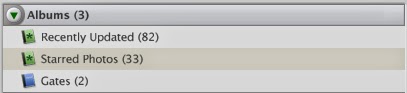
Albums can be viewed by clicking on “Albums” at the top of the left-side browser.

Albums browser with an album for “Gates.” 

With your photographs in an album, you can now arrange the order of the photographs by clicking-and-dragging the thumbnails in the main screen. Once you have the photographs in the sequence you want them, double-click the first photograph to go the “Edit Picture” screen. At the top is a Play button which will begin the slideshow presentation.

Play slideshow button.

Moving the cursor in slideshow view will cause a control bar to appear at the bottom. Here you can rotate a photo, zoom in, exit the slideshow, or make other adjustments.

Slideshow controls.

To return to the main screen from the “Edit Picture” screen, click the “Back to Library” button at top left.

Return to main screen button.

Second, we will show you how to use Picasa to create a Google Earth kmz file of locations containing image thumbnails. The secret to doing this is Geotags. Geotags are location coordinate information contained within the actual photograph. By clicking the blue “information” button in the Show/Hide Panels toolbar at the bottom right of the screen, you can view the photograph metadata. If a photograph is geotagged, the metadata will include a GPS Latitude and GPS latitude.

Show/Hide Panels buttons.

To geotag a photograph, click the red “balloon pin” button on the Show/Hide Panels toolbar. A window will expand on the right which looks just like Google Maps.

Places Panel.

Select the photograph(s) you want to geotag. (You can tag multiple photographs at the same time.)

Next, you need to find the location in the Google map. (Just like with Google Maps, you can switch to satellite view and zoom in/out.) There are a few ways to find the location. You can do this manually by dragging the screen with the cursor and using zoom controls, and then clicking the green “balloon pin” to drop it on the location. You can use the search bar under the map to enter the name of a location. The best method, though, since so many Pictorial Library places are archaeological sites, is to copy/paste the coordinates from the Pictorial Library’s Site Index into the search bar.

Once a photograph is geotagged, the thumbnail in the main screen will have a red “balloon pin” in the lower right corner.

Photograph with red “balloon pin” indicating
it has been geotagged.

To create a Google Earth kmz file, select the geotagged photographs you want to include. Again, you can use the selection tray as described above. For Windows computers only, go to Tools > Geotag > Export. This will create a kmz file from the photographs you selected. The kmz file can be opened in Google Earth or Google Maps, and it will contain yellow “pushpins” with thumbnail images of the photographs which have been geotagged to that location. (The kmz export feature is not available in the Mac version of Picasa. Instructions are here for accomplishing the same task.)

I can imagine this being useful, for example, if one is teaching on the life of Abraham. You can have “pushpins” at Haran, Shechem, Bethel, Hebron, etc. with thumbnails of Pictorial Library photographs. The kmz file can be distributed to students, or it might be used in classroom instruction. Perhaps a teacher might craft an exercise where students have to make a “map” of a biblical account using photos from the Pictorial Library.

This completes our series on “Using Pictorial Library of Bible Lands with Picasa.” Picasa can be a very helpful tool for locating and deploying the wealth of images in the library.

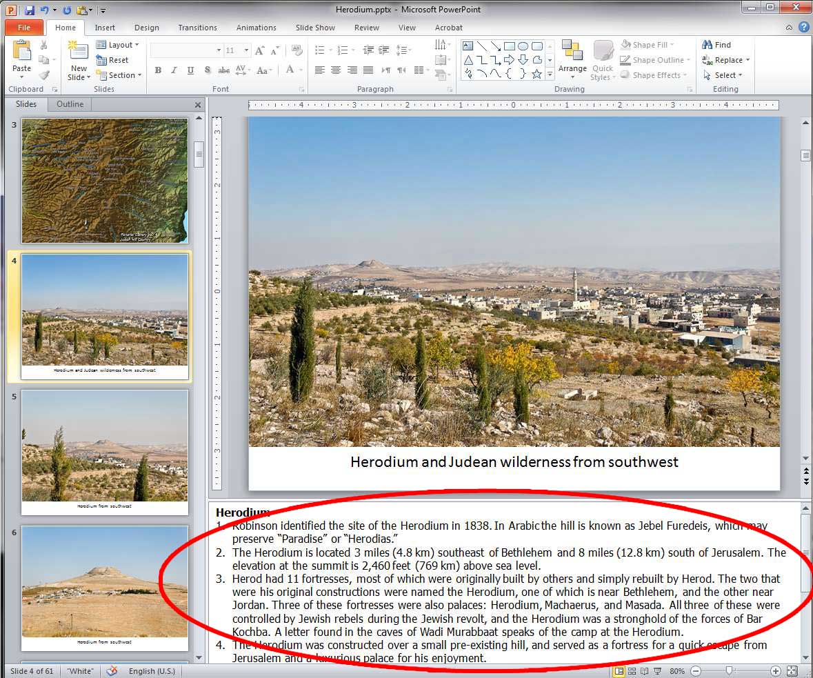
We close with a comment about the limitations of using the Pictorial Library only with Picasa (or similar applications). The photographs of the Pictorial Library come in pre-made PowerPoint presentations which contain the maps, abundant annotations in the Speaker’s Notes (see here and here), helpful labels, and have the photographs arranged in a logical order. Picasa misses out on all these features, so our recommendation is not to bypass the PowerPoints, but use Picasa in conjunction with them.

Share: