fbpx
(Post by A.D. Riddle)

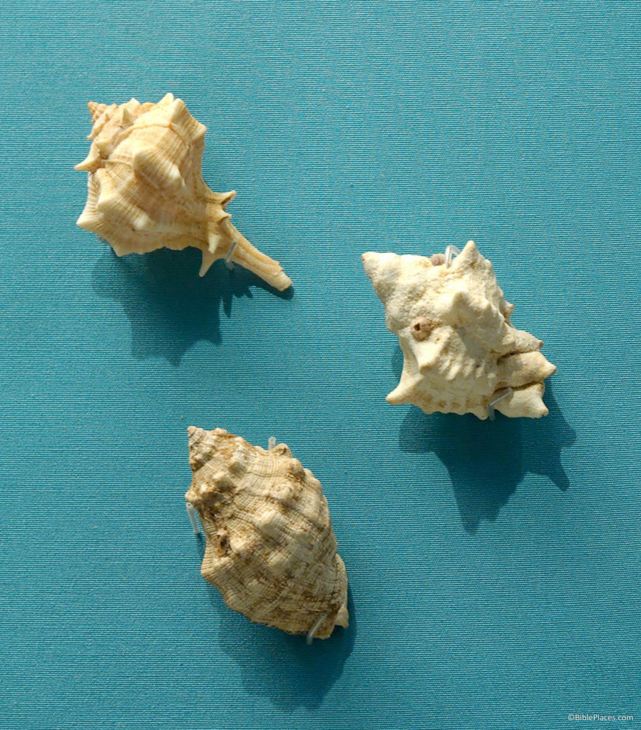
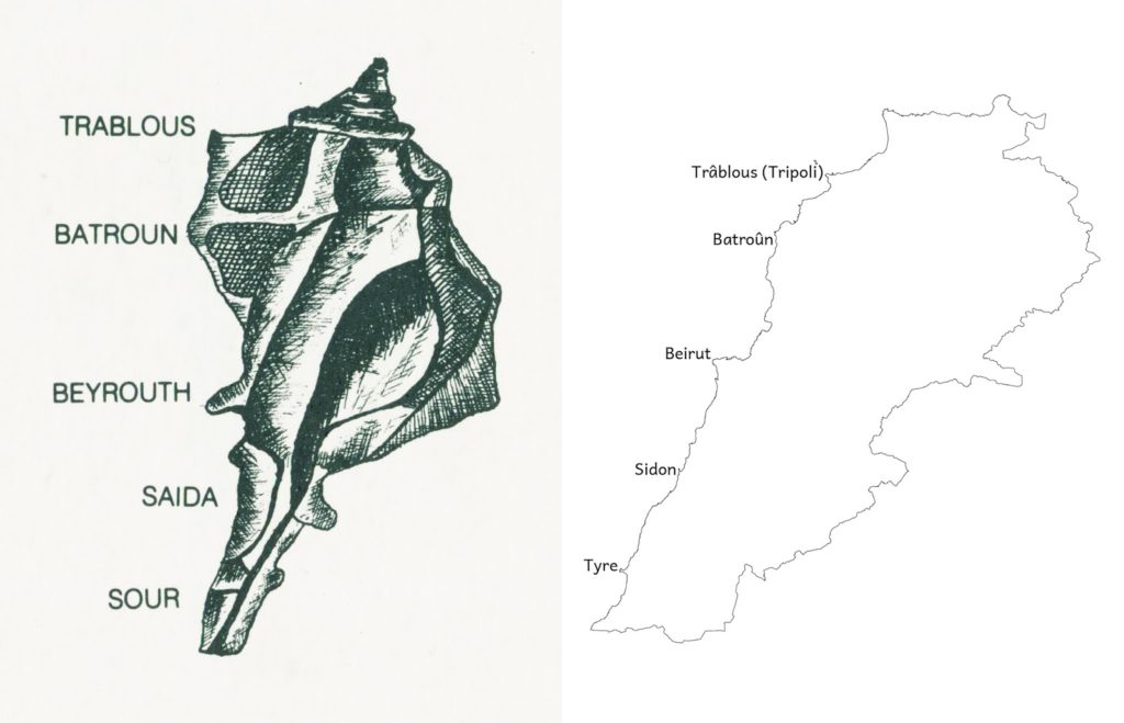
The journal Hannon: Revue libanaise de géographie is published by the Lebanese University in Beirut. The cover of the journal depicts a map of Lebanon using the shape of a Murex mollusk shell—a pretty clever idea, I thought. The sea snail that calls these shells home was extracted by the Phoenicians to create a purple dye.
Cover graphic of Hannon journal compared to a map of Lebanon.

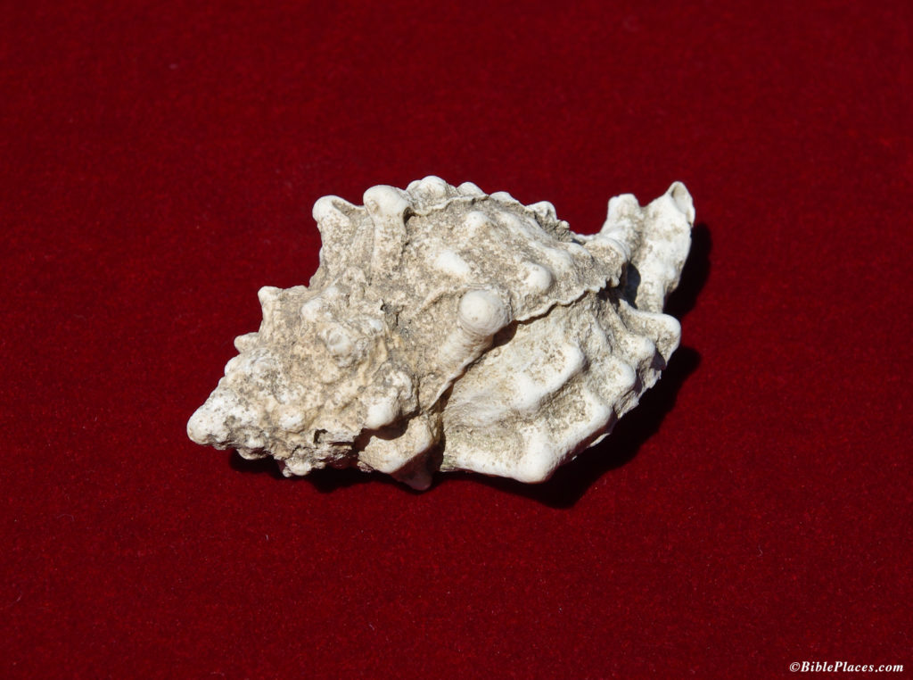
Murex shell from Sidon.

Three species of Murex at the British Museum.

Ferrell Jenkins has written several informative blog posts about the purple dye.

Share:
(Post by A.D. Riddle)

Last December, the publisher Brill released The El-Amarna Correspondence: A New Edition of the Cuneiform Letters from the Site of El-Amarna based on Collations of all Extant Tablets, by Anson Rainey.

When Anson Rainey passed away in February 2011, he had not yet completed this new edition of the Amarna Letters. Rainey undertook the massive effort of producing a new collation all tablets that contain correspondence from Tell el-Amarna (the exceptions being four tablets that since their discovery were lost or destroyed; two Hittite letters, and one Hurrian letter). A collation, in this context, means a copy of the text based upon close personal inspection of the physical inscription itself. Rainey describes in the Introduction how he began work on this project as early as 1971, although the main effort commenced in 1999. Since the tablets are currently held in several museums around the globe, this was no easy task. Below are a list of the museums. The first few museums hold dozens of Amarna Letters; the rest hold far less, in most cases only two or three tablets or even just a fragment of a tablet. The Amarna Letters are housed today in:
                    Vorderasiatisches Museum, Berlin
                    British Museum, London
                    The Egyptian Museum, Cairo
                    Louvre, Paris
                    Ashmolean Museum, Oxford
                    Metropolitan Museum of Art, New York
                    Pushkin Museum, Moscow
                    Musees Royeaux d’Art et d’Histoire, Brussels
                    Oriental Institute of the University of Chicago

                    İstanbul Arkeoloji Müzeleri

At the very end of last year, nearly four years after his passing, Rainey’s magnum opus was brought to completion: a two-volume set entitled The El-Amarna Correspondence: A New Edition of the Cuneiform Letters from the Site of El-Amarna based on Collations of all Extant Tablets. Handbook of Oriental Studies Section 1: The Near and Middle East 110. Boston: Brill, 2015.

(This is one of a few magna opera produced by Rainey in his lifetime—The Sacred Bridge could count as one [here, review here]; his four-volume grammar of the Amarna Letters, Canaanite in the Amarna Tablets, could count as another [vol. 1vol. 2vol. 3vol. 4]; an earlier publication of new Amarna Letters yet a third).

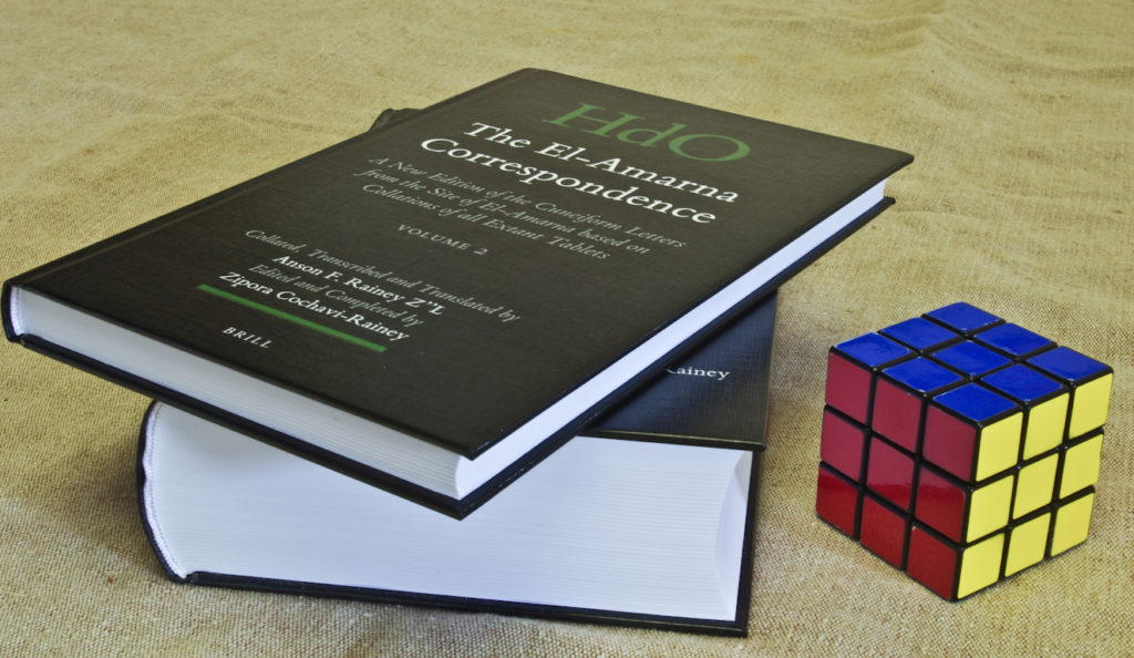
As you can see in the photo below, volume 1 is the main volume. It contains a 50-page introduction (including an essay by Jana Mynářová on the discovery of the tablets), a transliteration and English translation of every one of the nearly 350 Amarna Letters, and an Akkadian Glossary. Volume 1 is just a hair thicker than a Rubik’s Cube. Volume 2 is much slimmer and contains commentary for each letter:

  • the name of the sender and recipient
  • museum number of the tablet
  • previous publications of the text and translations
  • sometimes a brief paragraph about the disposition of the tablet or the historical situation of the tablet’s contents
  • line-by-line discussion for readings of specific cuneiform signs and words based on Rainey’s collation in comparison to earlier readings.

The El-Amarna Correspondence by Anson Rainey will be the standard edition of the Amarna Letters for this generation, and anyone who uses this material in their research would benefit from consulting Rainey’s work.

As I was preparing this post, I was a little surprised by the quality of proofreading I encountered. I expected in an academic work of this type that greater care would be taken. And since they have given it a regal price tag (retail $293), I would assume the publisher could afford top proofreading talent. There were a handful of typographical mistakes in volume 1, but volume 2 contained quite a few typographical mistakes as well as factual errors. Between and within the volumes, there is confusion over EA 380-382 (their disposition, museum numbers, etc.). On another note, for volume 1, page numbers were not included on the first page of each letter, and since several letters are less than a single page in length, that means there are stretches of the volume without any page numbers at all. It would have been nice to have a page number printed on every page.

Share:
(Post by A.D. Riddle)

With apologies for getting this out late, today is the last day of an introductory sale on The Virtual Bible, by Accordance Bible Software.

The Virtual Bible [is] a new visual resource which offers three-dimensional reconstructions of the land of Israel, first-century Jerusalem, the Herodian Temple, and more. The visuals, which include still images and video fly-throughs, were developed by Dr. Daniel Warner of New Orleans Baptist Theological Seminary and Dr. James Strange of the University of South Florida, in consultation with Leen Ritmeyer, an archaeological architect who is an expert on the Jerusalem Temple.

For sample videos, see this Accordance blog post.

For product details, click here.

This video shows how The Virtual Bible is produced.

As I was reading about this product, I learned that The Virtual Bible has been around for a little while (here and here; the project was begun in 1999). The Virtual Bible is new to Accordance, and they describe the product as “Enhanced” though I am not sure what that means.

For details of the sale, you can view the Accordance announcement here. The sale includes several other graphics packages in their summer sale, including four from BiblePlaces.com:

Share:
(Post by A.D. Riddle)

I recently saw an announcement for a brand new volume by David Chapman and Eckhard Schnabel that collects together all extra-biblical texts relevant to understanding the trail and crucifixion of Jesus. The book is entitled The Trial and Crucifixion of Jesus: Texts and Commentary. It caught my eye because I find Schnabel’s writing to be very thorough and helpful. Several books on crucifixion, in fact, have appeared in the last few years from the same publisher.

Chapman, David W.
2008 Ancient Jewish and Christian Perceptions of Crucifixion. Wissenschaftliche Untersuchungen zum Neuen Testament 2. Reihe 244. Tübingen: Mohr Siebeck.  [Republished by Baker Academic, 2010.]

The bulk of this volume is devoted to an inductive study of the ancient sources regarding crucifixion with an eye to understanding the way in which Jews perceived crucifixion. Here Chapman discusses ancient texts from various types of literature that can be described as Jewish (e.g., the Apocrypha, Josephus, Philo, rabbinics, etc.). Chapman’s survey reveals a variety of perceptions from martyrdoms to scandalous punishments for brigands and rebels…Concerning the primary sources, it seems that Chapman has not missed any significant extant material….Although acknowledging the existence of various methods and devices, [Chapman] is not claiming that Jesus died on a pole (or other device); rather, he says crucifixion could take place in a number of ways…The goals of crucifixion included torture, shame, and death. How the cross looked or what shape it was in was not the main concern. (Review by Joseph D. Fantin.)

Samuelsson, Gunnar.
2013 Crucifixion in Antiquity: An Inquiry into the Background and Significance of the New Testament Terminology of Crucifixion. 2nd ed. Wissenschaftliche Untersuchungen zum Neuen Testament 2. Reihe 310. Tübingen: Mohr Siebeck.

This work is a semantic study of the Greek words typically translated “crucify” or “crucifixion.” Prior to its release, popular media tried to create controversy out of the book’s “sensational” claim that the Greek terms do not refer specifically to crucifixion, but only generally to suspension.

Gunnar Samuelsson investigates the philological aspects of how ancient Greek, Latin and Hebrew/Aramaic texts depict crucifixions. A survey of the texts shows that there has been too narrow a view of the “crucifixion” terminology. The various terms do not only refer to “crucify” and “cross.” They are used much more diversely. Hence, most of the crucifixion accounts that scholars cite in the ancient literature have to be rejected, leaving only a few. (From the publisher’s website.)

Cook, John Granger.
2014 Crucifixion in the Mediterranean World. Wissenschaftliche Untersuchungen zum Neuen Testament 327. Tübingen: Mohr Siebeck.

This work, originally conceived as a revision of Hengel’s work on the subject, is in some ways a response to Samuelsson. It casts a wider net by investigating Greek, Latin, Hebrew and Aramaic texts, as well as pictorial representations and archaeological evidence. A very brief summary can be found at the Bible and Interpretation website.

To understand the phenomenon of Roman crucifixion, the author argues that one should begin with an investigation of the evidence from Latin texts and inscriptions (such as the lex Puteolana [the law of Puteoli]) supplemented by what may be learned from the surviving archaeological material (e.g., the Arieti fresco of a man on a patibulum [horizontal beam], the Puteoli and Palatine graffiti of crucifixion, the crucifixion nail in the calcaneum bone from Jerusalem, and the Pereire gem of the crucified Jesus [III CE]). This evidence clarifies the precise meaning of terms such as patibulum and crux (vertical beam or cross), which in turn illuminate the Greek terms [e.g., σταυρός, σταυρόω and ἀνασταυρόω] and texts that describe crucifixion or penal suspension. It is of fundamental importance that Greek texts be read against the background of Latin texts and Roman historical practice. The author traces the use of the penalty by the Romans until its probable abolition by Constantine and its eventual transformation into the Byzantine punishment by the furca (the fork), a form of penal suspension that resulted in immediate death (a penalty illustrated by the sixth century Vienna Greek codex of Genesis). Cook does not neglect the legal sources — including the question of the permissibility of the crucifixion of Roman citizens and the crimes for which one could be crucified. In addition to the Latin and Greek authors, texts in Hebrew and Aramaic that refer to penal suspension and crucifixion are examined. Brief attention is given to crucifixion in the Islamic world and to some modern forms of penal suspension including haritsuke (with two photographs), a penalty closely resembling crucifixion that was used in Tokugawan Japan. The material contributes to the understanding of the crucifixion of Jesus and has implications for the theologies of the cross in the New Testament. The relevant ancient images are included. (Abstract from author’s Academia.edu page.)

Chapman, David W., and Eckhard J. Schnabel.
2015 The Trial and Crucifixion of Jesus: Texts and Commentary.
Wissenschaftliche Untersuchungen zum Neuen Testament 344.
Tübingen: Mohr Siebeck.

The purpose of this comprehensive sourcebook by David W. Chapman and Eckhard J. Schnabel is to publish the extra-biblical primary texts that have been cited as relevant for understanding Jesus’ trial and crucifixion. The texts in the first part deal with Jesus’ trial and interrogation before the Sanhedrin, and the texts in the second part concern Jesus’ trial before Pilate. The texts in part three represent crucifixion as a method of execution in antiquity. For each document the authors provide the original text (Hebrew, Aramaic, Greek, Latin, etc.), a translation, and commentary. The commentary describes the literary context and the purpose of each document in context before details are clarified, along with observations on the contribution of these texts to understanding Jesus’ trial and crucifixion. (From the publisher’s website.)

Table of Contents

Part 1. The Jewish Trial before the Sanhedrin (E. J. Schnabel)
          1.1 Annas and Caiaphas
          1.2 The Jurisdiction of the Sanhedrin
          1.3 Capital Cases in Jewish Law
          1.4 Interrogation of Witnesses
          1.5 The Charge of Blasphemy
          1.6 The Charge of Being a Seducer
          1.7 The Charge of Sorcery
          1.8 Abuse of Prisoners
          1.9 Transfer of Court Cases
Part 2. The Roman Trial before Pontius Pilatus (E. J. Schnabel)
          2.1 Pontius Pilatus
          2.2 The Jurisdiction of Roman Prefects
          2.3 The crimen maiestatis in Roman Law
          2.4 Reports of Trial Proceedings
          2.5 Languages Used in Provincial Court Proceedings
          2.6 Amnesty and Acclamatio Populi
          2.7 Abuse of Convicted Criminals
          2.8 Requisitioning of Provincials
          2.9 Carrying the Crossbeam
          2.10 Titulus
Part 3. Crucifixion (D. W. Chapman)
          3.1 Crucifixion, Bodily Suspension, and Issues of Definition
          3.2 Bodily Suspension in the Ancient Near East
          3.3 Barbarians and Crucifixion according to Graeco-Roman Sources
          3.4 Suspension and Crucifixion in Classical and Hellenistic Greece
          3.5 Jewish Suspension and Crucifixion
          3.6 Victims of Crucifixion in the Roman Period
          3.7 Suspension and Crucifixion in Hellenistic and Roman Palestine
          3.8 Methods and Practices of Bodily Suspension in the Roman Period
          3.9 Crucifixion Terminology Applied to Earlier Traditions
          3.10 Perceptions of Crucifixion in Antiquity
          3.11 Reception of the Christian Message of the Crucified Messiah

Share:
(Post by A.D. Riddle)


Have you ever needed a map for teaching or for a class paper, but cannot find just the right map that you want on the web? Bible Mapper may be the answer to your problem.

Last month, David Barrett released Bible Mapper 5. “Bible Mapper is a fully interactive, highly accurate Bible mapping system that helps you quickly and easily create customized maps of the Holy Lands or study a particular period and aspect of Bible history.”

Having used previous versions of Bible Mapper, the things that impress me most about Bible Mapper are:

  • The accuracy of the data.
  • The degree of customization possible.
  • The wide area of coverage: from India and Uzbekistan in the east, to Portugal and Morocco in the west; from Great Britain in the north, to Ethiopia and Somalia in the south.
  • The maps you create with Bible Mapper are copyright free and may be used in papers, lectures, websites, and publications.

The key features new to version 5 are:

  • Create high resolution maps of Jerusalem (the Jerusalem Ordnance map of 1876 is also able to be overlaid on the terrain).
  • Upload your custom objects or styles to a repository to share with other registered users, or restrict access to yourself for easy import into other maps.
  • Import basic KMZ/KML data (points, lines, areas, etc.) created by other software (e.g., Google Earth) and customize it on your map.

I find that last feature to be especially convenient. For more information, visit the Bible Mapper website, read Mark Hoffman’s review, or read Todd’s review of version 4 on this blog.

Bible Mapper may be downloaded for free. Most features of the program are available to unregistered users, so you can give it a try. A registration key ($37) is required to use the program’s advanced features and to save maps that you create.

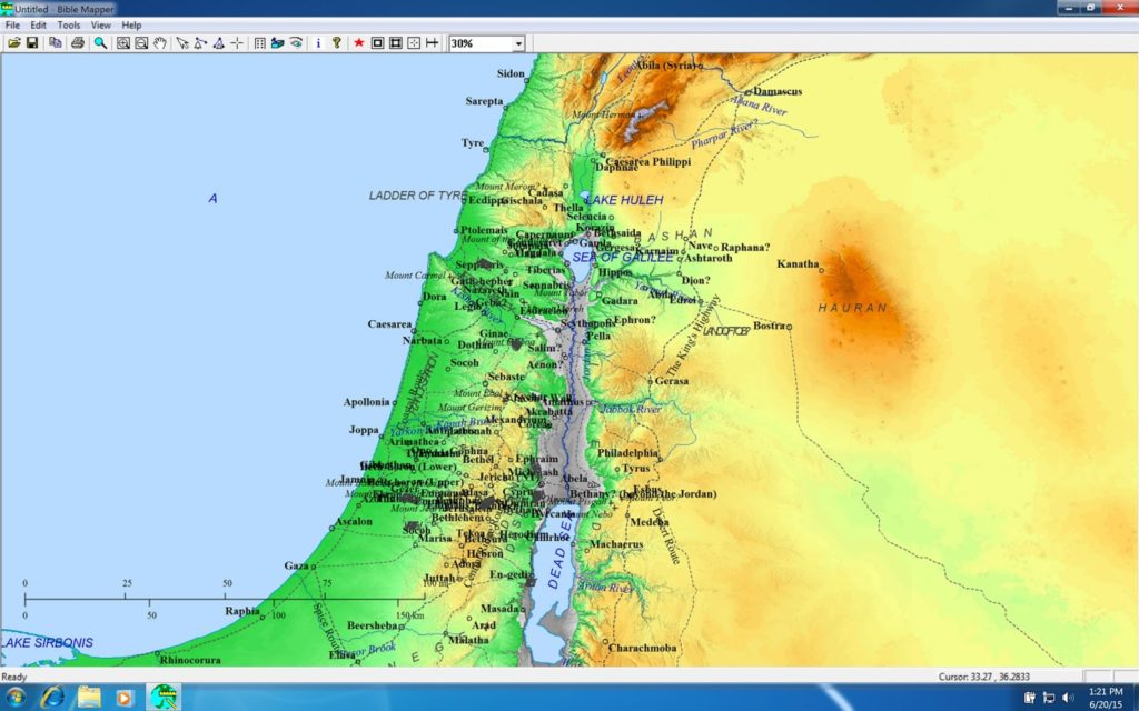
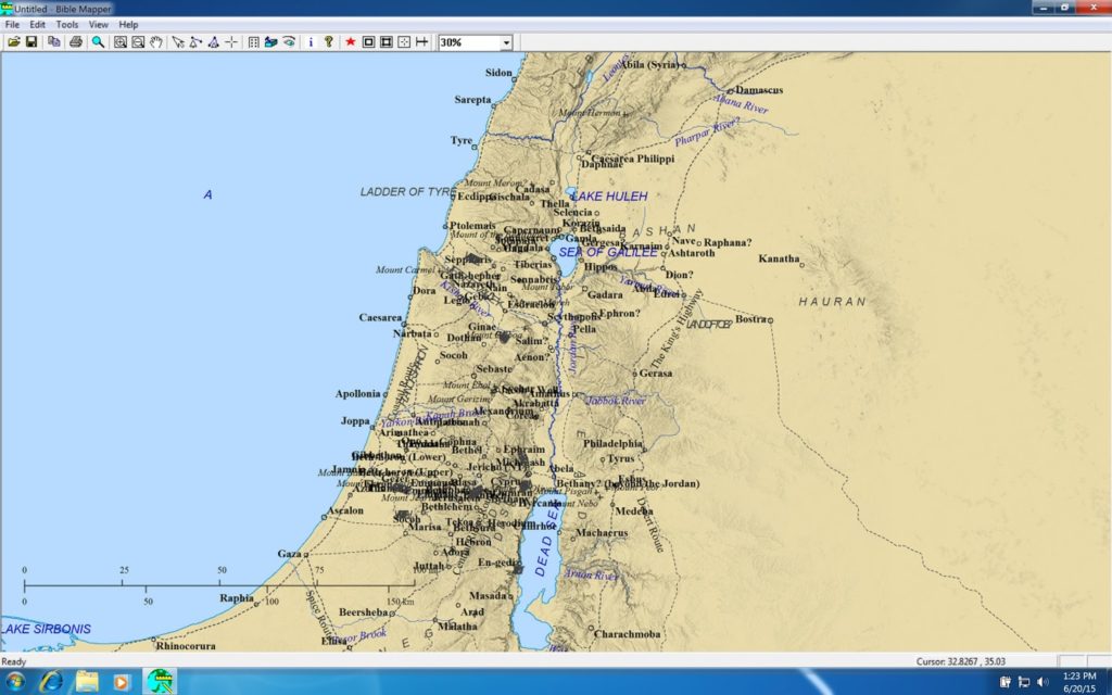
When you open the program, Bible Mapper looks like this.

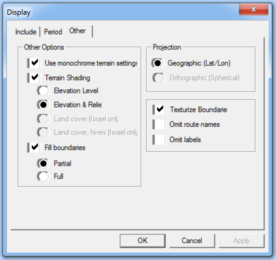
Bible Mapper allows you to choose between colorized terrain (above), or a monochrome appearance (below).

The “Tools” menu allows you to calculate distances between places, find a site, or obtain coordinates for a site.

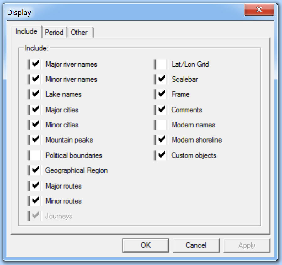
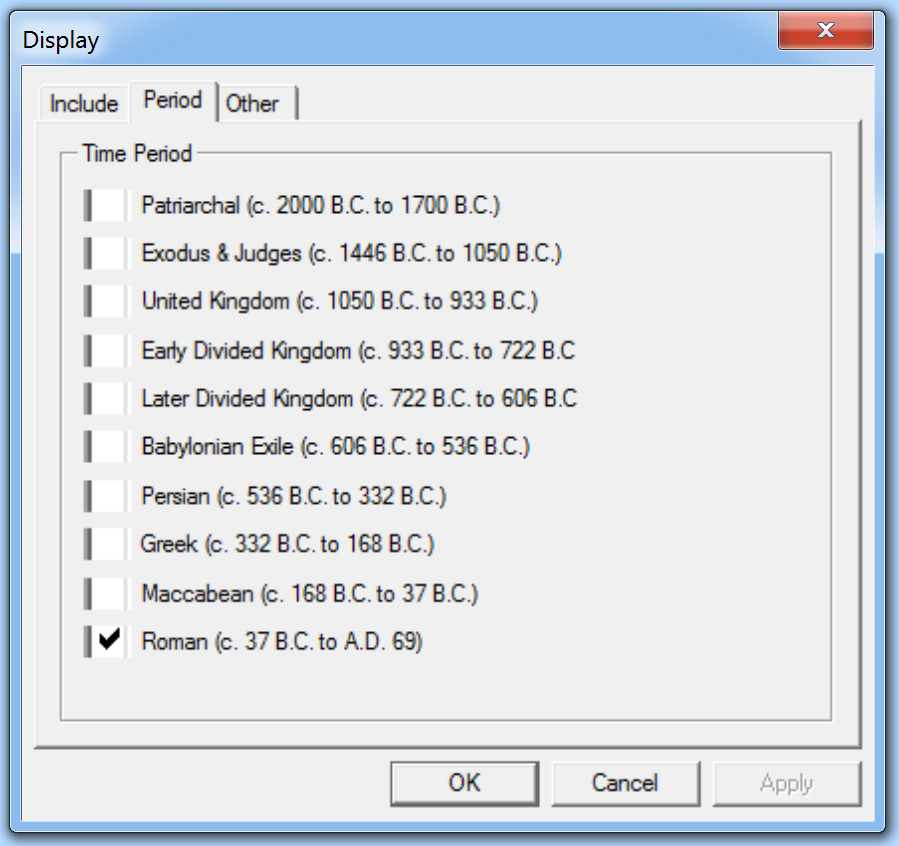
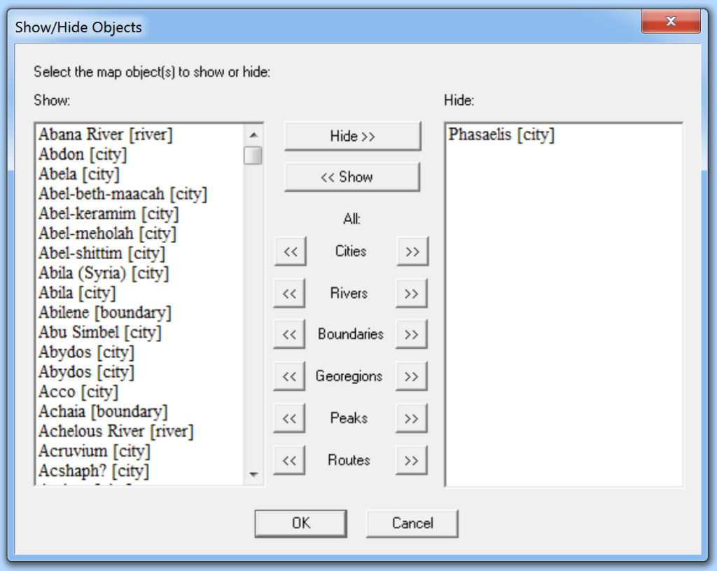
In my opinion, the real gold is the “View” menu. Here you can select what information is displayed: sites, roads, geographic features, or historical periods. Here are some of the options available.

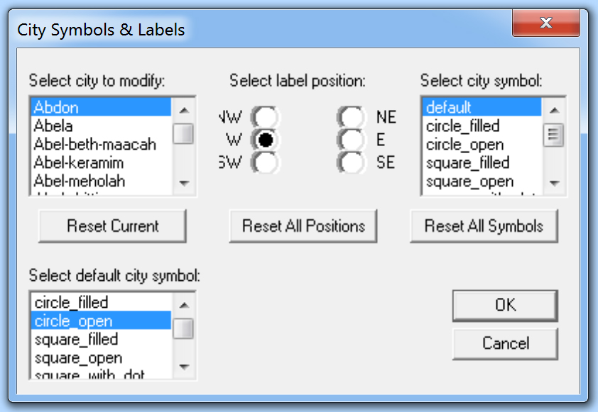
You can import your own sites, adjust the widths and colors of lines, and adjust the appearance of dots. There are even options for repositioning labels.

A number of sample maps can be viewed at the Bible Mapper website gallery.

Bible Mapper is a Windows program. As a Mac user, I am able to use it by running Windows on a virtual machine (such as Parallels). One small issue I experienced was that Mac for some unknown reason appended .exe to the downloaded file. The file should be .msi, so Mac users may have to change the file extension manually before installing.

David Barrett also has created a Bible geography quiz just for fun.

Previous Posts:

Bible Mapper 2.0

Making My Own Map

Bible Mapper: New Wiki

Bible Mapper Version 4

Share:
(Post by A.D. Riddle)

Oftentimes, while researching archaeological sites and/or biblical places, I come across things like this:

map reference 193.142
M.R. 219156
1972 1954

These are grid coordinates for sites. One encounters them in key works such as The New Encyclopedia of Archaeological Sites in the Holy Land (5 vols.), Anchor Bible Dictionary, or the volumes from the archaeological survey of Israel. I want to locate these sites in Google Earth, but how do I convert them? (This subject came to mind while reading Chris McKinny’s post on Shaaraim [see here].)

There are two coordinate systems for Israel, the Old Israeli Grid and the New Israeli Grid. Sometimes these are abbreviated OIG or NIG, but typically no indication is given as to which coordinate system is being used. (To read more about OIG, see this page, and for NIG this page.) I have found that most coordinates are according to OIG, even in newer publications. I am going to assume we are using OIG. (If not, hopefully the results are so wrong that one can tell right away that they are not OIG. This point highlights the fact that you need already to have some kind of rough idea where the right location is so that you can verify the results.)

The coordinates should have an even number of digits. Sometimes they are divided in half by a space, period, or slash, but other times there is nothing separating the string of digits.

If you are given six digits, then the first three digits give one coordinate and the second three digits give the other coordinate. If you are given eight digits, then the first four are one coordinate and the second four are the other. And so on.

The first coordinate gives the easting position (think longitude or x-axis), and the second coordinate gives the northing position (think latitude or y-axis). In other words, the coordinates give you lon/lat. This is the opposite order we normally use of lat/lon for geographic coordinates.

The first (easting, x) coordinate is actually always six digits. If you are only given three digits, then you need to append three zeros to the right side. If you are given four digits, then append two zeros to the right side.

The second coordinate, on the other hand, can be six or seven digits, and is a little more complicated. For the second (northing, y) coordinate, if you are given three digits, then you have to append a “1” to the left side and three zeros to the right side.

With these expanded coordinates, you can now make the conversion using a fantastic website named “The World Coordinate Converter.” (Thanks to Shawn French for finding this gem.) In the top right, from the first dropdown list, scroll down to Israel and select Israel 1923. This is the Old Israeli Grid.

Then, paste the coordinates into the fields. Below this in the second dropdown list, you will need to select “WGS 84/Pseudo-Mercator.” It is found under *World, which is the first group of reference systems. This is the datum used by Google Earth. Finally, click Convert and voila! you have coordinates that you can copy/paste into Google Earth/Maps.

Here are three examples.

Khirbet Jazzir

  1. Anchor Bible Dictionary gives the coordinates 219156 for Khirbet Jazzir. This is thought to be the most likely site for the Levitical city Jazer.
  2. The easting (longitude, x-axis) coordinate is 219. We need to add three zeros to make this a six digit number, namely 219000.
  3. The northing (latitude, y-axis) coordinate is 156. We need to add a “1” to the left and three zeros to the right to get 1156000.
  4. Now go to “The World Coordinate Converter,” select Israel 1923, and paste in the expanded coordinates in the same order they were given to us, 219000, 1156000. Make sure you are converting to “WGS 84/Pseudo-Mercator” and click the Convert button.
  5. The converter generates the following lat/lon coordinates that I can then paste right into Google Earth: 31.996063441518004, 35.728730514891744. Make sure lat is first, and lon is second.

Tell el-Maṣfā

  1. In an article by Israel Finkelstein, Ido Koch, and Oded Lipschits, entitled “The Biblical Gilead: Observations on Identifications, Geographic Divisions and Territorial History,” it is proposed that Mizpah of Gilead be identified with Tell el-Maṣfā.
  2. The coordinates given are 227193.
  3. This gets expanded to 227000, 1193000.
  4. The convertor returns 32.32932657748971, 35.815608335148326 which can be used in Google to locate the site. (We note that these coordinates do not correspond to the hill that they have marked on the p. 143 photograph. It looks to me like their arrow needs to be moved about 1 inch to the left.)

Karm er-Ras

Finally, I was recently asked to make a map that shows Karm er-Ras in Galilee. The Hadashot Arkheologiyot article for this site gives very precise coordinates for each excavation area, both NIG and OIG. The OIG coordinates for Area A are 181580/239335. These are already six digits, so all I need to do is paste them into “The World Coordinate Converter” to get 32.74860752349965, 35.33387296365357.

Additional Notes

The OIG and NIG coordinates are measured in meters. If you are given three digit coordinates, then the accuracy could be off by about half a kilometer. If you are given all six digits, then your accuracy is sub-meter.
If the “The World Coordinate Converter” fails to load the Converter, you can still use the website to get the information you want. Once you select Israel 1923 and paste in your coordinates, a placemark will appear on the map with an info-window. The lat/lon coordinates that you can use in Google Earth appear within this info-window.

For batch conversions, you can supposedly import a CSV into Eye4Software Coordinate Calculator 3.2 (Windows only).  I have not successfully completed a batch conversion, but the software claims it can do so.

Share: