fbpx

Signups are now open for this summer’s Institute of Biblical Context conference. I’ve been at this conference the last two years, and the response has been extremely positive. The Institute of Biblical ContextI don’t know anything else like this where all the sessions are devoted to unpacking the meaning of biblical passages using historical, geographical, literary, and archaeological insights. I plan to be there again this year and I recommend it to all of my readers.

You can read all of the details on the official website, but I’ll quickly note some highlights here. The theme this year is “The
Last Days of Jesus,” and they’ll be looking closely at events from the Passion Week. Scheduled talks include:

  • Triumphal Entry
  • Cleansing the Temple
  • Cursing the Fig Tree
  • What’s Up with Judas
  • Trials before Sanhedrin, Pilate, and Antipas
  • Barabbas
  • Flogging and Method of Crucifixion
  • Tearing of the Curtain

One thing that people like is that the presentations are shorter, which means that the speaker gets right to the main points, and they can pack more subjects in. Some favorite speakers from the past are returning, and there are several new additions as well. I always find that the speakers are extremely well-prepared, and their presentations are packed with great visuals.

The conference is held in Zeeland in western Michigan, which is beautiful and warm in June. You can download the conference brochure here, and the early bird price is available until April 10. I think the conference is a great investment, and an additional bonus is to meet up with like-minded people who love learning about the Bible and its world.

Share:

[UPDATE: The sale appears to be over. There are some new copies selling at 50% off in the Marketplace.]

I’m not sure why, and I’m not sure how long it will last, but at the moment Amazon is selling Chris McKinny’s new book for 90% off ($83.95 marked down to $8.61). My People as Your People: A Textual and Archaeological Analysis of the Reign of Jehoshaphat came out a few months ago and it’s a beautiful synthesis of historical and archaeological research on a particularly important era in Judah. Here are the chapter titles:

  • Chapter One: Introduction
  • Chapter Two: Israel of the Omrides
  • Chapter Three: The Battle of Ramoth-gilead in 1 Kings 22:1-36, 2 Chronicles 18, and Historical Implications from the Tel Dan Stele
  • Chapter Four: Jehoshaphat’s Reign According to 1 Kings 22:41-50
  • Chapter Five: An Archaeological Survey of Judah in the Late Iron IIA Using Archaeology as a Source for Reconstructing History
  • Chapter Six: Conclusion

The hardcover book is 159 pages plus an extensive bibliography. It is published by Peter Lang in their American University Studies series.

Readers of this blog know Chris McKinny from his many contributions here, including:

So I thought you’d want to know about this steal while it’s available.

Share:
by Chris McKinny 

The tribal town lists and boundary descriptions in the book of Joshua (chapters 13-21) are the most significant textual sources for the geography of the ancient Israel/Judah since they contain the vast majority of place names mentioned in the entire canon. In a soon-to-be submitted (and hopefully accepted) dissertation, I deal with the specific identifications of all of the towns and topographic markers mentioned in Joshua 15 (Judah); 18:12-28 (Benjamin); 19:1-10 (Simeon); and 19:40-46 (Dan) within the framework of a larger argument about the date and purpose of the town lists of Judah (Josh 15:21-62) and Benjamin (Josh 19:21-28). Over the course of the project, I compiled a digital archaeological database/atlas of all of the sites mentioned and discussed in the dissertation (embedded below). This project is called the “Interactive Map: A Historical Geography of the Administrative Divisions of Judah: The Town Lists of Judah and Benjamin in Joshua 15:21-62 and 18:21-28” (click to open in a separate window). The entire map is searchable and each entry (click on each button to expand) includes the biblical place name (in English, Hebrew and Greek), the identified ruin with an archaeological breakdown from the Middle Bronze until the Byzantine period including the Iron II size in dunams, and a bibliography of the archaeological data. The bibliography for the archaeological data contained in the database/atlas can be accessed here.

Satellite Bible Atlas users may also be interested in a more traditional map of the town lists/administrative division that I have prepared using the SBA‘s base map. A PDF of the map can be accessed here. I have added a JPEG version of the map below.

Share:
by Chris McKinny

I am excited to announce that Seeking a Homeland is planning a study tour of Israel for this upcoming summer! See here for details/registration and below for a discussion of the uniqueness of the planned tour.

Dates: June 10-19, 2016


Leader: Chris McKinny

Brief Itinerary (10 field days): 
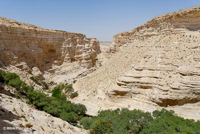
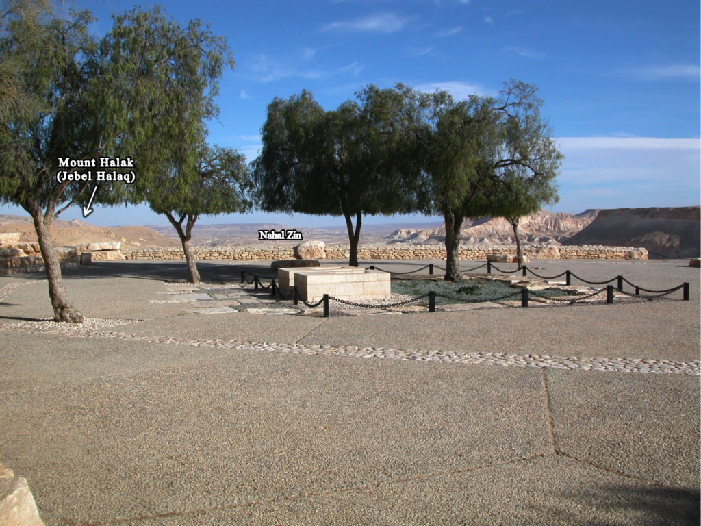
June 10 Arrival/Coastal Plain, June 11 Shephelah and Negev, June 12 Dead Sea, June 13-14 Jerusalem, June 15 Jordan Valley, June 16 Jezreel Valley, June 17-18 Galilee, June 19 Coastal Plain, June 20 Departure or Tel Burna Archaeological Project (see below)

Focus: Geographical, historical, biblical, and archaeological background of Israel, the land of the Bible

Level of Difficulty: Moderate, a lot of walking and several difficult hikes


Availability: 15-30 people


Price: $2,300/person (excluding airfare and lunches)


Add-on: Tel Burna Archaeological Project June 19-July 15, 2016 (1-4 weeks); a $150 discount will be applied to a participant who joins the project (minimum one week).


Deadline: March 31, 2016

Description: 

This study tour is not for everyone. During this tour, there will be very little time for relaxation and even less time for shopping, but we will find time to swim in the Mediterranean, Sea of Galilee and Dead Sea.

This tour is built on the IBEX (The Master’s College) model – where I have taught/led study tours since 2010. This type of study tour will be much different than your standard “church” or religious tour of Israel that often devote equal amounts of time to the hotel’s swimming pool as they do at biblical sites.

While intensive study tours are much less common than the typical tour described above, there are other good options. So what makes Seeking a Homeland’s tour unique?

Two things:

First, this tour will be led by an experienced teacher who also is a trained and active biblical archaeologist (in the field, classroom, and the academy).

Second, participants will have the opportunity to excavate at Tel Burna (Libnah), a major archaeological site, immediately following the tour. In my opinion, an archaeological excavation is the natural “follow-up experience” to an intensive geographical study of Israel. This is born out by the fact that many people who visit Israel develop an interest in biblical archaeology and attempt to follow current discourse through such means as Biblical Archaeological Review and this blog. On the other hand, there are some who have only taken part in an archaeological excavation in Israel and have not had the opportunity to travel throughout Israel and, subsequently, gain a working knowledge of the country’s geography and history. Planning the field tour in connection with the archaeological project allows for participants to experience both the broad scope of biblical geography while also participating and helping recover the “nuts and bolts” (or “weapons and pottery”) of individuals who actually lived during the time of the Bible. This combination makes Seeking a Homeland’s tour unique and a good opportunity for those who have never been to Israel or returnees who would like to refresh their past geographical knowledge and gain new insight by participating in an important archaeological investigation of a biblical site.

Our goals for the field tour will be three-fold:
1) to observe as much of the country as possible.
2) to illustrate and contextualize the Old and New Testament narratives against the backdrop of Israel’s geography, archaeology and history.
3) to internalize the landscape, background, and worldview of the biblical authors and audiences, in order to achieve better and more nuanced interpretations and, thereby, applications of the biblical text.

For those who decide to join the Tel Burna Archaeological project following the tour, an additional goal will be for participants to “experience the physical culture (cooking/eating, religious, military, administration, etc.) of the Canaanite and Israelite world” through a first-hand experience of archaeological excavation. Imagine yourself finding a Canaanite figurine depicting Asherah (Judges 2:13)  or a LMLK seal impression from the time of King Hezekiah (2 Kings 19:8) – both from the town of Libnah, which the Bible says was defeated by Joshua (Joshua 10:31-32) and Sennacherib (2 Kings 19:8). These are the types of finds that are waiting for us at ancient Libnah.

Canaanite Plaque Figurine

Interactive Map of Tour Itinerary:

Share:
by Chris McKinny

Many visitors to Israel have visited the Nahal Zin and hiked into Ein Avdat. While witnessing the canyon’s spectacular views and wildlife, visitors will probably be informed that Nahal Zin was the southern border of the promised land (and thereby Canaan and the tribe of Judah) based on a connection between the large, continuous canyon (Arabic – Wadi el-Marra) and the southern boundary descriptions in the Bible (Num. 34:4; Josh. 15:3).

Ein Avdat – BiblePlaces.com

The identification of Wadi el-Marra with part of the Wilderness of Zin seems to be very plausible, even if the name “Nahal Zin” is a modern construction. Essentially, the identification of Wadi el-Marra with the southern boundary is based on the following two pieces of evidence: 1.) Wadi el-Marra is the only natural topographic boundary in the region and 2.) it is located between the Ascent of Akkrabim and Kadesh-barnea (Ein el-Qudeirat), which fits the biblical description. However, there is an additional piece of evidence that seems to make this identification even more secure – the location of Mount Halak at Jebel Halaq. Update – see here for Musil’s description of Jebel Halaq (German).

Southern Boundary Markers of Canaan/Judah on Karte Von Arabia Petraea (A. Musil 1906)

This identification was made over a century ago by Alois Musil in his Karte Von Arabia Petraea who was told that the northern cliff face of Wadi el-Marra (i.e. Nahal Zin) was called Jebel Halaq by the local population. Since “jebel” means “mountain” in Arabic and the second part of the name is identical to the biblical place name, this identification was generally accepted. However, since the early cartographic projects did not cover the Negev Highlands (e.g., the Survey of Western Palestine, Van De Velde’s Map) most are unaware of this connection and its implications for biblical geography. Mount Halak is mentioned twice in the book of Joshua, in both cases it is within a north-south boundary description describing the territory that Joshua conquered.

“So Joshua took all that land, the hill country and all the Negeb and all the land of Goshen and the lowland and the Arabah and the hill country of Israel and its lowland from Mount Halak, which rises toward Seir, as far as Baal-gad in the Valley of Lebanon below Mount Hermon. And he captured all their kings and struck them and put them to death. Joshua made war a long time with all those kings.” (Josh. 11:16–18 ESV) 

“And these are the kings of the land whom Joshua and the people of Israel defeated on the west side of the Jordan, from Baal-gad in the Valley of Lebanon to Mount Halak, that rises toward Seir” (Joshua 12:7 ESV)

Aerial view of Nahal Zin with view of Mount Halak (Jebel Halaq), photo by Bill Schlegel

Jebel Halaq faces towards southern Jordan and the mountains of Edom (i.e. Mt. Seir), which matches the passages from Joshua. When we add Mount Halak (Jebel Halaq) to the accepted identifications of Tamar (En-Hazeva), the Ascent of Akkrabim (Roman road west of Tamar rising to Mamshit), and Kadesh-barnea (Ein el-Qudeirat), it is clear that the various boundary descriptions were describing the same border, which they demarcated using various topographical features (oases, mountains, and natural roads). 

For those who visit the Nahal Zin/Ein Avdat, Mount Halak (Jebel Halaq) can be seen either on the bus ride down to the hike or at the Ben-Gurion tomb, which overlooks the Nahal Zin. Be sure to look that way next time you make it down there!

Ben-Gurion tombs with Nahal Zin and Mount Halak in background
Share:

If you ever wanted to learn more about the Lands of the Bible but you’re not a traditional student or
you can’t afford to travel to the Middle East, you will want to check out the free online “Survey of the Lands of the Bible” class that Mark Vitalis Hoffman is offering through Gettysburg Seminary.

The course runs from September to December and gives you the opportunity to do as much or as little as your schedule permits. You can watch videos, read the textbook, and join in discussions.

You can learn more here.

This also would be a great opportunity for those who have traveled to the Lands of the Bible but the tour left them longing for more!

Share: