fbpx

(Post by Seth M. Rodriquez)


After a holiday break, we are back with the next installment of our series on “obscure sites in the PLBL.” Today we will be focusing on the Neolithic site of Catalhoyuk in central Turkey. Like many archaeological sites, at first glance this location looks like a normal hill.  But there is much more than meets the eye…

The PLBL provides the following general information about the site in the PowerPoint annotations:

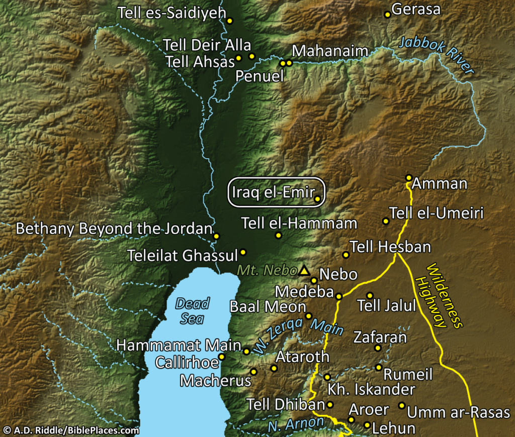
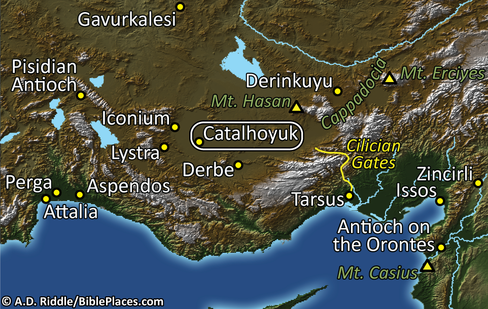
Çatalhöyük (Catal Hoyuk, Catal Huyuk) is located in the Konya Plain, about 21 miles (37 km) southeast of Konya
(ancient
Iconium). It is the largest Neolithic site that has been discovered and is very
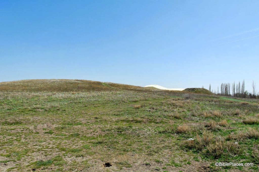
well-preserved. The site consists of two flat mounds, a large mound to the east
and a smaller mound to the west. The mounds are said to resemble the shape of a
fork, hence the name of the site (
çatal is Turkish for fork). The eastern
mound of
Catalhoyuk rises 65 feet (21 m) above the surrounding plain and covers an area of 32
acres (13 ha). 
Thirteen occupational strata have been excavated dating to the Neolithic
period, the earliest of which dated to ca. 7200 BC and the latest to ca. 5500
BC. The town had a population of up to 8,000 people.


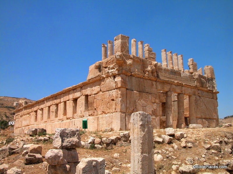
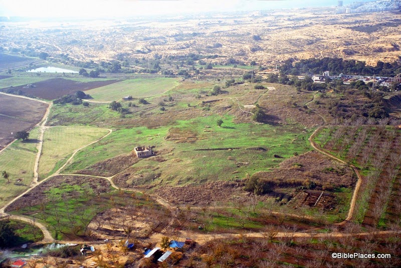
And the surface of the tell is nothing to write home about, as you can see in the photograph below.

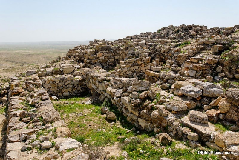
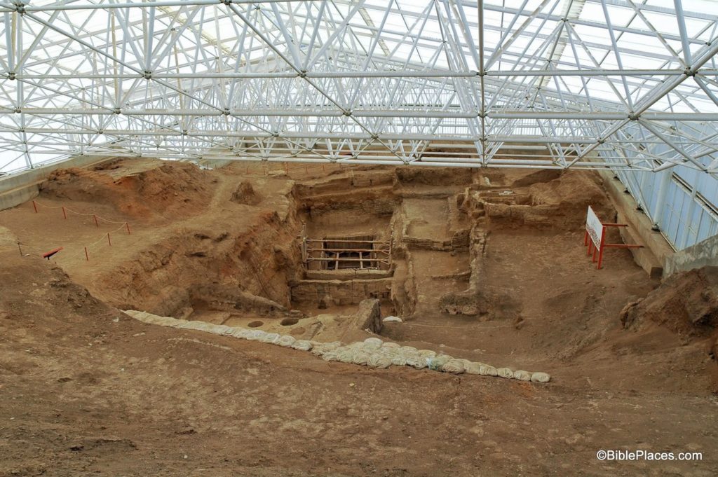
However, there are some striking features about this site. As the archaeologists dug into the tell, they discovered a city that was comprised of houses connected to houses with no streets. It appears that the inhabitants of the city walked over the flat roofs of the houses to get from one end of town to the other! Below is a photograph of some of the excavations being conducted at the site. (You get two-for-one this week.)

Again we turn to the annotations in the PLBL for more information:

Catalhoyuk is made up of domestic dwellings
packed together without any streets. The people moved about on the roofs of the
houses and entered the houses through holes using ladders. The houses were made
of mudbrick and the interiors were plastered and decorated with murals. Houses
typically consisted of two rooms with raised platforms along the walls…. An oven was often
located near the ladder, beneath the hole in the roof. Throughout the town,
there are a number of large courts.

So the next time you are tempted to complain about your neighbor’s kids playing too loud in the backyard or the high volume of traffic that passes in front of your house, just be grateful that you don’t live in the ancient city of Catalhoyuk where your neighbors would have walked on your roof on their way to work.

These photographs and annotations are available in Volume 9 of the Pictorial Library of Bible Lands and is available here for $34 (with free shipping). Other photographs from this volume can be seen here, here, and here.

A helpful video that shows a reconstructed time lapse of how the city was built and the ruins were formed can be found here.

Share:

(Post by Seth M. Rodriquez)

In our everyday lives, most of us feel far removed from the biblical world. The stories of Israelites and Judeans, Assyrians and Babylonians, and Jews and Romans seem like they happened long ago in a far off place. And yet every now and then you run across something that makes you think about how connected we are with those times. Our picture of the week is one such example.

We continue our series on obscure sites in the Pictorial Library of Bible Lands with a photograph of some of the inscriptions at Nahr el-Kalb (a.k.a., Dog River) in Lebanon. There is a limestone cliff near the end of the river, and the inscriptions carved on that cliff are a virtual “Who’s Who” of military leaders who have passed through the area in both ancient and modern times. In the map below, you can see the site’s location along the coast of Lebanon between Byblos and Beirut. (Thanks again are due to A.D. Riddle for the map graphic.)

There are numerous inscriptions on this cliff, ranging from 1276 BC to AD 2000. These inscriptions commemorate the actions of Ramses II (Egyptian pharaoh in 13th c. BC), Esarhaddon (Assyrian king in 6th c. BC), Caracalla (Roman emperor in 3rd c. AD), Proculus (Phoenician governor in 4th c. AD), Barquq (Mamluq sultan in 14th c. AD), Napoleon III (French emperor in 19th c. AD [not to be confused with his uncle, Napoleon Bonaparte]), and others. Not all of the inscriptions are about military victories. Some of them just commemorate road improvements or the construction of a bridge. Yet the fact that leaders from various times and places all carved inscriptions in this place over the course of over 3,000 years is quite remarkable. This site provides us with a visible link between the modern day and all of the historical periods from the time of the ancient Egyptians onward.

For example, in the photograph above (taken by A.D. Riddle) you can see four inscriptions clustered together (click on the photo to enlarge). The one on the left was originally an Egyptian stela carved by the army of Ramses II in the 13th century BC. In AD 1861, this space was re-used by Napoleon III to commemorate the French intervention in the war between the Druze and Maronites. The two inscriptions to the right of Napoleon’s were carved by the ancient Assyrians (the man in the picture is looking at one and the other can be seen directly behind him). The texts of these two stelae have not endured the ravages of time, but the relief of an Assyrian king can still be seen on one of them. These inscriptions date to sometime in the Iron Age. Above the Assyrian stelea, you can see an inscription carved by the British Desert Mountain Corps during World War I, which records their military victories at Damascus, Homs, and Aleppo in 1918.

So in this one photograph we have the armies of ancient and modern nations represented. The juxtaposition of ancient Egypt and Assyria with the French and British reminds us that we are all part of an unbroken string of history. We are not so far removed from the ancients as we think.

This photograph and map, along with over 700 other images, are included in Volume 8 of the Pictorial Library of Bible Lands, and is available here for $34 (with free shipping). Further images of the inscriptions at Nahr el-Kalb can be found here at LifeintheHolyLand.com, and photographs from nearby Byblos can be seen here on BiblePlaces.com.

Share:

(Post by Seth M. Rodriquez)

Our picture of the week focuses on the obscure site of Serabit el-Khadim in the Sinai Peninsula.  This is not a place that you will visit on your typical tour of Egypt.  In fact, it was not a place that even many ancient Egyptians would have visited!

Located about 17 miles (27 km.) from the Gulf of Suez, Serabit el-Khadim was a mining site. Teams of miners would be sent to this region by the Pharaoh to dig up turquoise and copper. However, this was only carried out during times when there was a strong central government in Egypt.  The site was occupied on and off from the time of the 4th Dynasty (c. 2600 B.C.) to the time of the 20th Dynasty (c. 1100 B.C.) The following map, which is included in Volume 7 of the Pictorial Library of Bible Lands, shows its position near the Gulf of Suez. (A special thanks is due to A.D. Riddle who created the original maps in the PLBL and has volunteered to customize those maps for this series of blog posts.)

Pictured below are the ruins of the Temple of Hathor that stood at this site and the scorching desert of the Sinai spreading out below it. Starting with a small shrine within a cave, this temple complex grew larger and larger over the course of several hundred years as successive Pharaohs each added their own special touch.

In The Archaeological Encyclopedia of the Holy Land, the temple and its development is described in the following way:

During the excavations an early high place, and a series of temples that replaced it, were revealed within a temenos (enclosure), 200 feet by 140 feet in area. The original Egyptian shrine consisted of a cave sacred to Hathor, goddess of the land and of minerals. In front of the cave a portico was constructed, and then a large court; and further shrines were added during the long Egyptian occupation of the site. Within the temenos were caves dedicated to other deities, such as the moon-god Thoth.

Mining of turquoise did not begin at Serabit el-Khadem until the time of the 12th Dynasty …. Turquoise was essential to the Egyptian jewelry industry, while copper was important for the production of tools and weapons …. The earliest Egyptian monarch to send an expedition to Sinai was Sneferu, the first king of the 4th Dynasty. Mining continued with some interruption down to the end of the 6th Dynasty, when both mines were again worked under Ammenemes III of the 12th Dynasty. Stalae set up in the temple record the various mining expeditions, of which no less than seven took place during Ammenemes III’s reign. …

The temple of Serabit el-Khadem had been enlarged repeatedly. Continuing the process, Sethos I, founder of the 19th Dynasty, extended it. Rameses II and Merneptah are also recorded in the temple, as is Rameses III of the 20th Dynasty. At the beginning of the 21st Dynasty the mines of Sinai went out of use once more.

This map and photograph, along with over 1,000 other images, are available in Volume 7 of the Pictorial Library of Bible Lands, available here for $34 (with free shipping).

Excerpt is taken from “Serabit el-Khadem,” in The Archaeological Encyclopedia of the Holy Land, Logos Edition, ed. Avraham Negev (New York: Prentice Hall Press, 1990).

Share:

(Post by Seth M. Rodriquez)

Our obscure site of the week is somewhere that I have never been. I know of this fascinating location only through the PLBL collection. However, Josephus seems to have known it fairly well. It was a site built in the Hellenistic period in the hills above the Plains of Moab, northeast of the Dead Sea.

This site is today known as “Sir” and it is located near the modern village of Iraq el-Emir (click on the map above for a higher resolution). It was built by Hyrcanus, who lived in the third century B.C., during the time when the Ptolemies and Seleucids fought for control of the Levant. Hyrcanus was the youngest son of Joseph, who in turn was the nephew of Onias the high priest. Joseph and Hyrcanus were appointed by the Ptolemy V Epiphanes to collect taxes in the region and send them back to Ptolemy’s capital city, Alexandria. Joseph collected taxes from Jerusalem, but because of a family quarrel Hyrcanus had to content himself with settling on the other side of the Jordan River. It is here that he built the palace that is shown in the photo below:

Josephus provides us with the following details about this building:

Hyrcanus determined not to return to Jerusalem any more, but seated himself beyond Jordan, and was at perpetual war with the Arabians, and killed many of them, and took many of them captives. He also erected a strong fortress, and built it entirely of white stone to the very roof, and had animals of a great magnitude engraved upon it.  He also drew around it a great and deep canal of water. He also made caves of many furlongs in length, by hollowing a rock that was near to him; and then he made large rooms in it, some for feasting, and some for sleeping and living in. … Moreover, he built courts of greater magnitude than ordinary, which he adorned with vastly large gardens. And when he had brought the place to this state, he named it Tyre [also spelled Tyros or Tyrus]. This place is between Arabia and Judea, beyond Jordan, not far from the country of Heshbon. (Josephus, Antiquities of the Jews 12:229-231, 233.)

The animal engravings can still be seen on this structure, although most of them have not endured the ravages of time. They are not very clear in this photograph, but additional photos of the animal engravings are available in Volume 6 of the PLBL. One of the animal engravings was in the shape of a leopard and it served as a water fountain with a stream of water spewing out of the leopard’s mouth. The caves that Josephus mentioned have also been found in this area.

So the next time you’re passing through the hills above the Plains of Moab, on your way to more popular sites such as Amman and Medeba, take a little time to visit this small but fascinating site that was described for us so well by Josephus, almost 2,000 years ago.

This map and photo, along with over 850 other images, are available in Volume 6 of the Pictorial Library of the Holy Land, and is available here for $34 (with free shipping).

The excerpt is taken from The New Complete Works of Josephus, revised and expanded edition, trans. by William Whiston, commentary by Paul L. Maier (Grand Rapids: Kregel Publications, 1999), p. 402.

Share:

(Post by Seth M. Rodriquez)

What if people in the future forgot the name of your city? Sound ridiculous? In archaeology, that is actually a common occurrence…

Continuing our series on “obscure sites in the PLBL,” our picture of the week comes from the Biblical Negev. About halfway between Beersheba and Arad are the ruins of a significant city from the time of Hezekiah. The site’s modern name is Tel Ira, and you can see its location in the center of the map below (click on the map for a higher resolution).

In the photograph below, you can see the remains of an Iron II casemate wall found at Tel Ira. The scorching terrain of the Negev can be seen in the background.

The following information is provided in the PowerPoint notes in Volume 5 of the Pictorial Library of Bible Lands:

Tel Ira was excavated from 1979 to 1987 by Itzhak Beit-Arieh and others. The six-acre site was occupied in the Early Bronze III, Iron II, Persian, Hellenistic, Early Roman, Byzantine, and Early Arab periods.

In the late 8th or early 7th century BC (approximately the time of King Hezekiah), the site was entirely surrounded by a solid wall that was 5-6 feet (1.6-1.8 m) thick. In the east wall excavators uncovered a gate with six chambers and two towers, similar to gates found at Hazor, Megiddo, and Gezer.

Excavators believe that Tel Ira was one of the most important sites in the Negev during the 7th century BC. It may have been destroyed by an Edomite attack. The ancient name of the site has not been determined.

A casemate wall was excavated near the six-chambered gate. Its total thickness is about 16 feet (5 m). The exterior wall (left in photo above) measures 5 feet thick (1.5 m) and the interior wall is 3 feet (1.0 m) thick.

The city wall was exposed on the complete circumference of the site.

Two statements in the third paragraph strike me as odd. The first is that this was “one of the most important sites in the Negev during the 7th century BC.” The second is: “The ancient name of the site has not been determined.” After we have dug at so many sites and learned so much about the biblical world, how could we not know the name of one of the most important cities within the territory of Judah during the period of the Davidic monarchy?

Years ago, Edwin Yamauchi wrote a book called The Stones and the Scriptures where he makes an interesting argument about how much we really know about the ancient world. He points out that our knowledge about the ancient world shrinks proportionately as we move from what existed in the historical period to what we have available for study today. He argues that out of everything that existed in antiquity, there is only a fraction of the material remains that have survived; of the surviving remains, only a fraction of the sites where this material is located have been surveyed or found; out of the known sites, only a fraction have been excavated; and out of the excavated sites, only a fraction have been published.

So when it comes down to it, we have only a fraction of a fraction of a fraction of information available to us, based on the archaeological record alone. Sometimes this deficiency can be helped through written sources from antiquity (such as the Bible) but often we are left with sites without names, as is case with Tel Ira. So this once prominent city of the Negev finds itself today classified as one of the “obscure sites” in the Holy Land.

This photograph and map, along with over 700 other images, are available in Volume 5 of the Pictorial Library of Bible Lands, and is available here for $34 (with free shipping). More photographs and information about Tel Ira can be found at the following websites:

Share:

(Post by Seth M. Rodriquez)

Our picture of the week is an “elephant in the room,” archaeologically speaking. This site was occupied by Israel’s most notorious neighbor, was a flourishing city 100 acres in size, and was once a resting place of the Ark of the Covenant. Yet this site is hardly (if ever) visited by tourists in Israel today. Thus, we continue our series of “obscure sites” with a map and photograph of the Philistine city of Ashdod.


Ashdod is located only 3 miles (4 km) from the Mediterranean coast. In ancient times it possessed some prime real estate along the main international highway that passed through the Levant, which helped contribute to the city’s wealth and prominence. In the map below (included in the PowerPoint files in Volume 4 of the PLBL), Ashdod can be seen in the far left. (Click on the image to enlarge it.)


The site was excavated for nine seasons in the 1960s and 70s. Remains from the Middle Bronze period to the Byzantine period were found here. At its largest size, the site was comprised of an upper city of at least 20 acres and a lower city of at least 70 acres.

The city reached this peak size during the time of the Philistines, when it was one of the five major cities of Philistine coastal plain (along with Ekron, Gath, Ashkelon, and Gaza). Amihai Mazar summarizes the archaeological findings at Ashdod from this period in the following way:

At Ashdod the first Philistines settlement (Stratum XIII), although unfortified, was a well-planned and densely built city, some twenty acres in area. … The next two levels at Ashdod (Strata XII-XI) denote successive rebuildings of the Philistine city in the twelfth and eleventh centuries B.C.E. In Stratum XII the ruined fortifications of the last LB II city (Stratum XIV) served as foundations of a solid city wall. At the end of the eleventh century B.C.E. (Stratum X), Ashdod expanded to a size of about 100 acres, thus becoming one of the largest cities in the country. In this time Ashdod was surrounded by a solid wall with a four-chamber gate. This enlarged city endured for a long time in Iron II.

During this period is when the Ark of the Covenant was captured by the Philistines in a battle against the Israelites (1 Sam. 4:1-11). The Ark was carried back to Ashdod and set in the temple of the Philistine god Dagon. As the story unfolds in 1 Samuel 5, this turn of events did not bode well for the statue of Dagon. It was supernaturally knocked down twice and consequently had its head and hands broken off. Furthermore, the people of the city were struck with a plague of tumors. So eventually the people of Ashdod sent the Ark to the neighboring city of Gath, where it wreaked further havoc on the Philistines.

The city of Ashdod also appears in several other places in the Old Testament. It is noted in the book of Joshua that it was not conquered by the Israelites when they entered the land of Canaan (Josh. 13:1-3), but several hundred years later it was conquered by King Uzziah of Judah (2 Chr. 26:6-7) and then by the Assyrians (Isa. 20:1-2). The city also is mentioned (and targeted!) in a number of prophesies in the Old Testament (Amos 1:8; 3:9; Isa. 20:1-2; Jer. 25:20; Zeph. 2:4; Zech. 9:6). Finally, in the book of Nehemiah the people of Ashdod opposed the rebuilding of the wall in Jerusalem (Neh. 4:6-8) and intermarried with some of the Judeans (Neh. 13:23-27).

Although this site has an immense significance both biblically and archaeologically, it is not currently set up to host tourists. When I visited the site in 2006, I was on my own in a borrowed car. I had to park and walk through an orchard to get to the site. Nothing was marked and I couldn’t even get to the top of the acropolis. The tell is bordered by industrial buildings and there is nothing there to indicate that this was once the thriving Philistine metropolis of Ashdod. And so, this once important city sadly finds itself among the “obscure sites” of the Holy Land.

This photo and over 1,500 others can be found in Volume 4 of the Pictorial Library of the Holy Land and can be purchased here for only $39 (with free shipping). Additional pictures and information about other Philistine cities can be found on the BiblePlaces website here and here, and on the LifeintheHolyLand website here.

The excerpt above is taken from Amihai Mazar, Archaeology of the Land of the Bible: 10,000-586 B.C.E., The Anchor Bible Reference Library (New York: Doubleday, 1990), p. 308, which is available for purchase here.

Post Script:  For those of you who may be interested, I have posted a review of the Rose Then & Now Bible Map Atlas on my personal blog here. Specifically, the review focuses on the electronic version published by Logos Bible Software.

Share: