fbpx

Joshua 10

Routing the Five-King Coalition

Jerusalem During the Conquest

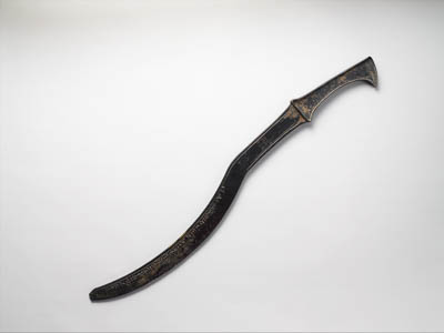
Adoni-zedek king of Jerusalem heard how Joshua had taken Ai (Joshua 10:1).

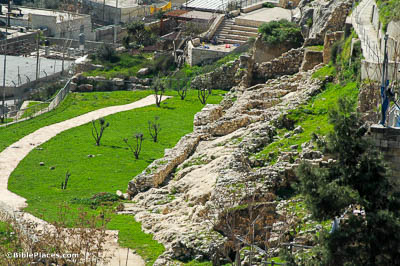
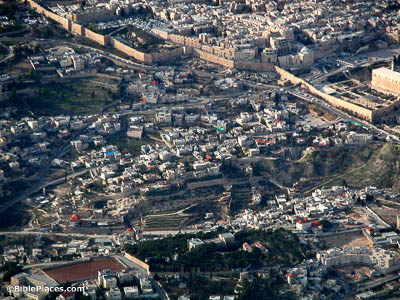
At the time of Joshua, Jerusalem was located on the ridge above the Gihon Spring, shown in the center of this photo. It was only after its capture by David that the city was extended further to the north to include the area now covered by the Temple Mount. The older city, today commonly referred to as the City of David, is completely outside of the modern Old City walls.

Canaanite Fortifications

Then Adoni-zedek king of Jerusalem sent unto Hoham (Joshua 10:3).

Excavations south of the Gihon Spring revealed fortifications from the Canaanite and Israelite periods. This photo shows “Area E” as designated by Yigal Shiloh in his excavations from 1978–85. The Middle Bronze fortification line seen here was likely still in use in the Late Bronze Age when Adoni-zedek was king of the city.

Gibeon

Therefore the five kings of the Amorites . . . encamped against Gibeon, and made war against it (Joshua 10:5).

The location of ancient Gibeon has been firmly established by excavations at el-Jib, the mound seen here. Over thirty jar handles with the name “Gibeon” were recovered at the site. This city would not have been an easy target, as can be seen from its location atop an isolated hill. This would explain why the king of Jerusalem wanted assistance from so many other kings when he went to war with Israel’s new ally.

Beth-horon Ridge

He slew them with a great slaughter at Gibeon and chased them by the way of the ascent of Beth-horon (Joshua 10:10).

The Beth-horon Ridge Route connects the Central Benjamin Plateau with the Aijalon Valley. Because the descent is long and gradual, the Beth-horon ridge is the best route down from the Benjamin Plateau toward the west. The road along this descent would have been well-known to the armies of the south and would have been the logical escape route for them when fleeing from the Israelites. The modern highway still follows the ancient route.

Gilgal

And Joshua returned, and all Israel with him, to the camp at Gilgal (Joshua 10:15).

The Israelite camp was located to the east of the now-ruined city of Jericho. Gilgal does not appear to have ever been a city, but only a temporary campsite. However, it seems from later biblical accounts that the location retained a certain religious importance (Judg 3:19; 1 Sam 13:7-10; Amos 4:4). Though it is impossible to know exactly where the camp was, it may have been somewhere on the right side of the green plain shown here.

Ancient Swords

And Joshua took Makkedah on that day and struck it with the edge of the sword (Joshua 10:28).

The phrase “struck it with the edge of the sword” is particularly apt for the sickle sword, a kind of weapon carried at this time. This sword was designed as a slashing weapon, with the damage done by the curved edge of the blade. This is different than a straight sword, which is more often used as a piercing weapon. The pictured Assyrian sickle sword dates to the 14th or 13th centuries BC.


Purchase the Collection:

Joshua (Photo Companion to the Bible)

FREE Shipping plus Immediate Download