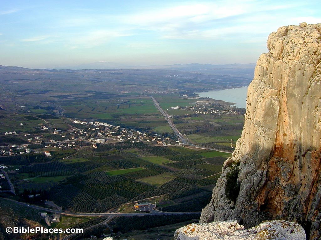
The Plain of Gennesaret spreads out below the Arbel cliffs. About 5 miles (8 km) long and 2 miles (3 km) wide, this stretch of land alongside the Sea of Galilee’s northwest shore was renowned for its fertility. Josephus wrote that it was “wonderful in its characteristics and in its beauty. Thanks to the rich soil there is not a plant that does not flourish there, and the inhabitants grow everything: the air is so temperate that it suits the most diverse species.”
Sea of Galilee
Also known as Bahr Tubariya, Ginnosar, Lake of Galilee, Lake of Gennesaret, Lake of Gennesar, Sea of Chinnereth, Sea of Chinneroth, Sea of Kinnereth, Sea of Tiberias, Lake of Tiberias, Waters of Gennesaret, Yam Kinneret
Plain of Gennesaret
View from Northwest
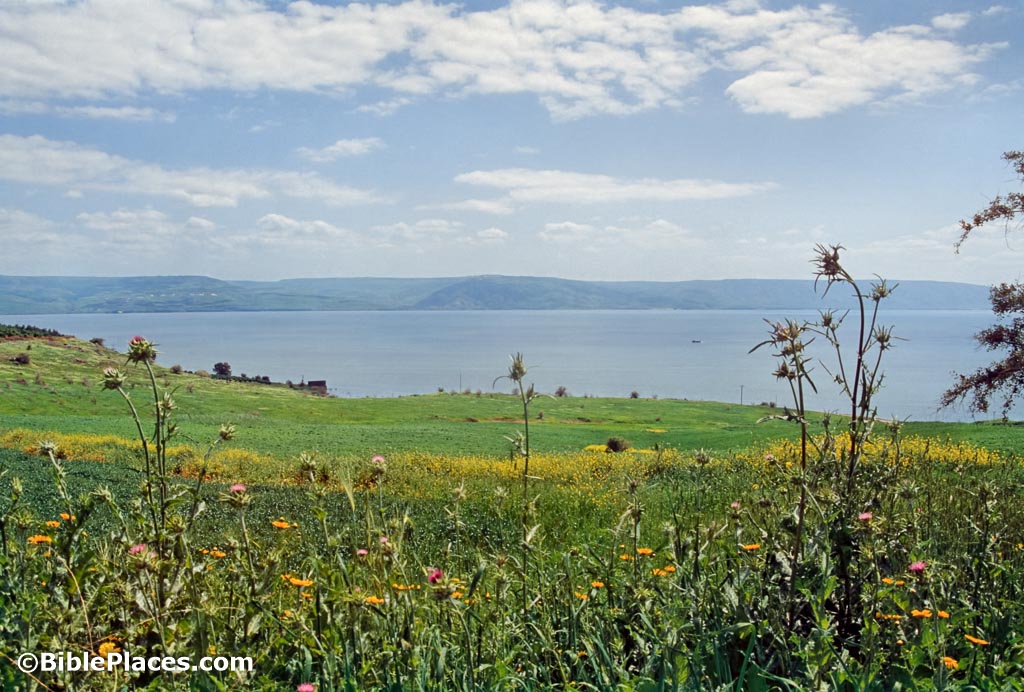
The Sea of Galilee is fed by the Jordan River, rainfall and springs on the northern side. More properly designated a lake, the Kinneret (the Old Testament and modern name) is 13 miles (21 km) long and 7 miles (11 km) wide. At its deepest point, the lake is only 150 feet (45 m) deep. The rabbis said of it, “Although God has created seven seas, yet He has chosen this one as His special delight.”
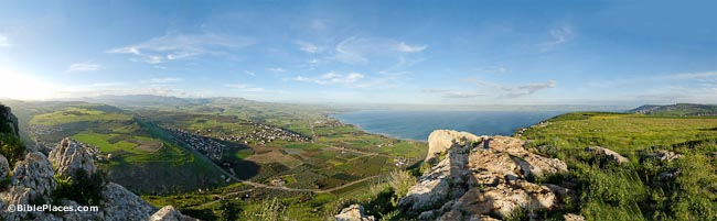
View from Arbel
From the summit of Mount Arbel on the western side of the Sea of Galilee, one can see the entire lake, the city of Tiberias, the mountains of Galilee, and the Golan Heights. On a clear day, Mount Hermon is visible.
Hippos and Harbors
Hippos (Susita) was a major city of the Decapolis located on a round hill overlooking the shore. The modern harbor of Kibbutz En Gev is visible below it. In the 1st century, at least 16 harbors were located on the lake. All the lake’s settlements had their own harbor, even if it was very small. The largest one belonged to Gadara had a 650-foot (200-m) breakwater.
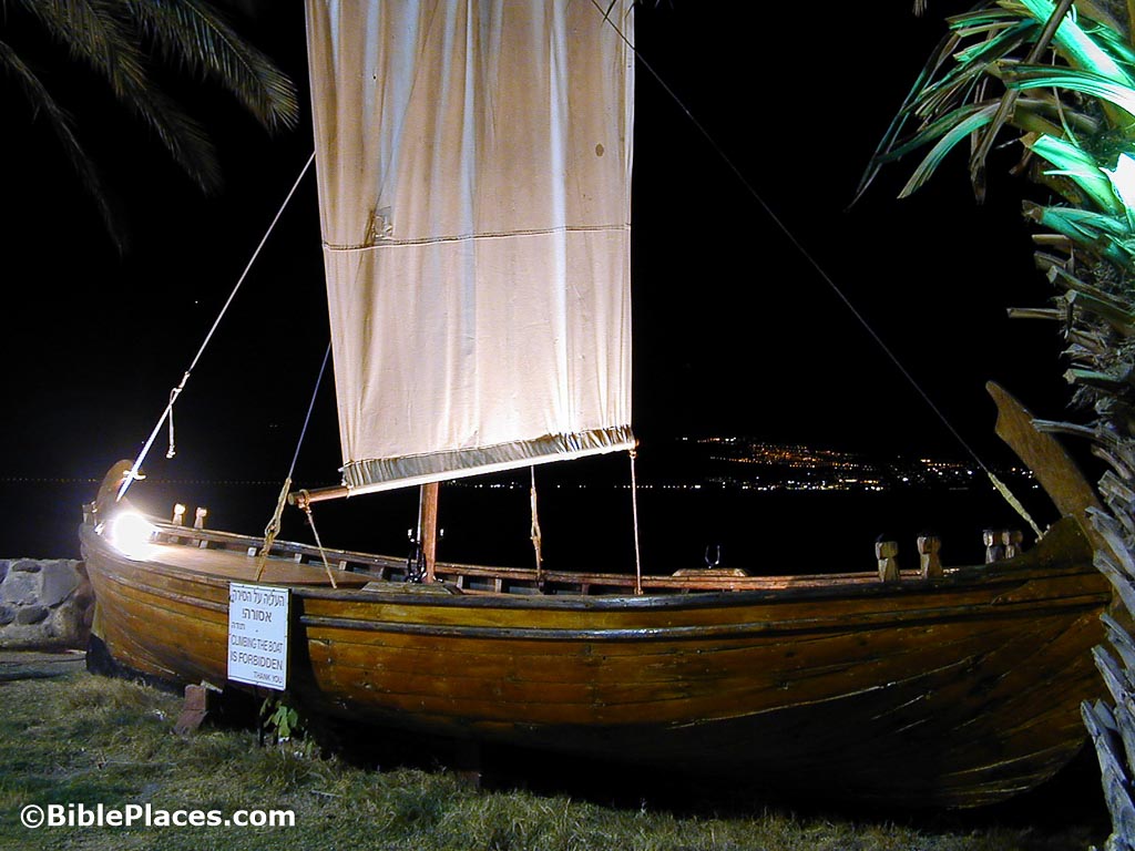
Wooden Boat Reconstruction
In 1986, a wooden vessel from the first century was discovered near Nof Ginosar on the lake’s northwestern shore. Studies have determined the type of wood that was used (mainly cedar and oak), the style of construction (mortise and tenon joints), the date (on the basis of construction techniques, pottery, and Carbon 14 tests) and the size (26 x 7 ft [42×8 m] – big enough for 15 men). Pictured at right is a reconstruction of how the ancient boat might have looked. This was formerly on display at Kibbutz En Gev.
Check out our Gospels collection!
10,000 slides illustrating Matthew, Mark, Luke, John
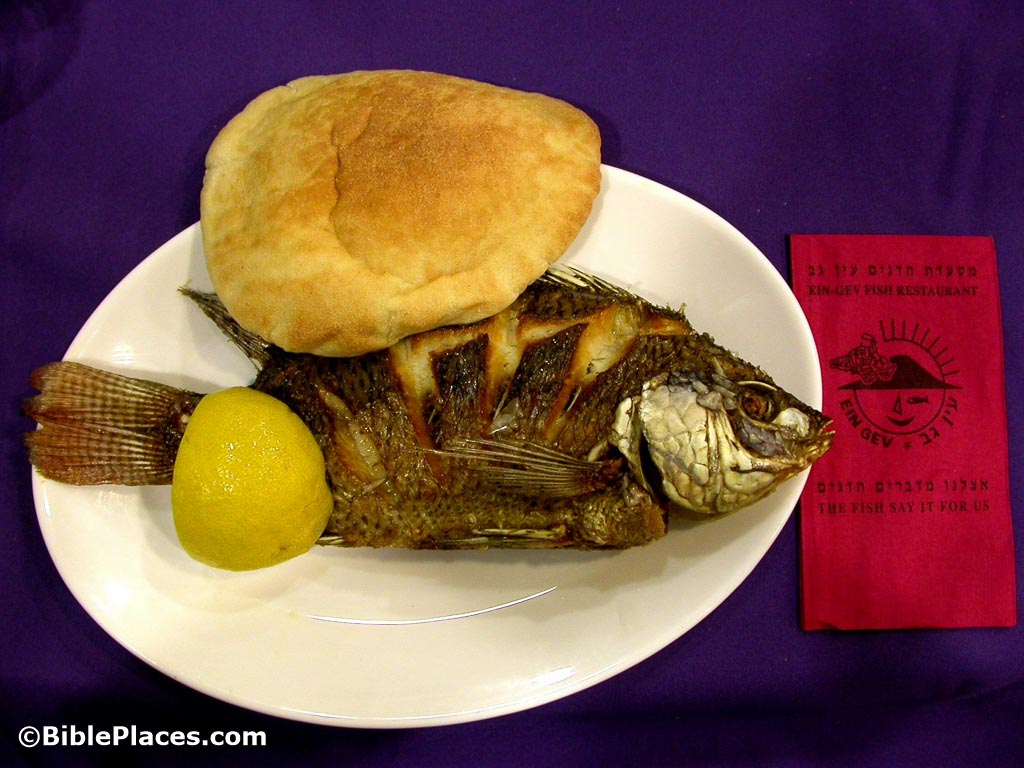
St. Peter's Fish
Three types of fish were primarily sought by fishermen in antiquity in these waters. Sardines likely were the “two small fish” that the boy brought to the feeding of the 5,000. Sardines and bread were the staple product of the locals. Barbels are so known because of the barbs at the corners of their mouths. The third type is called musht but is more popularly known today as “St. Peter’s Fish.” This fish has a long dorsal fin which looks like a comb and can be up to 1.5 feet (0.5 m) long and 3.3 pounds (1.5 kg) in weight.
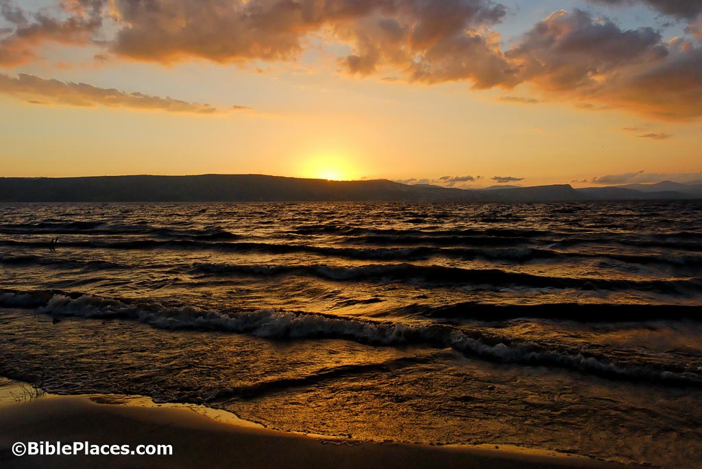
Sunset
The peaceful calm of the Sea of Galilee can quickly become transformed by a violent storm. Winds funnel through the east-west aligned Galilee hill country and stir up the waters quickly. More violent are the winds that come off the hills of the Golan Heights to the east. Trapped in the basin, the winds can be deadly to fishermen. A storm in March 1992 sent waves 10 feet (3 m) high crashing into downtown Tiberias and causing significant damage.
Download all of our Galilee and the North photos!
$39.00 $49.99 FREE SHIPPING
Related Websites
See the related sites of Bethsaida, Capernaum, Chorazin, Cove of the Sower, Mt. of Beatitudes, and Tabgha. See also our historical pages, Sea of Galilee and Sources of the Jordan River, at Life in the Holy Land. And for Bible chapters related to the Sea of Galilee, see Mark 6 and John 21.
The Sea of Galilee (Jewish Virtual Library) Gives a brief and encyclopedic history of the region.
The Sea of Galilee – Israel’s Musical Lake (Sar-El) This longer, more comprehensive introduction to the lake is illustrated by a couple beautiful photos and an 8-minute video.
Sea of Galilee and the New Testament (Bible History Online) A nice map of Galilee in the 1st century AD, along with biblical, geographical, and cultural facts.
Top 10 Christian Sites at the Sea of Galilee (Israel 21C) A nifty list of key cities, parks, and attractions to visit while you’re in the area.
Galilee, Sea of (ChristianAnswers.net) Interests the reader with both physically and biblically descriptive facts, including internal links to related topics.
Sea of Tiberias (Bibleatlas.com, subset of Bible Hub) A map and in-depth information for the area. Highlights include an excellent discussion of the surrounding geography and special information about the fish and storms.
Sea of Tiberias (The Catholic Encyclopedia) Paints a vivid picture of life in this region, both in biblical and modern times. Text only, no photographs.
Harbours of the Sea of Galilee (Leen Ritmeyer) Includes a map of the harbors Jesus would have known, along with a sketch of the ancient Capernaum harbor, and brief accompanying text.
Ports of the Sea of Galilee (Ferrell Jenkins) A good article with a few photos showing the slowly declining water level of the Sea, particularly centered in Tabgha.
Sea of Galilee Comparison: Low vs. Full (YouTube) This interesting video shows the contrast in water level between 2018 and 2020 in the Sea, and discusses the implications. Informative and enjoyable!
First Century Harbors on the Sea of Galilee (The Urantia Book Fellowship) Includes a map of the remains of 1st-century harbor breakwaters.
Ancient Sea-Faring on the Sea of Galilee (Jesusboat.com) A first-person account of the ancient boat’s discovery, excavation, and issues surrounding it.
Ancient Harbors of the Sea of Galilee (BibleArchaeology.org) This text-heavy article gives a good look (including a map) of harbors around the lake, including a bibliography for further research.
Galilee (Encyclopedia.com) Quite an extensive history of the area, from prehistoric to modern, including a section on the kibbutzes.
Sea of Galilee (Into His Own) Brief encyclopedia-type article with many internal links to articles on pertinent people and places. Limited photos.
The Galilean Fishing Economy and the Jesus Tradition (K. C. Hanson) “Examines fishing as a sub-system within the political-economy and domestic-economy of first-century Galilee.” Although references to “the Jesus Tradition” imply a non-historical view of the biblical accounts, the article provides an excellent historical-cultural framework in which to place Jesus’s ministry.
Hippos Excavation Project (official site) A comprehensive look at the Hippos-Sussita excavation. Provides information about the excavation and some excavation reports, as well as links to related books.