Gibeah
Also known as Gibeah of Saul, Taliel-el-Fûl, Tell el-Ful, Gibeah of Benjamin, Gibeath, Taleil-el-Fûl
Identifying Gibeah
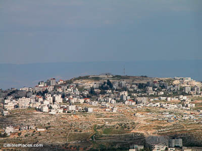
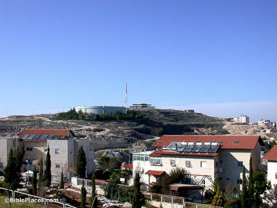
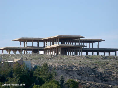
In 1841, Edward Robinson proposed that Gibeah and Geba were variants of the same name. He located them at Jaba, 5 miles (8 km) northeast of Jerusalem. Robinson later changed his identification of Gibeah to Tell el-Ful, 3 miles (5 km) north of Jerusalem. Other scholars including P. Lapp, J. M. Miller, and P. Arnold have challenged this identification, but most conservative scholars agree with Robinson’s conclusion. This photo shows Tell el-Ful from the west, with the distinctive shape of the unfinished palace of King Hussein on the summit.
Gibeah's Strategic Significance
The area of Gibeah was allotted to the tribe Benjamin and later became the scene of the rape of a concubine which led to civil war among the tribes (Judg 19:10-20:48). Considered a good location because of its position along the edge of the Central Benjamin Plain, Gibeah was the first capital of Israel (1 Sam 11:4). The “Gibeah Funnel” controlled traffic. This funnel is created by drainage systems on both sides of the central ridge which force all north-south traffic through Gibeah. The city was also close to the crossroads guarding east-west traffic from Gezer to Jericho.
King Hussein’s Palace
Saul and Jonathan made Gibeah the base of their military operations (1 Sam 13:2, 15-16;
14:2-3). Seven sons of Saul were hung here in revenge for the killing of the Gibeonites (2 Sam 21:1-6), indicating that the site must have remained the home of the rest of Saul’s household after the king’s death. King Hussein’s unfinished palace sits where King Saul’s palace once was. The Jordanian monarch began construction on the palace in 1965, but lost control of this area in the 1967 War.
Excavations
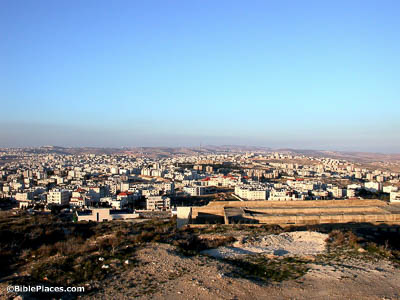
The site was excavated by Charles Warren, in 1868, for a period of two weeks. In 1874, Claude Condor described the remains. William F. Albright excavated in 1922–1923 and again in 1933. Shortly before construction work began on King Hussein’s palace, Paul Lapp performed a six-week salvage excavation in 1964. Very little of Saul’s fortress remains, and what remains is very poorly preserved. There are large, roughly-dressed stones in irregular courses. Inside the fortress, there is much pottery from the time of Saul through the Iron Age. This photo provides a view looking north from the site of ancient Gibeah.
Download all of our Samaria and the Center photos!
$ 39.00 $ 49.99 FREE SHIPPING
Related Websites
Gibeah (Bible Hub) A complete list of biblical references to Gibeah, along with entries from several dictionaries about the location.
Gibeah (Exploring Bible Lands) Includes a short introduction to the site; but especially notable for a close photo of the unfinished palace of King Hussein.
Gibeah of Saul (Ferrell Jenkins) Particularly notable for several unique photos around the tell.
Gibeah of Benjamin (Tel el Ful) (Jewish Press) Includes several photos of the unfinished palace, along with summary information and a floor plan of Saul’s palace by Albright.
Gibeah (Twitter/X) This 1931 image provides a rare aerial view of King Saul’s palace. (See original post here.)
Gibeah (Photoshelter) A 1966 photograph showing the glacis wall of King Saul’s palace.


