Located at the northern edge of the semi-arid Cappadocian steppe, Hattusha was the capital of the Hittite Old Kingdom, and later Empire, from circa 1650 BC to circa 1200 BC. The city measures approximately 1.3 miles (2.1 km) north-south and 0.7 miles (1.1 km) east-west in size, and its elevation slopes down from 4,100 (1,250 m) in the south to 3,120 feet (950 m) in the north. On the northwest is the modern village of Boğazkale (formerly named Boğazköy).
Hattusha
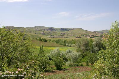
The Hittite Capital
Excavations
Hattusha was discovered in 1834 by Charles Texier. Excavations were first conducted by Ernest Chantre in 1893–94. Then, in 1906–07 and 1911–12, Hugo Winckler and Theodor Makridi carried out excavations on behalf of the German Archaeological Institute. The German Archaeological Institute has continued excavations under the direction of Kurt Bittel (1931–39 and 1952–77), Peter Neve (1978–93), Jürgen Seeher (1994–2005), and Andreas Schachner (2006–present).
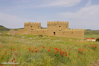
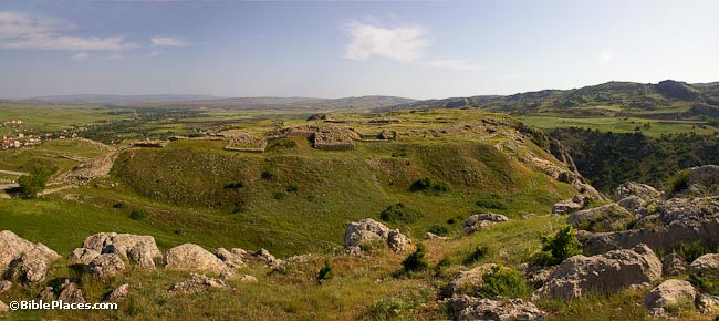
History
In the Early Bronze Age, circa 2000 BC, Hattusha was settled by Hattians, a people indigenous to north-central Anatolia. An Old Assyrian merchant colony, or karum, like the one at Kultepe/Kanesh, was established here in the 19th–18th centuries BC (Middle Bronze Age). The Hittites arrived in the 17th century BC, and their first king was named Hattusili (ca. 1650–1620 BC), which means “one from Hattusha.” The Hittites established an empire centered at Hattusha in the 14th–13th centuries BC. Most of the city’s excavated remains date to the reign of Tudhaliya IV (ca. 1237–1209 BC).
The Great Temple
The Hittites referred to Hatti as “the Land of a Thousand Gods.” At Hattusha, archaeologists have discovered thirty-one temples, the largest of which is the Great Temple, located in the lower city at the northern end of the site. The temple stands on a raised platform and measures 215 feet by 140 feet (65 x 42 m) in size. It was surrounded on all sides by 82 long storerooms. The entire complex covered an area of 3.5 acres (1.4 ha).
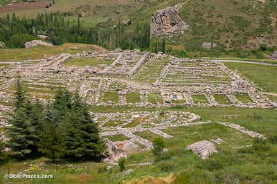
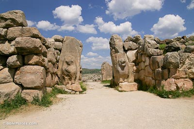
The Lion Gate
Located in the western wall of the upper city, the Lion Gate consists of a passage with parabolic arches at each end flanked by rectangular towers. The entrance arches contain sculptures of standing lions, from whence the gate received its name. The sculptures include such details as the lions’ mane hairs and whiskers. A groove was cut into each side of the arch to allow chariot wheels to pass through.

Yerkapı Rampart
Yerkapı is an artificial ridge at the southern end of Hattusha. Against the ridge, a trapezoidal rampart was constructed which measures 820 feet (250 m) in length and is 265 feet thick at the base (80 m). From the south, it has a 35-degree slope and rises 100 feet (30 m) above ground level. Yerkapı is the highest point in the city. Centered atop the rampart was the Sphinx Gate, so-named because both of its doorways were lined by sphinx sculptures. The Sphinx Gate was joined to a casemate wall that ran along the top of the rampart and joined with the Lion Gate on the west and the King’s Gate on the east.

Download all of our Eastern Turkey photos!
$34.00 $49.99 FREE SHIPPING
Related Websites
See also Ararat-Urartu, Carchemish, Haran, Karatepe, and Nemrut Dag.
Hattusa (Wikipedia). Summarizes the history of Hattusha, including the recent dispute between Germany and Turkey over a sphinx sculpture.
Hattusa: The Ancient Capital of the Hittites (Amusing Planet). This page has some great photos.
The Last Days of Hattusa (Biblical Archaeology Society). This is a somewhat long but interesting article about the Hittites.
Bogazkoy / Hattusa (World Archaeology). This article describes some of the discoveries that have been made by archaeologists.
Hattusa Timeline (Ancient History Encyclopedia). A brief but helpful timeline.
Bogazkale pictures – Hittite pictures (Dick Osseman). Gallery of photographs of Hattusha.
Lion Gate in Hattusa (Turkish Archaeological News). Discusses one of the most notable features of the site.